Share icon
Date

Hurricane Ida struck southeast Louisiana as a powerful Category 4 storm on Sunday, Aug. 29, 2021 - the 16th anniversary of Hurricane Katrina’s landfall in 2005. Ida brought destructive storm surge, high winds, and heavy rainfall to the region and left over 1 million customers without power, including the entire city of New Orleans.  

This day/night-band imagery of Hurricane Ida was captured by the VIIRS instrument onboard the NASA/NOAA Suomi-NPP satellite early the morning of Aug. 30, 2021. Day/night-band imagery is useful for identifying nighttime lights from cities, and can be used to monitor for loss of light which may indicate power outages in the wake of a disaster. Credits: NASA

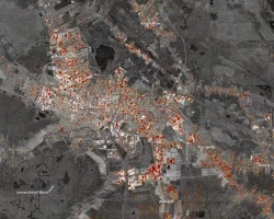
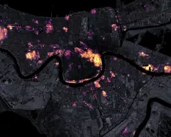
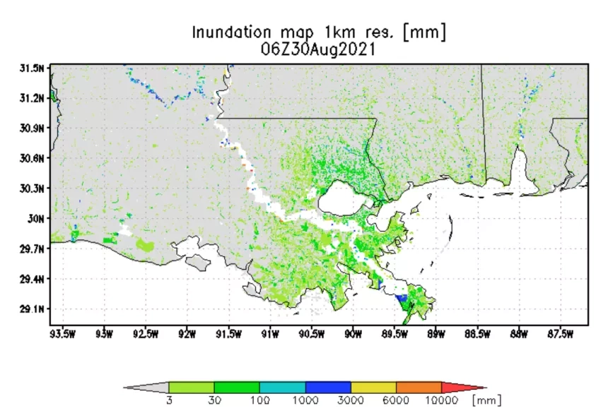
The NASA Earth Applied Sciences Disasters program area has activated efforts to monitor the storm and its impacts and is providing Earth-observing data, maps and analysis to aid response and recovery efforts. The program is participating in coordination calls with FEMA and is working to identify and support other stakeholders including U.S. Army North and officials from states in the path of the storm. NASA has unique capabilities to monitor disasters from an integrated Earth systems perspective and is leveraging these capabilities and expertise to assess the impacts of the storm, including power outages, damage to buildings and key infrastructure, and the extent of flooding. Maps and data are being provided on the NASA Disasters Mapping Portal.

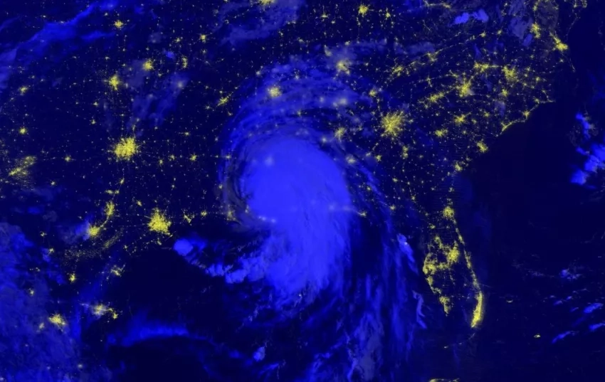
Near real-time data for monitoring the storm on the NASA Disasters Mapping Portal Tropical Cyclone Dashboard. Click here to view fullscreen. Credits: NASA 

This imagery derived from ESA Sentinel-1 satellite observations on Aug. 28, 2021, at 7:02 p.m. CDT, provides a look at water conditions in Louisiana before the storm made landfall.  The zoomed image is a derived surface water extent product, which shows in blue where all water viewable by the satellite is located.  When combined with ancillary datasets such as known water layers, road networks and building footprints, products such as this can be used to assess water location over a large area and identify
This imagery derived from ESA Sentinel-1 satellite observations on Aug. 28, 2021, at 7:02 p.m. CDT, provides a look at water conditions in Louisiana before the storm made landfall. The zoomed image is a derived surface water extent product, which shows in blue where all water viewable by the satellite is located. When combined with ancillary datasets such as known water layers, road networks and building footprints, products such as this can be used to assess water location over a large area and identify potentially flooded regions. Due to limitations of the satellite sensor, water under vegetation is not detected using this technique, nor is surface water between structures, such as buildings in urban areas. Credits: NASA. Contains modified Copernicus Sentinel data (2021) processed by ESA, Alaska Satellite Facility, and NASA Marshall Space Flight Center.

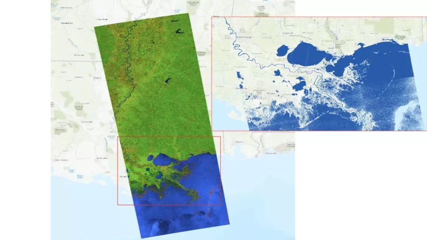
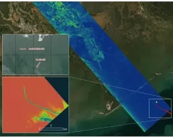
Researchers from across NASA and its partner organizations are working to support the efforts of the Disasters program. The Applied Sciences research project “Integrating SAR Data for Improved Resilience and Response to Weather-Related Disasters,” working with the Alaska Satellite Facility (ASF), is developing flood maps using Synthetic Aperture Radar (SAR) data. The project “Development and Implementation of Remote Sensing Techniques for Oil Spill Monitoring and Storm Damage Assessment in an Operational Context” is working with the NOAA Science Advisory Board (SAB) oil desk to monitor for potential oil spills or hazardous material spills caused by the storm. The project “Open Critical Infrastructure Exposure for Disaster Forecasting, Mitigation and Response” is examining potential damage to power stations and other key infrastructure. The project “Enabling Landslide Disaster Risk Reduction and Response throughout the disaster life cycle with a multi-scale toolbox” is monitoring for the potential of rainfall-induced landslides across Appalachia as the storm moves north.

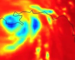
This animation shows estimated precipitation rates and accumulations from Hurricane Ida for Aug. 26 to 29, as the storm moved across the Caribbean and made landfall in southeastern Louisiana. The data is collected by a constellation of satellites united by the NASA / JAXA Global Precipitation Measurement (GPM) mission Core Observatory, which also obtained an overpass of Hurricane Ida shortly before landfall. Credits: NASA

NASA continues to monitor Ida as it moves north over the southeastern U.S., providing Earth-observing satellite data, maps and analysis to stakeholders to aid response and recovery efforts.

Get the latest updates on Hurricane Ida from the NHC

Learn more about how NASA monitors hurricanes.

This flood inundation map from the UMD Global Flood Monitoring System (GFMS) shows regions in Louisiana  that likely experiencing flooding from Hurricane Ida on Aug. 30, 2021, based on inputs from recent NASA IMERG precipitation data and hydrological models. Credits: UMD GFMS
This flood inundation map from the UMD Global Flood Monitoring System (GFMS) shows regions in Louisiana that likely experiencing flooding from Hurricane Ida on Aug. 30, 2021, based on inputs from recent NASA IMERG precipitation data and hydrological models. Credits: UMD GFMS


Astronauts onboard the International Space Station (ISS) captured this photograph of Hurricane Ida on Aug. 29, 2021. Click here to learn more about how ISS photography is used to monitor disasters and provide situational awareness to aid response efforts on the ground. Credits: European Space Agency