The Advanced Land Observing Satellite-2 (ALOS-2), a Japanese Aerospace Exploration Agency (JAXA) satellite, is a follow-on mission from the "DAICHI", which contributed to cartography, regional observation, disaster monitoring, and resource surveys. ALOS-2 will succeed this mission with enhanced capabilities.
Specifically, JAXA is conducting research and development activities to improve wide and high-resolution observation technologies developed for DAICHI in order to further fulfill social needs.
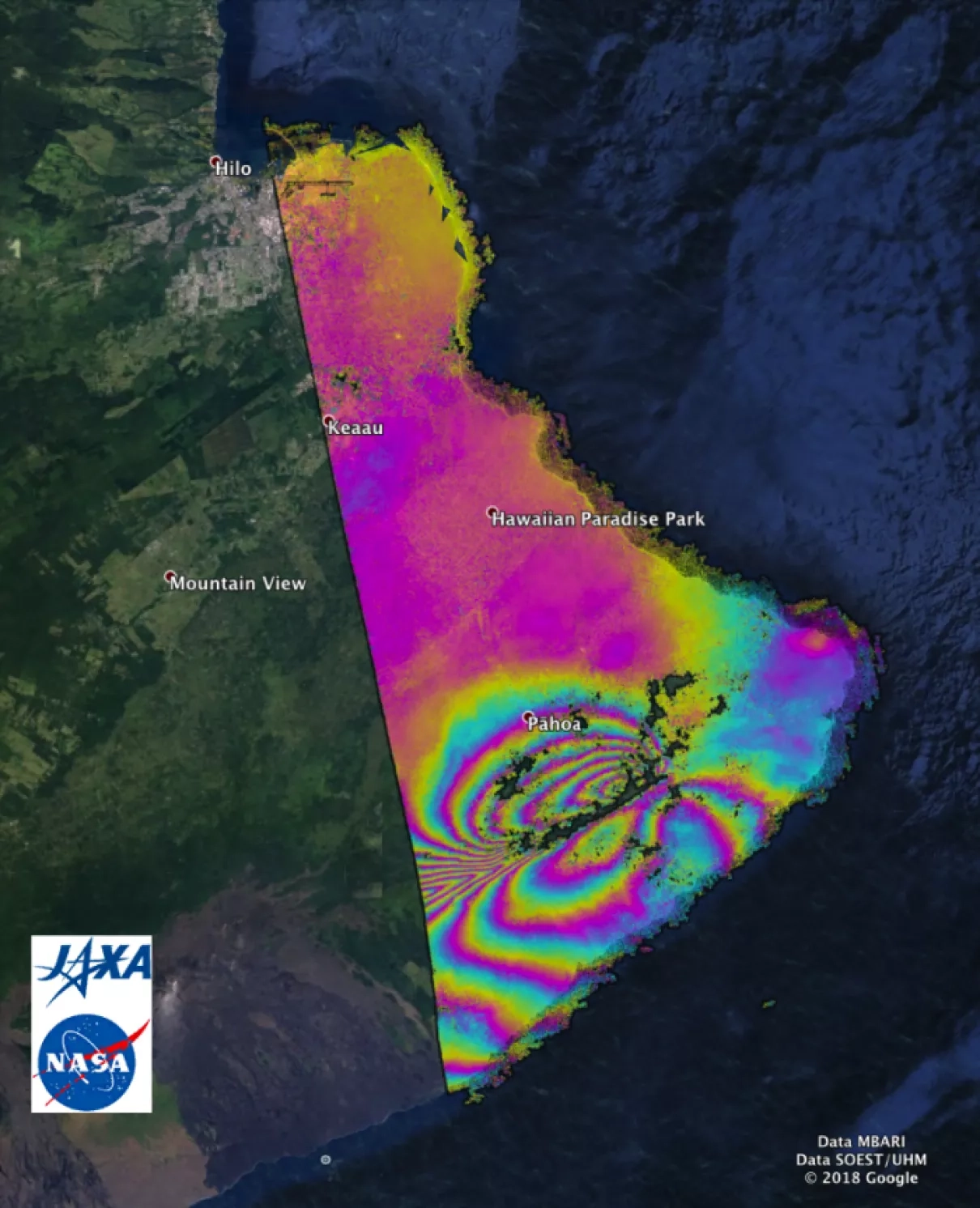
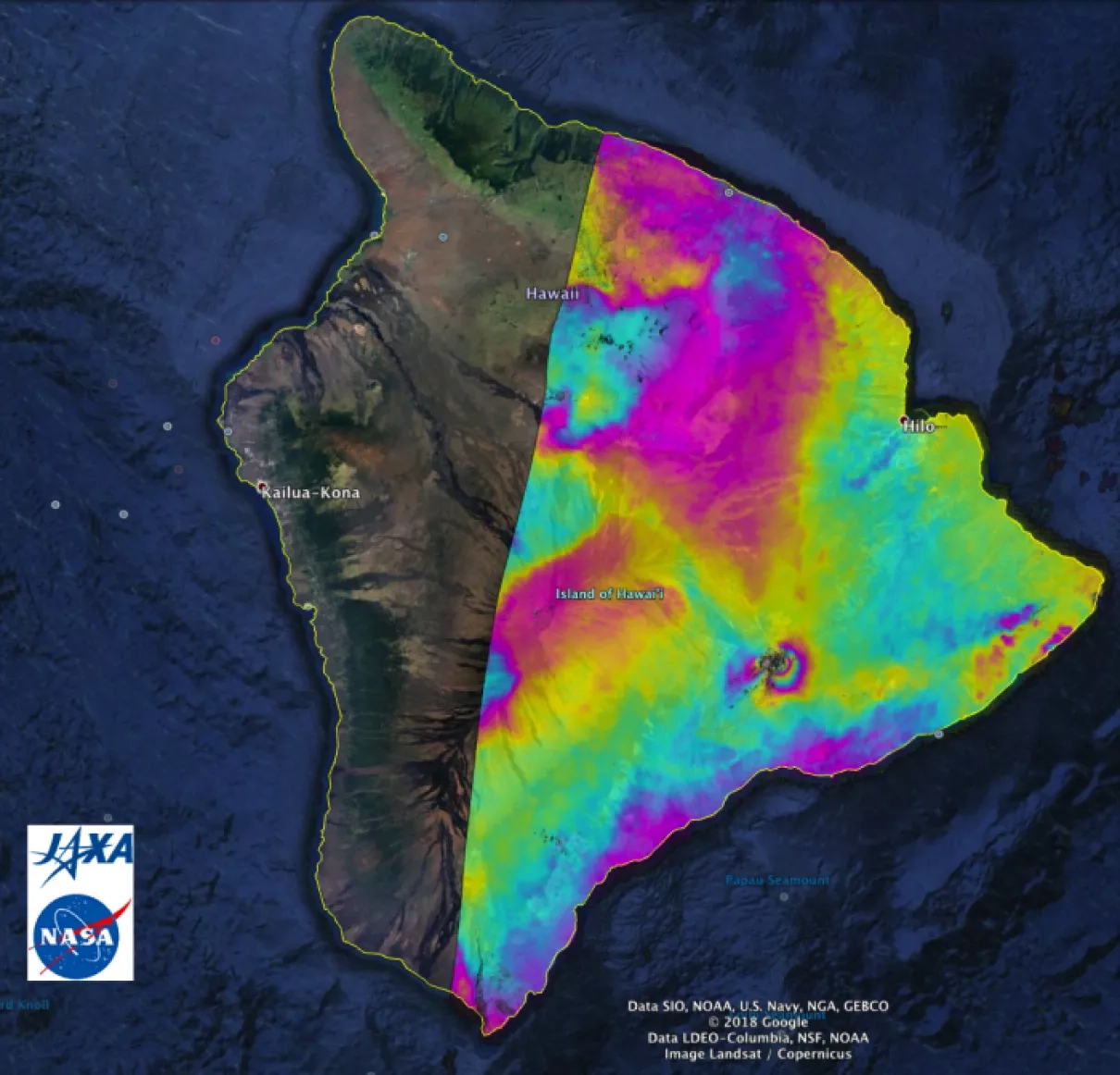
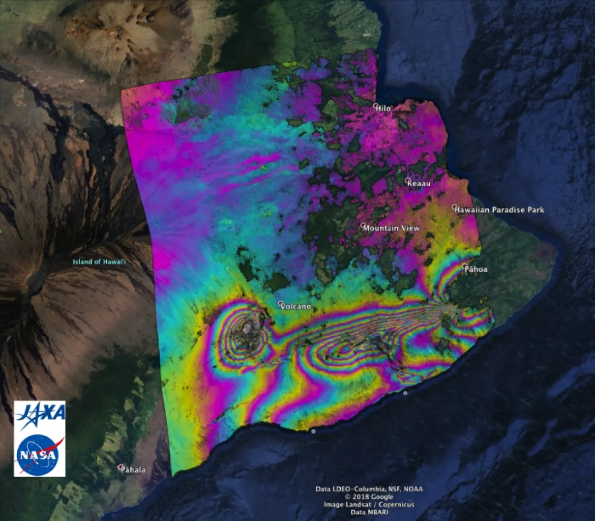
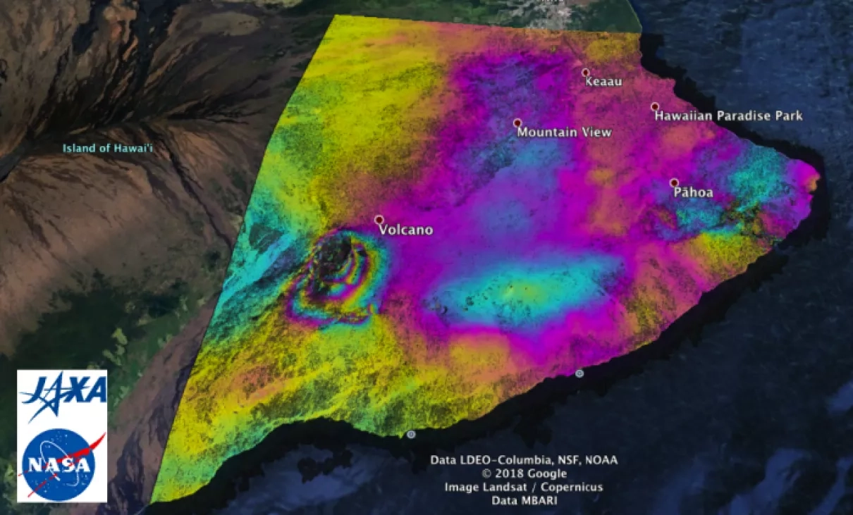
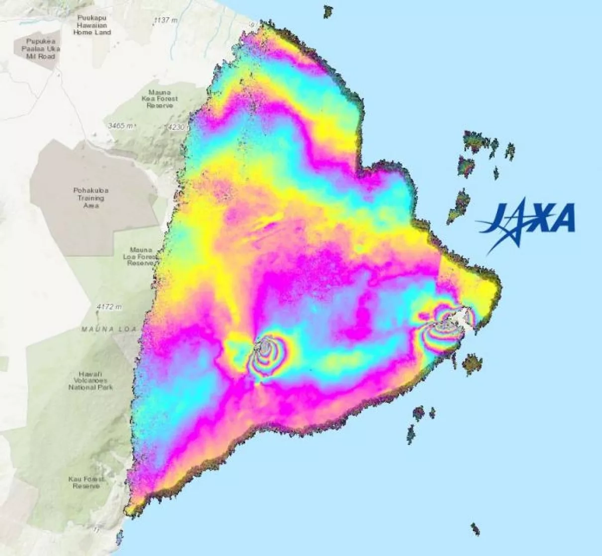
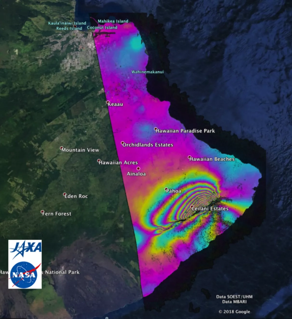
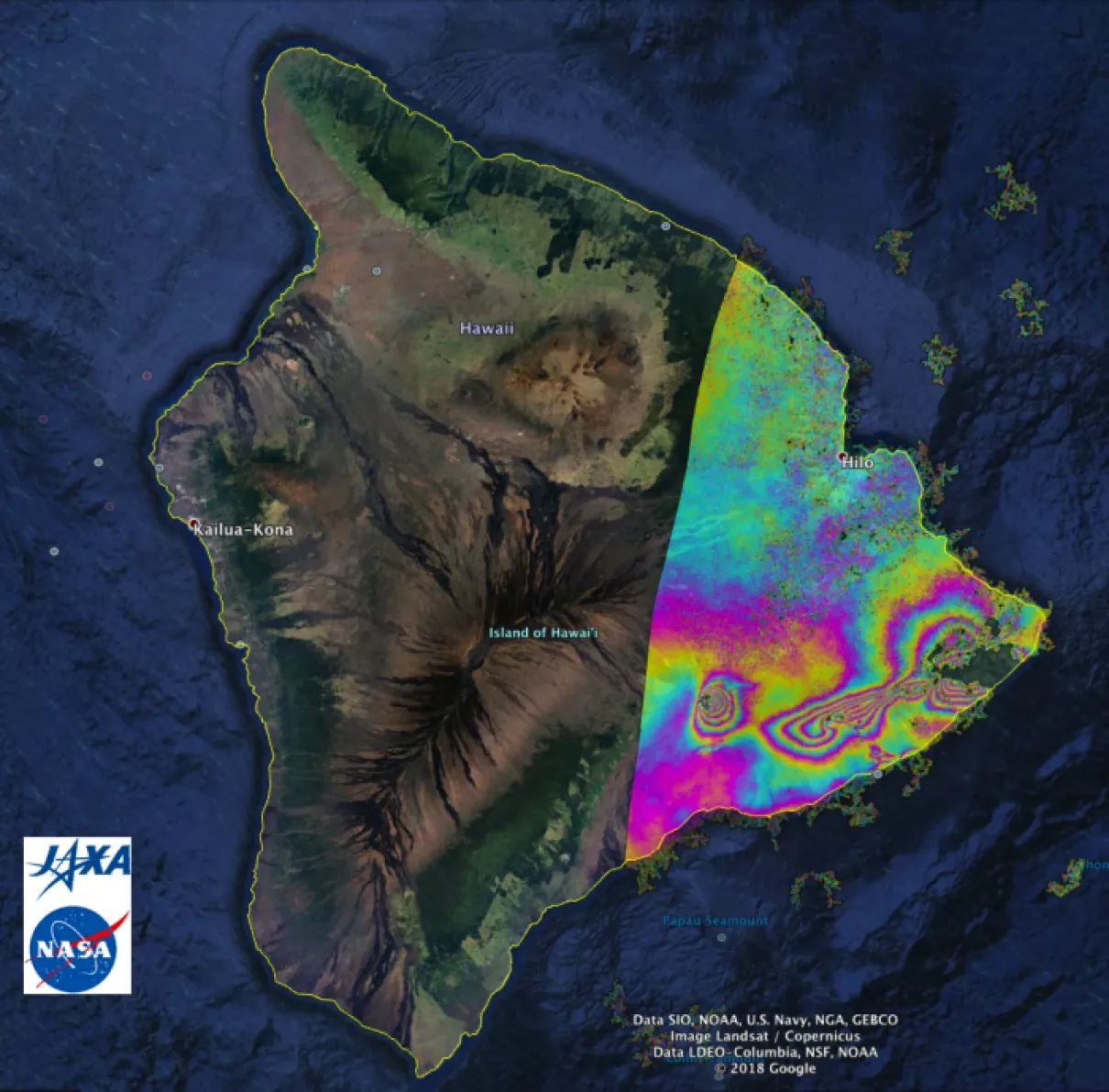
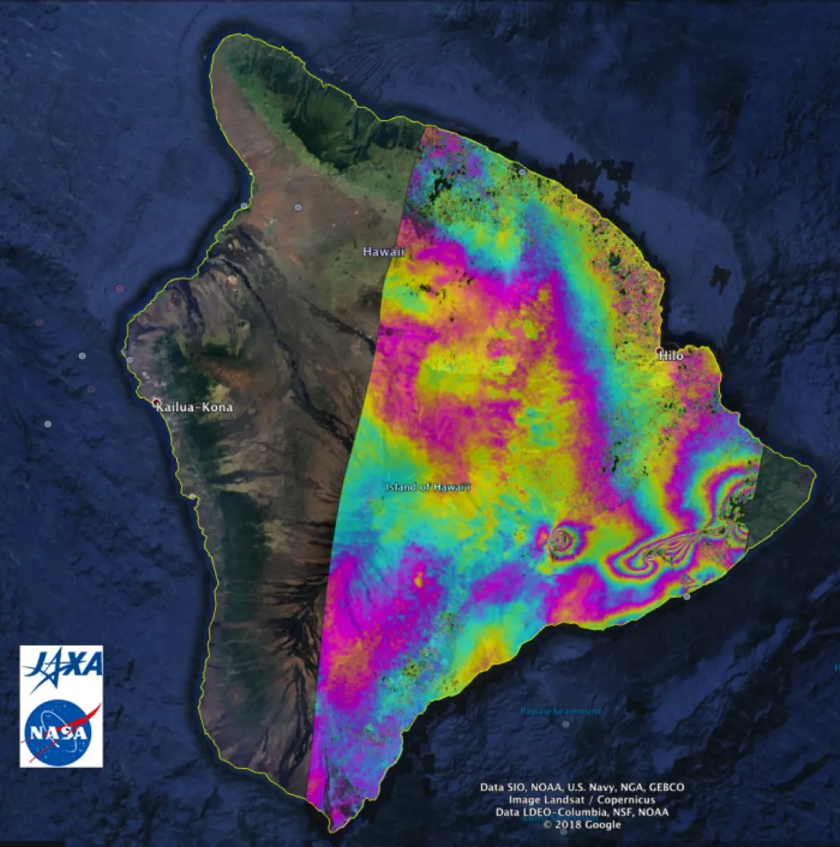
Each interferometric synthetic aperature radar (InSAR) image, or interferogram, shows the amount of permanent surface movement caused almost entirely by the volcanic eruption that started on May 3, 2018 and the associated earthquakes, as viewed by satellite, between the two dates listed on each product.
Notable locations of surface deformation: deflation of Kilauea caldera, dike opening in far eastern ERZ (East Rift Zone).
In the map, surface displacements are seen as color contours (or "fringes"), where each color cycle represents 4.7 inches (11.9 centimeters) of surface motion.
June 23rd 2018:
This latest interferogram shows continued deflation of the summit.
June 5th 2018:
ALOS-2 interferogram of the Kilauea eruption area comparing the June 5th, 2018 acquisition relative to December 19, 2017. This shows the entire eruption deformation to date (plus the M6.9 earthquake). It does not completely cover the lower East Rift Zone where the fissure eruption is ongoing.
May 31st, 2018:
May 26th, 2018:
May 22nd, 2018
May 17th, 2018
May 12th, 2018
May 8th, 2018: