Researchers from NASA’s Earth Applied Sciences Disasters program area are working with representatives from the Geological and Mining Institute of Spain (IGME-CSIC) to support the Canary Islands Volcanic Emergency Plan (PEVOLCA) and identify thermal anomalies, or “hot spots”, that indicate volcanic activity on the island of La Palma.
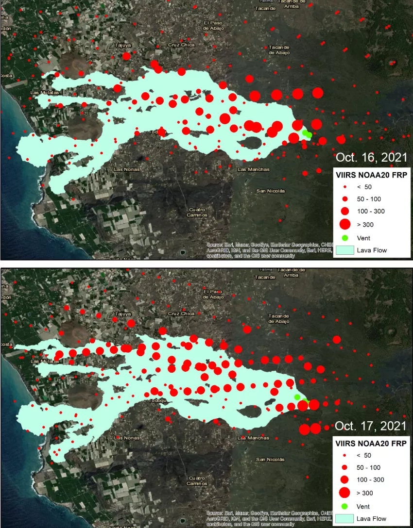
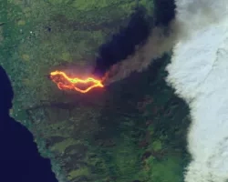
Using satellite data from the NOAA-20 Visible Infrared Imaging Radiometer Suite (VIIRS) collected on Oct. 16 and 17, the researchers identified regions on the western side of the island with higher-than-average surface temperatures (hot spots) which are associated with lava fields emitted by several volcanic vents. This information was provided to the PEVOLCA and IGME teams to help locate new volcanic fissures which were emanating volcanic ash and gas.
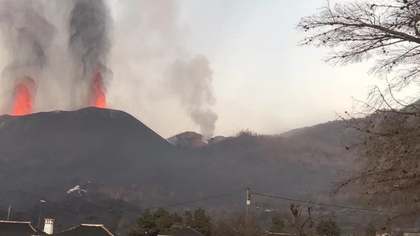
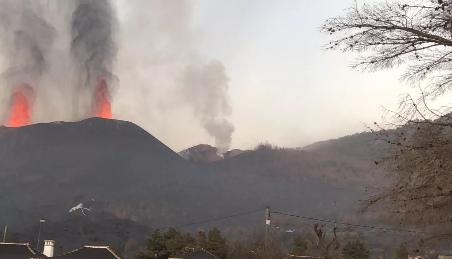
The above photo, taken by a member of the IGME team at the southeast side of the main volcanic cones on Oct. 17, shows two active vents erupting lava fountains, and one vent emitting ash with no lava. VIIRS satellite observations detected thermal anomalies over this region indicating potential new volcanic activity, which helped the researchers on the ground determine where to look for signs of new lava that could potentially spread to previously unaffected areas and impact local communities.
Marta Pizarro, a researcher from IGME, sent feedback on how their team used the VIIRS data:
“The thermal anomaly maps are useful to identify colada reactivation and the opening of new vents. We have observed that days of high radiation are coincident with reactivation of the northern lava flows. Also, we observed the emergence of fumarole fields in locations just before covered by hot spots in the thermal maps. We are also exploring the potential correlation between seismic energy daily release and increasing of spot radiation.”
Oct. 19 marks 30 days since the Cumbre Vieja volcano on La Palma began erupting, and within that time lava has covered 811.8 hectares according to Copernicus satellite observations, and destroyed nearly 2,000 buildings. The NASA Disasters program continues working closely with stakeholders, including IGME and PELVOCA, to ensure that satellite observations can be used within 24 hours of their acquisition to inform decision making, and to identify new areas of concern that researchers on the ground can further explore. These satellite observations can help local communities anticipate and prepare for further volcanic activity, and mitigate potential impacts to lives and property from lava and volcanic ash and gas.
Related Impact