June 2nd, 2018:
This Sentinel 2B Short Wave IR data shows the progress of the new lava channel toward the Kapoho Bay on June, 2nd around 9pm UTC (11 am HST). At that time, the flow head was around ~ 1500 yards (1.4 km) from the Kapoho Bay and the lastest USGS report (June 4th at 12 am HST) indicates that the Lava was only at 245 Yards (220 m) 37 hours later, giving an average speed of 34 yards/h. USGS indicates that Laze is likely to form at the entry point of the lava.
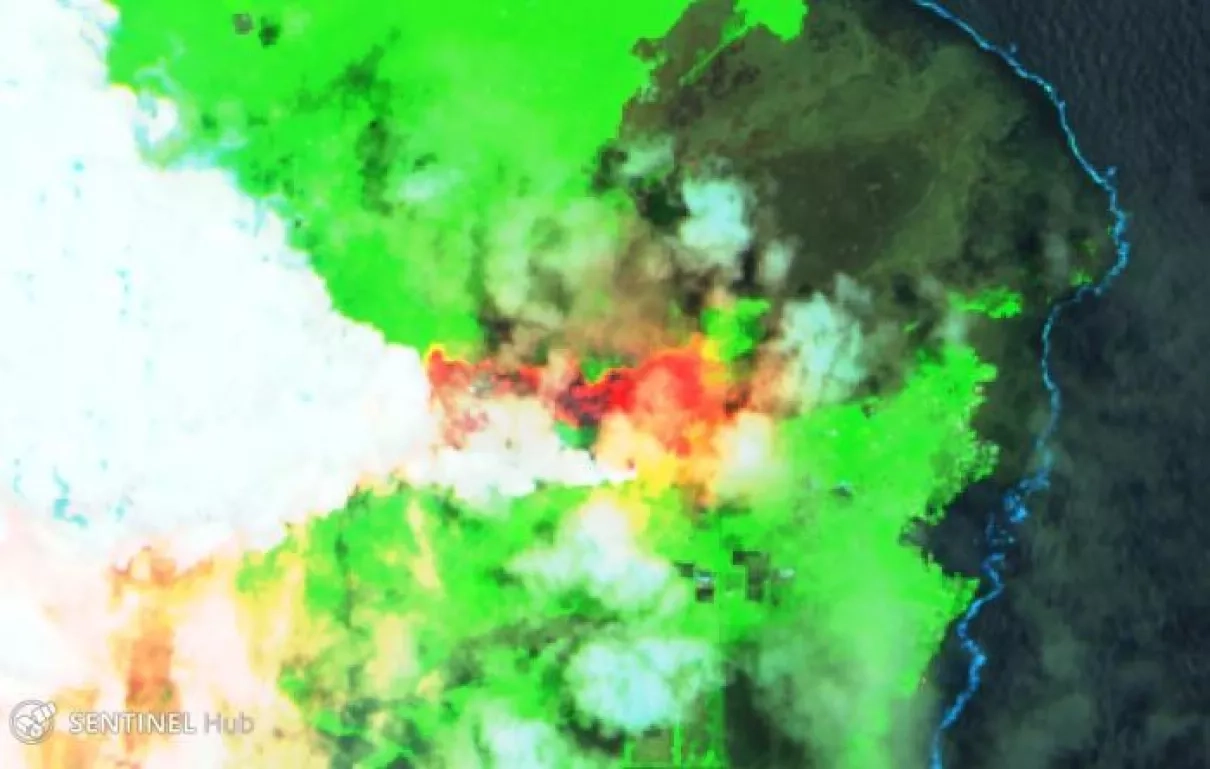
May 23rd, 2018:
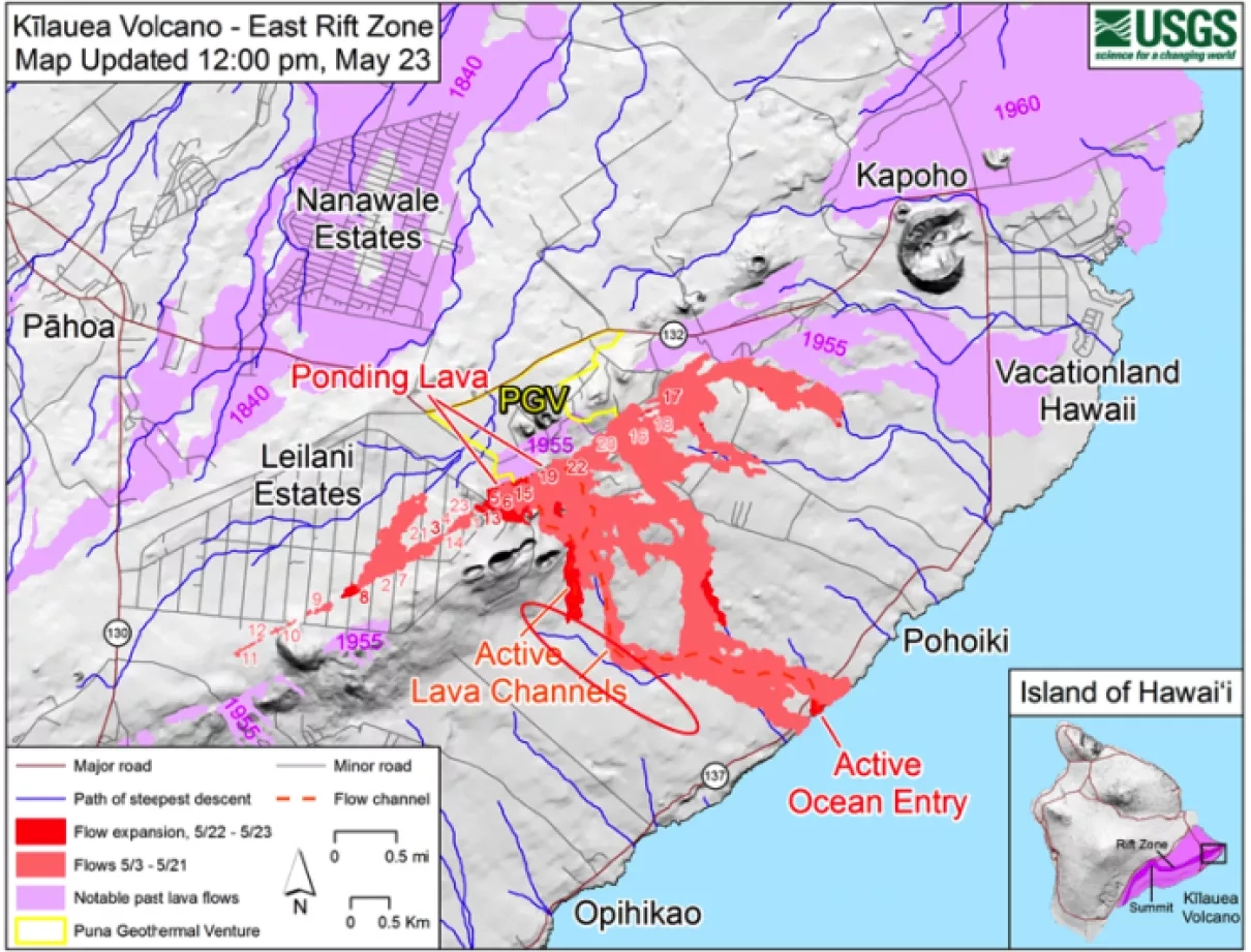
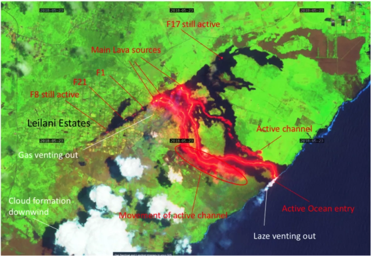
The above two images show a comparison between the USGS rift zone map and Sentinel 2B data collected on May 23rd 2018. A noticeable feature is the rapid progress of a lava channel (west side) toward the ocean seen near 12:00 pm by USGS and observed by Sentinel 2B later in the day. Multiple active lava fissures can also be seen with this image on top of old lava patterns shown through dark color such as the one in Leilani estates area. Atmospheric features such as the white/bluish plume coming out from the Lava and the formation of clouds downwind can also be seen. The entry point of the lava creates a plume of "Laze" but with a limited extension.
May 18th, 2018:
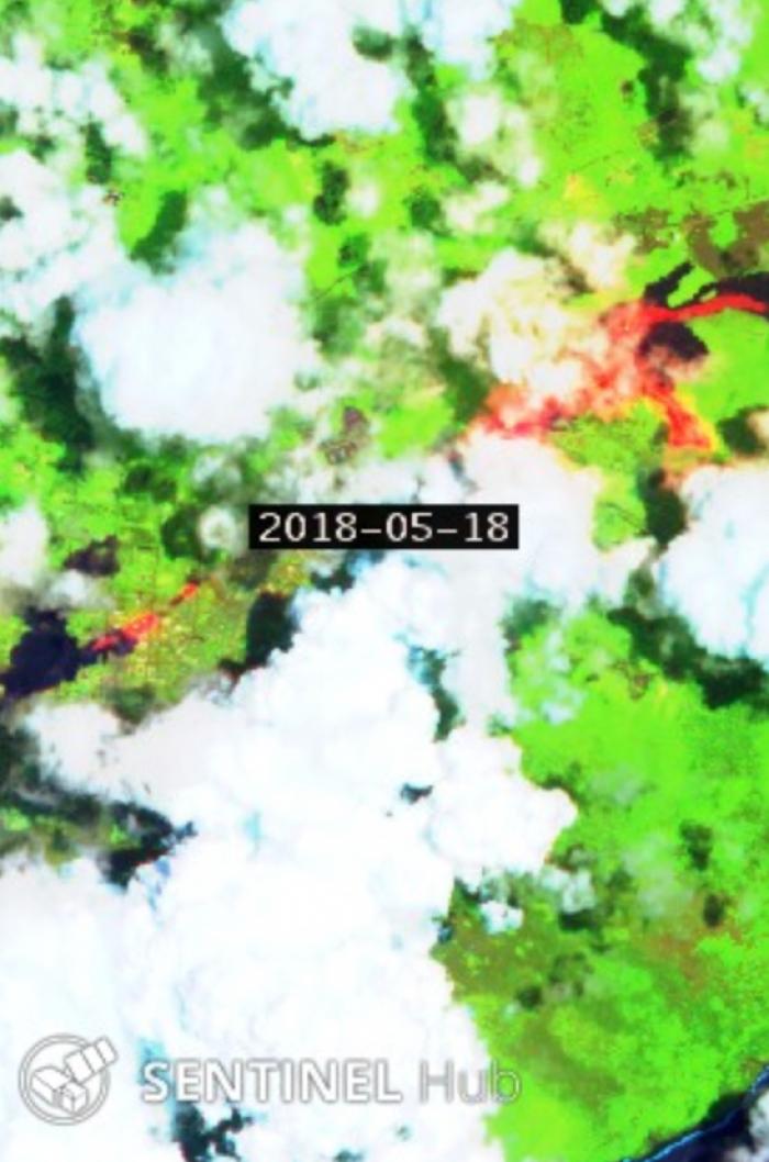
This image from the agriculture band of the Sentinel 2B satellite on May, 18th 2018 shows the lava flows over South Pohao in Hawaii coming from fissure 16-17-18. The second Lava stream branch (going south) appears to be moving in the direction of the water.


