More than half of Minnesota’s cold-hardy population lives in the Minneapolis-Saint Paul region. Like many other major metropolitan areas, air pollution can be a recurring health hazard–even in the seemingly pristine air of America’s “Star of the North.”
A 2015 report from the Minnesota Department of Health and the Minnesota Pollution Control Agency found that in 2008, the most recent year that data linking public health and air pollution was available, air pollution contributed to the early deaths of about 2,000 people in the metro area.

The agencies studied two pollutants: ground-level ozone, which causes smog; and fine particulate matter. This fine particulate matter is made of air pollution particles with a diameter of less than 2.5 micrometers – about 3% the size of a human hair – and they're commonly known as PM2.5.
This fine particulate matter can be the byproduct of anything from industry emissions to vehicle exhaust. Because of their small size, these toxic, microscopic particles can settle deep into the lungs. Prolonged exposure can cause permanent respiratory problems.
One of the ways that the U.S. Environmental Protection Agency (EPA) fulfills its mission to protect human health and the environment is through its AirNow website. AirNow monitors local air quality across the United States and provides a daily Air Quality Index (AQI). To better measure and monitor fine particulate matter, EPA partnered with NASA to add satellite measurements of PM2.5 into the AirNow system.
“[AirNow] helps us make better air quality forecasts and alerting decisions for the citizens of Minnesota.”
–Steve Irwin, Minnesota Pollution Control Agency
The satellites allowed the team to measure something called Aerosol Optical Depth, which measures the amount of particulates in the air by seeing how much sunlight they're blocking or absorbing. That data is taken at a 4-kilometer scale across the United States, and this finer-scale coverage allowed the project team to develop a system to provide a better measurement of air quality in places that have little or no ground-based monitors. It's called the AirNow Satellite Data Processor.
Steve Irwin is an air quality meteorologist with the Minnesota Pollution Control Agency. He says that adding this data into the larger air quality measurements has been a critical upgrade. “[Our state agency's] air quality forecasting program uses AirNow on a daily basis,” Irwin said.
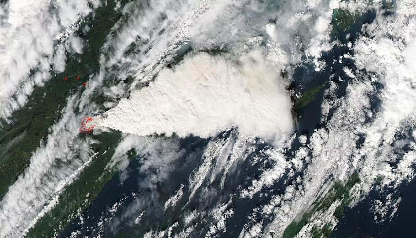
With forested land covering a third of the state, wildfires have long been a part of Minnesota’s history and smoke from those fires has become an increasingly common air quality hazard. One of the state’s largest wildfires was the Pagami Creek Fire of 2011, which scorched more than 90,000 acres across Minnesota’s Arrowhead Region in the northeastern part of the state.
But more recently, the wildfire smoke – and the associated health hazards – have been coming in from other states and Canada.
“We’re now seeing more long-range transport from ‘mega-fires’ out west that are becoming more numerous due to past fire suppression methods and climate change,” Irwin explained. “Even though these smoke events are sometimes short-lived in Minnesota, they produce our highest concentrations of PM2.5. These events also represent our greatest forecast challenge, as models and monitors aren’t always able to capture the impacts of an approaching plume.”
As hazardous smoke plumes threaten multiple states, AirNow has increasingly become the go-to source of information for health agencies, the public, and the media.
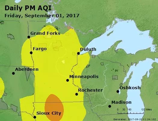
Most importantly for Minnesota state authorities, the addition of NASA satellite data allows for greater coverage of their state. Previously, critical PM2.5 data was missing for a large portion of Minnesota. Now, when wildfires bring smoke through the area, health officials have an extra tool at their fingertips, allowing them to expand air quality forecasting program to a statewide level.
“The fire, smoke and [aerosol] layers incorporated into AirNow are important for our forecasters to have a better understanding of potential air quality issues,” Irwin said. “[AirNow] helps them make better air quality forecasts and alerting decisions for the citizens of Minnesota.”
This story is part of our Space for U.S. collection. To learn how NASA data are being used in your state, please visit nasa.gov/spaceforus.