Image

NASA
NASA
Tasseled cap greenness transformation derived from Landsat 8 imagery over lodgepole pine forest in the Intermountain West study area
Completed Projects
Madelyn Savan
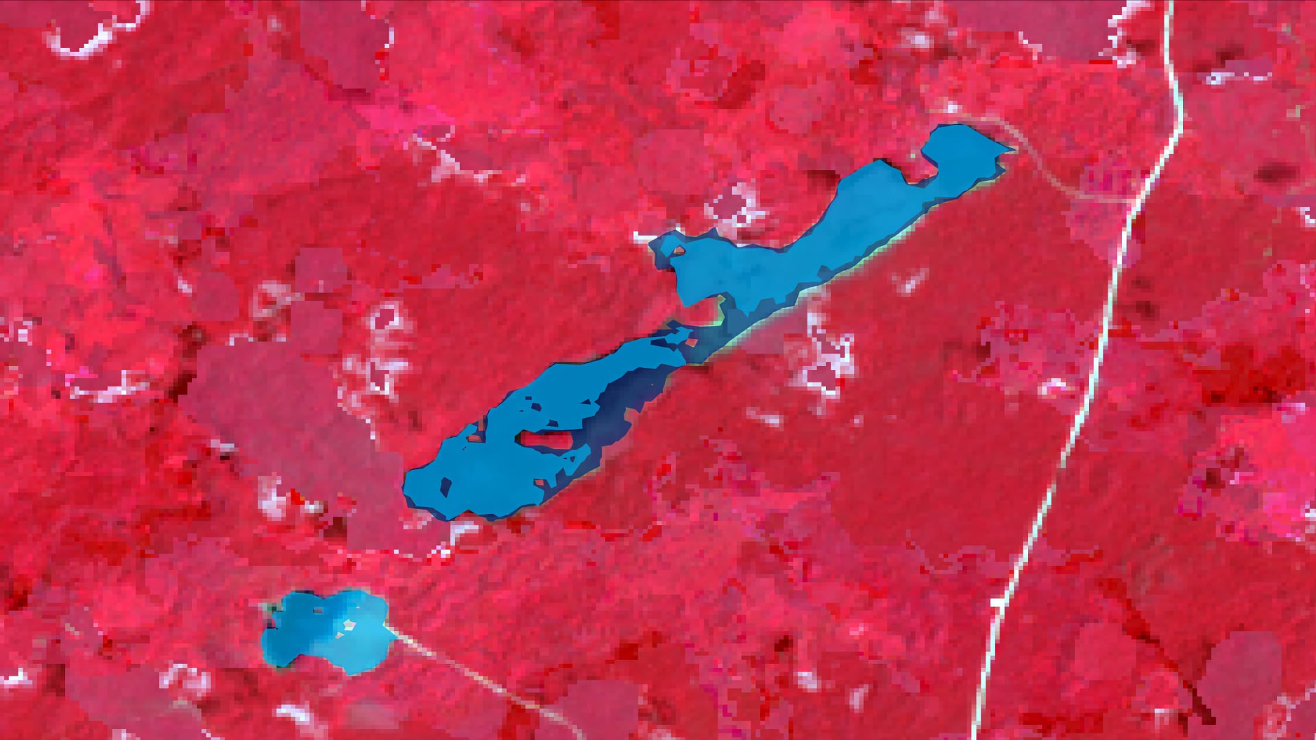
As climate change increases the severity and frequency of extreme weather events in the tropics, it is vital for the safety of local communities and the health of ecosystems to monitor seasonal inundation. Forested inundation affects the ability of forested...
Dr. Sunita Yadav-Pauletti
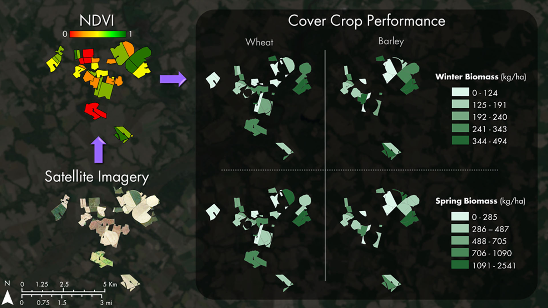
Winter cover crops are an essential component of adaptive management practices to reduce soil erosion, nutrient loss, and nutrient leaching leading to water quality degradation. The Maryland Department of Agriculture (MDA) and Chesapeake Bay partners (US Geological Survey and USDA Agricultural Research Service) oversee...
Mariam Moeen

The barrier islands of Louisiana’s Breton National Wildlife Refuge (BNWR) are disappearing due to sea level rise, extreme hurricanes, sediment starvation, and the Deepwater Horizon oil spill. This decline in land area has damaged important bird habitat and reduced the...
Rebecca Lehman
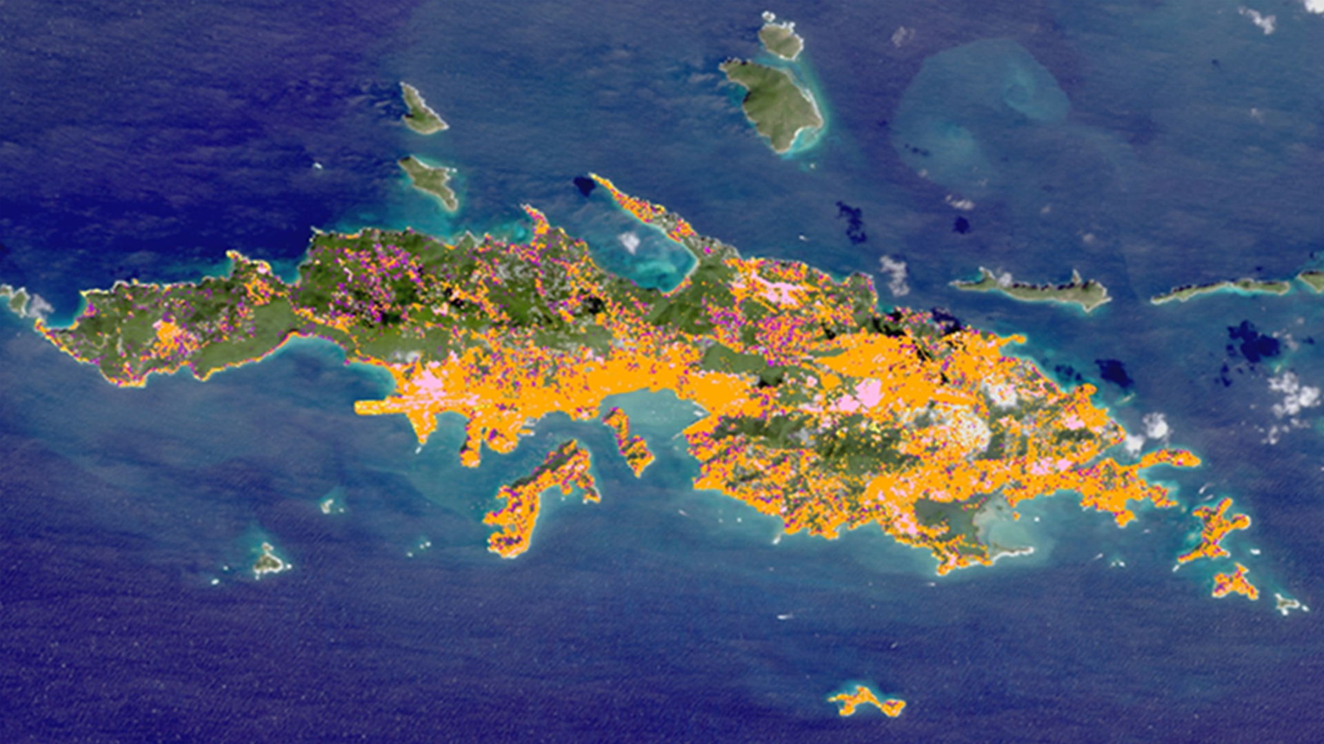
The United States Virgin Islands (USVI) are home to an array of diverse and stunning habitats. The beauty of the islands has continued to attract visitors and residents, which overtime has increased human development and impact. The resulting land-use change increases sediment loads and the...
Eric Jensen
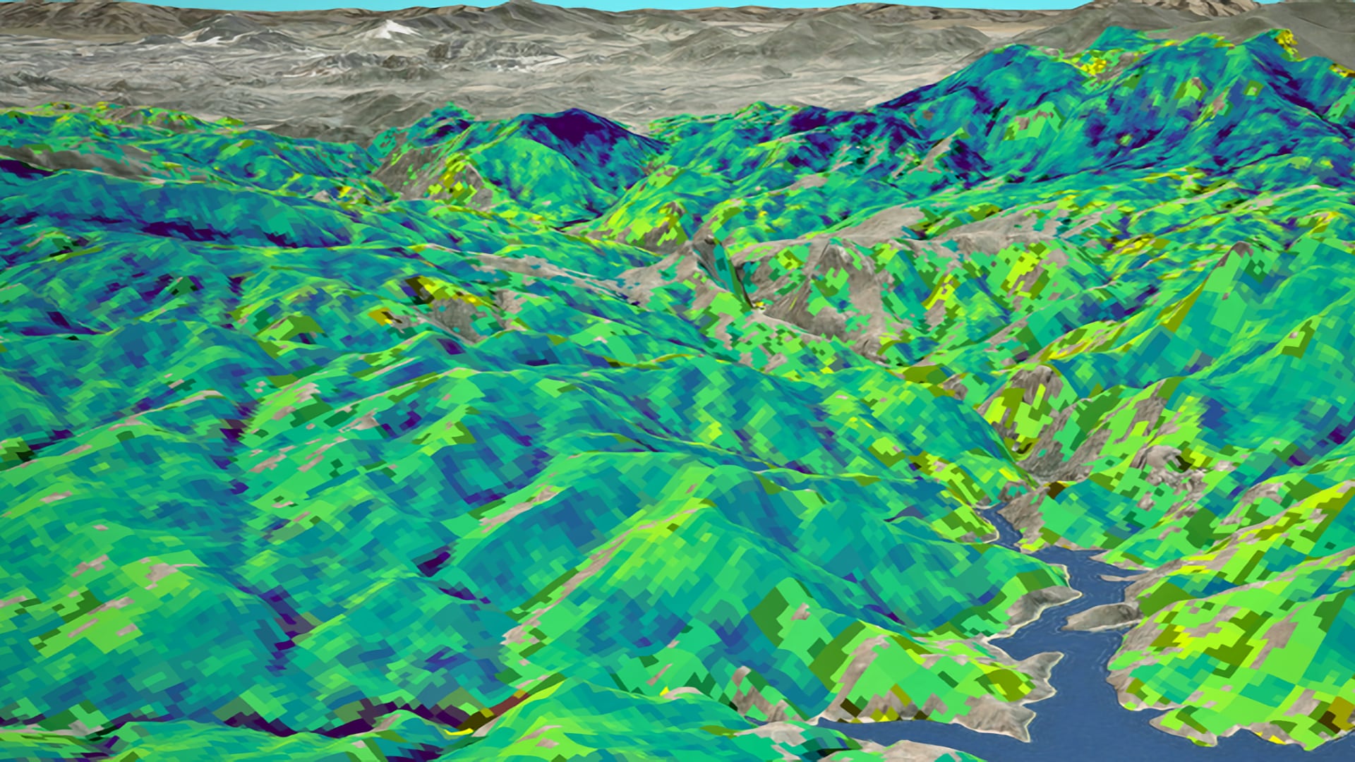
Forest composition and structure in the Colorado Front Range has been altered by changing wildfire regimes. In particular, increased moderate- and high-severity fire significantly reduces forest cover following fire and often results in reduced seedling regeneration. Reduced tree canopy regrowth...
Amanda Aragón
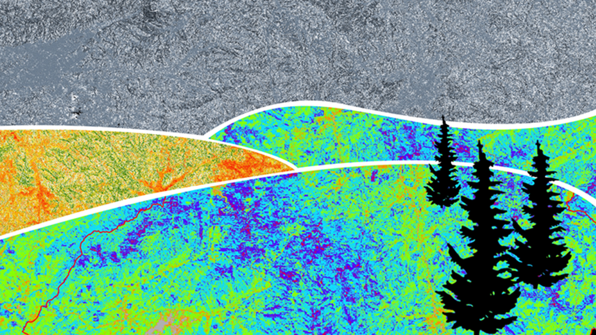
Wildfires in the southeastern US are understood less than those in other portions of the nation. In October and November 2016, over sixty individual wildfires ignited among seven states in the Southern Appalachian region. These fires damaged hundreds of buildings, caused numerous power outages, and...
Amanda Aragón
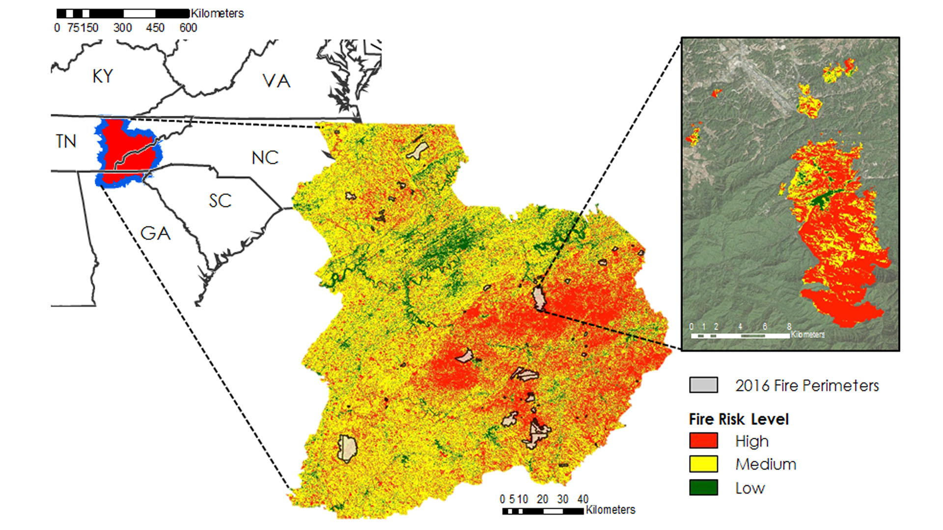
Wildfires in the southeastern US are less understood compared to other portions of the nation. In October and November of 2016, over 60 individual wildfires ignited among seven states in the Southern Appalachian region. These fires damaged hundreds of buildings, caused numerous power outages...
Dionne Blanks
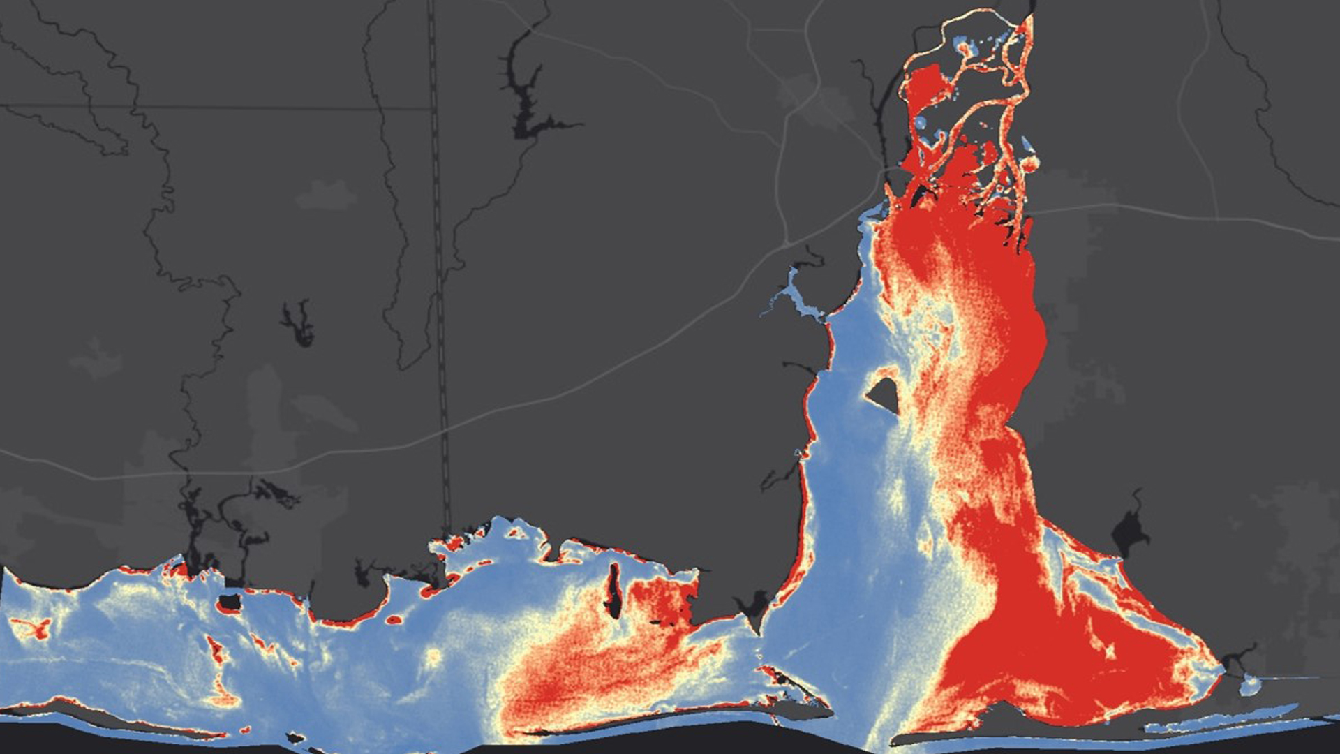
The Mobile Bay and Mississippi Sound region comprise the majority of the coastal estuaries along the Alabama and Mississippi Gulf Coast. These bodies of water provide the salinity conditions needed to sustain diverse wildlife species and coastal habitats. Changes in water quality parameters directly impact...
W. Patrick Frier
Glen Canyon National Recreation Area (NRA) contains a diverse suite of culturally and historically significant archaeological sites that are threatened by erosion and changing land cover dynamics. The National Park Service (NPS) is tasked with monitoring, studying, and preserving these archeological sites, many of which...
Darcy Gray
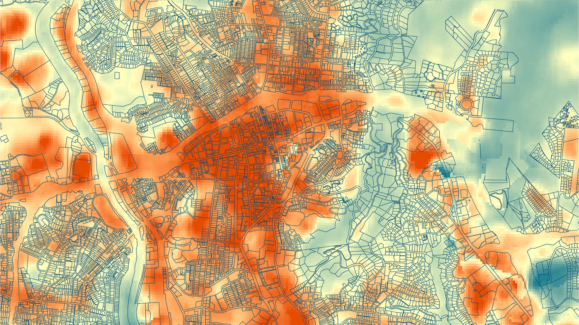
Asheville, North Carolina has had a population growth of approximately 10 percent over the past decade, while the city’s tree canopy cover has simultaneously decreased by 6.4 percent. A well-known benefit of urban tree cover is the mitigation of the...