Extreme winter rains in January 2018 following the Thomas Fire in Ventura and Santa Barbara Counties caused severe debris flows, destroying 73 homes and damaging over 160 structures in the town on Montecito, just east of Santa Barbara. NASA UAVSAR airborne radar platform detected changes caused by the debris flows between two images acquired on November 2, 2017 and February 5, 2018. An enhanced image pair (top left) show disturbed areas in orange. The two image pairs can’t be matched and decorrelate in areas of severe surface disruption from the fire scar and debris flows (top right). In the middle panels the radar images are overlaid on the structure damage map produced by the County of Santa Barbara. The fire scars and damage correspond well with the risk map (lower left) and damage map (lower right).
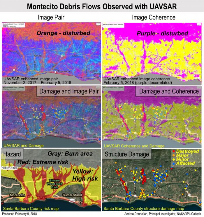
With an operational system, products such as this have the potential to augment the information available for search and rescue, and for damage assessment for government agencies or for the insurance industries. Radar has the advantage of being all-weather with the ability to image through clouds.


