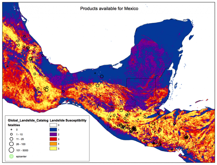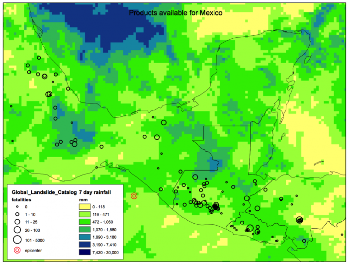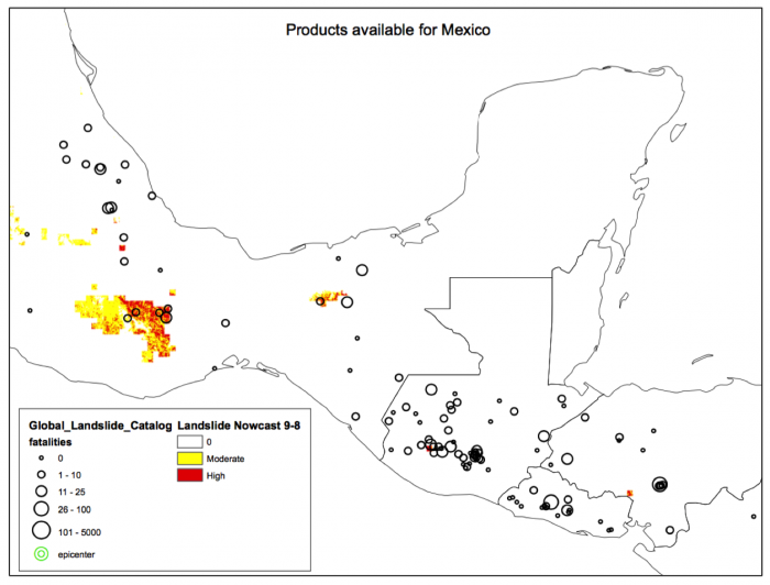
The global Landslide Hazard Assessment for Situational Awareness (LHASA) model is developed to provide situational awareness of landslide hazards for a wide range of users. Precipitation is a common trigger of landslides. The GPMIntegrated Multi-satellitE Retrievals for GPM (IMERG) data shows recent precipitation, updated every thirty minutes. A LHASA landslide “nowcast” is created by comparing GPM data from the last seven days to the long-term precipitation record provided by the Tropical Rainfall Measuring Mission (TRMM) Multi-satellite Precipitation Analysis (TMPA). Because IMERG data is only available starting in 2014, the record of historical rainfall was established by TMPA, comparing 2001-present. The TMPA rainfall probability distributions were then compared to that of IMERG and the rainfall thresholds were adjusted so that the IMERG data more closely mapped to those of the TMPA archive. The past 7 days of rainfall are considered, with each day is weighted according to their date before present, with the last twenty-four hours having the most impact.