Published
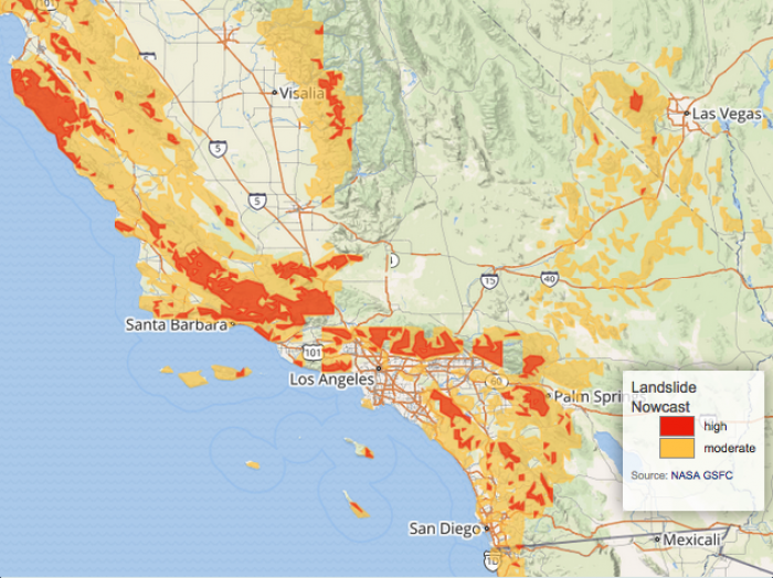
Winter rains falling on recently burned ground triggered deadly mudslides near Santa Barbara, California on the 9th of January. The potential for landslides is shown above.
This map was generated by the global Landslide Hazard Assessment for Situational Awareness (LHASA) model, a model that combines GPM precipitation data with a global landslide susceptibility map. LHASA gives a broad overview of landslide hazard in nearly real time, but site-specific information should be obtained prior to emergency operations or building projects.


