Visit the interactive map website: http://science.maps.arcgis.com/apps/MapSeries/index.html?appid=9ef5b5839e584a38be15423a4418e27d
The United States and Argentina have combined resources to produce a Spanish language website sharing satellite imagery and videos of the recent wildfires in Argentina. The project is a joint effort between Argentina, NASA, the US Department of State and ESRI. CONAE, who uses NASA’s algorithms and data, was the lead satellite organization responding to this disaster.
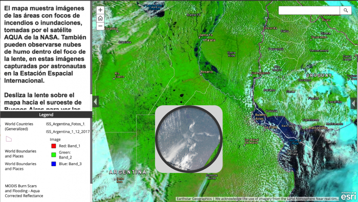
The interactive maps featured on the website show images of areas with fires or floods, taken by NASA's AQUA satellite. Smoke clouds can also be seen to the southwest of Buenos Aires within the movable lens icon, which displays images captured by astronauts on the International Space Station.
Instrument / Model: MODIS


