Published
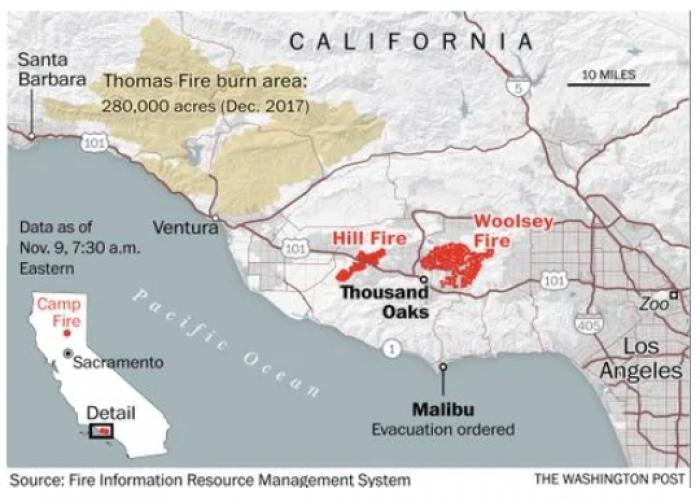
NASA’s Fire Information for Resource Management System (FIRMS) distributes Near Real-Time (NRT) active fire data within three hours of satellite overpass from both the Moderate Resolution Imaging Spectroradiometer (MODIS) and the Visible Infrared Imaging Radiometer Suite (VIIRS). Natural Resource Managers need to know where a fire is quickly to be able to prepare for and respond to a wildfire event. NASA FIRMS NRT helps to visualize the location of a fire in a timely manner.


