Share icon
Published

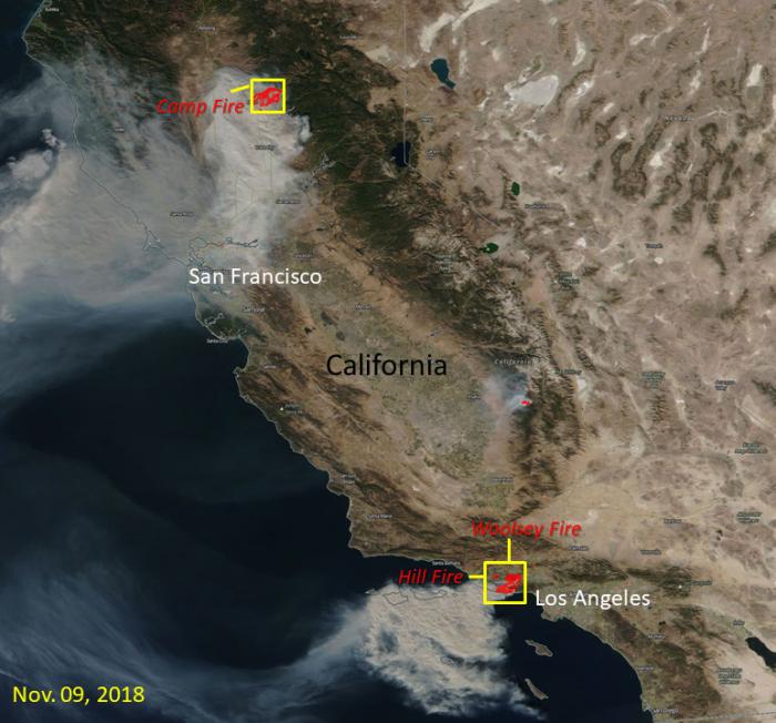
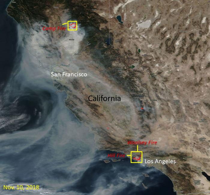
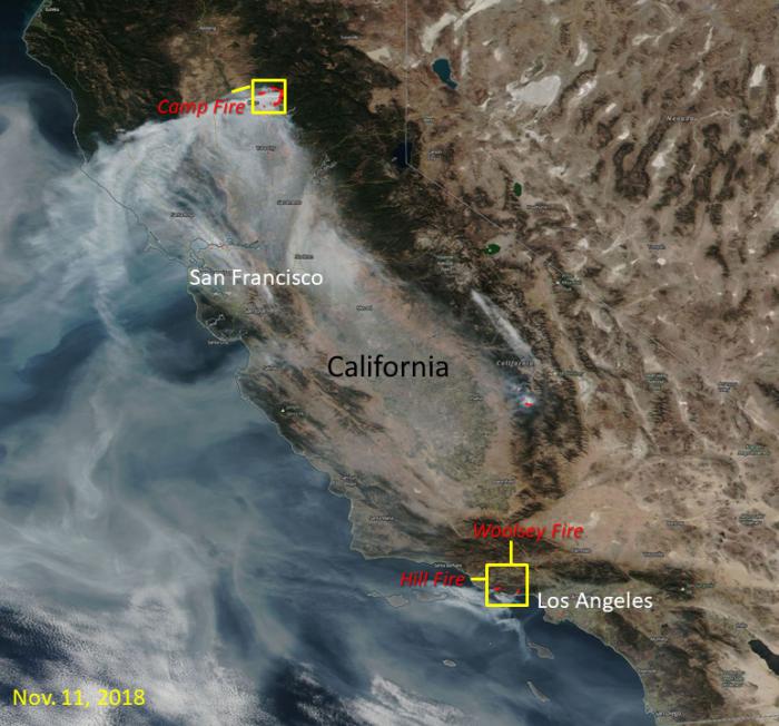
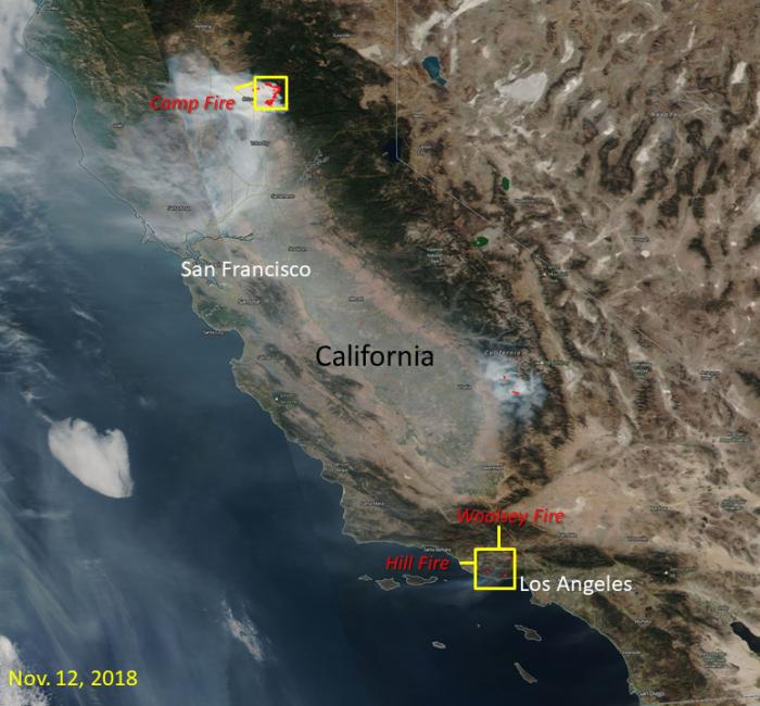
The images below show the California wildfires located by NASA Visible Infrared Imaging Radiometer Suite (VIIRS) Near Real-Time Fires and Thermal Anomalies product (in red points) from the Land, Atmosphere Near real-time Capability for EOS (LANCE). The map of California was provided through VIIRS true color imagery via NASA Worldview from November 9 - 12, 2018. The images show the extent of the Camp Fire, Woolsey Fire and Hill Fire burning in California. The red outlines with smoke indicate areas of active fire.

Image of NASA's Visible Infrared Imaging Radiometer Suite (VIIRS) Near Real-Time Fires and Thermal Anomalies
November 9th, 2018 VIIRS Near Real-Time Fires and Thermal Anomalies product from NASA LANCE.
Image of NASA's Visible Infrared Imaging Radiometer Suite (VIIRS) Near Real-Time Fires and Thermal Anomalies
November 10th, 2018 VIIRS Near Real-Time Fires and Thermal Anomalies product from NASA LANCE.
Image of NASA's Visible Infrared Imaging Radiometer Suite (VIIRS) Near Real-Time Fires and Thermal Anomalies
November 11th, 2018 VIIRS Near Real-Time Fires and Thermal Anomalies product from NASA LANCE.
Image of NASA's Visible Infrared Imaging Radiometer Suite (VIIRS) Near Real-Time Fires and Thermal Anomalies
November 12th, 2018 VIIRS Near Real-Time Fires and Thermal Anomalies product from NASA LANCE.

Related Impact

Story
News