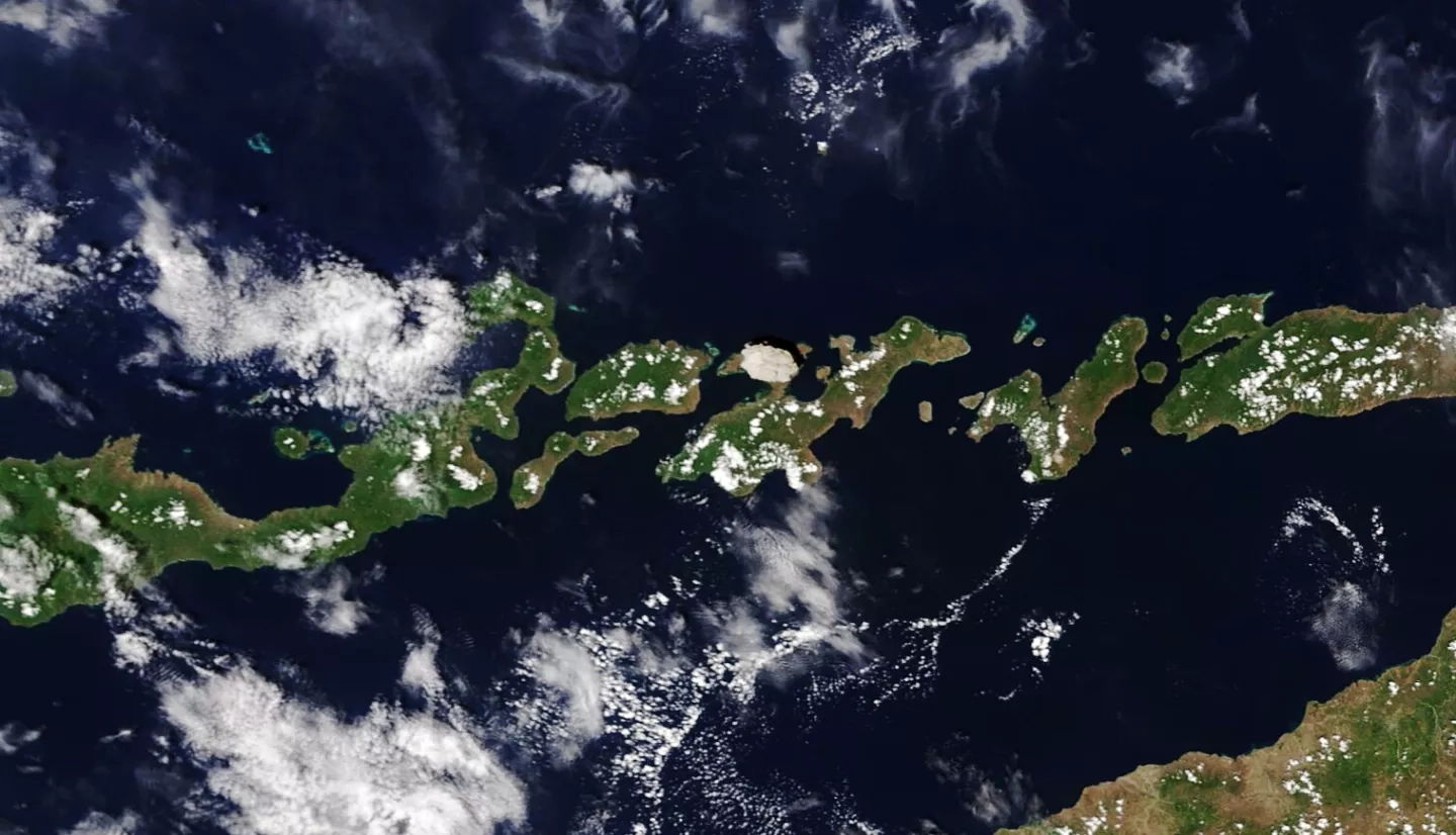
On November 29, 2020, a powerful eruption at Lewotolo volcano (also called Mount Ile Lewotolok) lofted a plume of ash and gas high into the air over Lembata, an island in Indonesia’s Lesser Sunda Islands. Using model and satellite data, NASA researchers tracked the volcanic plume for three days as it spread through Earth’s atmosphere, and supported Australia’s Darwin Volcanic Ash Advisory Centre (VAAC) to help monitor potential impacts to aviation.

Researchers frequently track sulfur dioxide (SO2) when studying the impacts from volcanoes, as it indicates the presence of a volcanic ash cloud. These ash clouds often contain abrasive ash particles, which are a hazard to aircraft engines, frames and avionics, and thus pose major threats to aviation. Large concentrations of SO2 in volcanic plumes also pose a short-term hazard to aviation by impacting cabin air quality, and lead to the production of long-lasting sulfate particles, which can affect Earth’s climate and ozone layer.
Using satellite observations from the Visible Infrared Imaging Radiometer Suit (VIIRS) and Ozone Mapping and Profiler Suite (OMPS) instruments aboard the NASA/NOAA Suomi-NPP satellite, NASA researchers tracked the spread of sulfur dioxide (SO2) over time from the eruption. OMPS measurements, which use solar backscatter ultraviolet (UV) radiances to remotely sense SO2, are more sensitive than the VIIRS observations and can show the full dispersion of volcanic clouds during days and months after an eruption. However, VIIRS thermal infrared SO2 measurements are higher spatial resolution, and are available at both day and night as well as at low light conditions. By collecting and comparing SO2 observations from multiple satellite instruments, researchers can gain a more complete situational awareness of the volcanic ash cloud to better track its impacts.
SO2 data from the eruption was also converted to Geographic Information Systems (GIS) format and shared on the NASA Disasters Mapping Portal, allowing other disaster-management organizations to easily download and analyze the data.
The researchers also ran models to simulate the dispersion of ash from the eruption in order to track its trajectory and better understand its potential impacts. Ash layers are shown traveling at different speeds and directions as they are transported by atmospheric winds. The models show that the volcanic plume reached up to 50,000 feet into the atmosphere, high enough to pose a threat to aviation. NASA’s experimental Langley Trajectory Model (LaTM) was run alongside NOAA’s operational Hybrid Single-Particle Lagrangian Integrated Trajectory (HYSPLIT) model, and results from the two model runs were compared and validated with the observational satellite data.
By comparing model data with observational data, researchers can assess the effectiveness of the model in predicting the ash transport and identify potential areas of improvement for future versions of the model. Model data can also help fill in the gaps between satellites observations and give VAAC’s and other disaster-management teams increased situational awareness to help mitigate potential impacts by diverting aircraft around the volcanic plume.


