Published
The NASA GSFC Disaster Team utilized a new algorithm for producing night time optical data, which was used as one of the assets for assessing impact of the Louisiana floods at the request of FEMA. In this case, the data was used for determining power outages as a means of mapping impact zones. (NASA Direct Readout Lab).
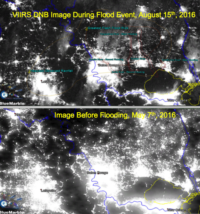
Top: During flood event, Aug 15th, 2016;
Bottom: Before event, May 7th, 2016.
A similar product developed by NASA MSFC to difference images such as these was first provided by NASA Disasters to DHS/FEMA to support efforts to restore power after Hurricane Sandy.


