NASA Data Incorporated into Bangladesh Weather Forecasts
Weather forecasters in Bangladesh are now better able to predict severe weather due to the inclusion of NASA Earth science data. “Bangladesh is a hotspot for high-impact weather events—intense rainfall, damaging wind and hail, frequent lightning strikes, and cyclones,” said Azizur Rahman, director of the Bangladesh Meteorological Department.
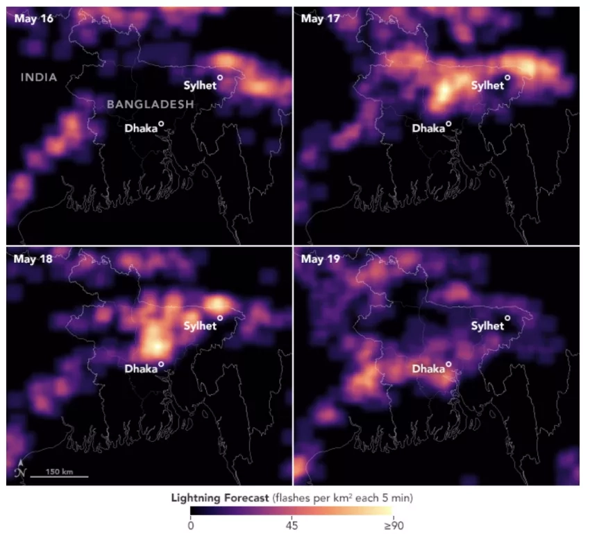
Bangladesh has a long history of deadly and costly storms. Among the most worrisome are kalbaishakhi, which are localized but extremely powerful and deadly storms. A 1989 tornado that is believed to be the deadliest in world history, stemmed from a kalbaishakhi, as well as a lightning strike at a wedding party causing 17 deaths in 2021.
Kalbaishakhi are notoriously difficult to forecast because they are so small. That's what led the U.S.-based SERVIR program to work with Bangladesh officials to launch the High-Impact Weather Assessment Toolkit (HIWAT). It is a website-based tool helps better weather forecasts by pulling in data from NASA’s Earth-observing satellites and combining it with BMD’s local observations. The project was led by Patrick Gatlin, a research meteorologist at NASA’s Marshall Space Flight Center, with SERVIR’s Hindu-Kush Himalaya team at the International Centre for Integrated Mountain Development (ICIMOD).
More about the project can be found at the NASA Earth Observatory story: NASA Data Supercharges Forecasting in Bangladesh


