Imagen

The first phase of the NASA-UCLA-NCAR technology transfer workshop was held in Addis Ababa, Ethiopia between 15th and 29th December 2017. The workshop is the culmination of a joint project between University of California, Los Angeles (UCLA) and National Center for Atmospheric Research (NCAR), funded by NASA’s Applied Sciences program. The primary objective of the project is to improve hydropower production in East Africa by leveraging NASA’s Earth Observation Satellites (EOS) and state-of-the art forecasting and hydrologic modeling systems. Specifically, a Decision Support System (DSS) comprising of calibrated North American Multi-Model Ensemble (NMME) forecasts, a hydrologic model in the form of NASA’s Land Information System (LIS) and a non-linear optimization software is developed to predict water availability in reservoirs at seasonal, medium and short-range time scales. The transfer of the developed DSS is planned to take place in four phases: workshops on remote sensing, climate and hydrologic forecasting, and hydropower optimization, followed by a conference in Addis Ababa.
In the first workshop, focus was on the fundamentals of remote sensing, programming and data analysis with R and validation of remote sensing data with R. Held in two stages, the workshop started on the 15th December 2017 by building the theoretical foundation of remote sensing of hydrologic fluxes, primarily precipitation.
In the first stage, the participants were introduced to the basics of satellite remote sensing, specifically remote sensing in visible and near infrared spectrum, with a focus on NASA’s Landsat and MODIS products. Next, the theoretical basis of rainfall algorithms in missions such as TRMM and GPM was explained. In addition, the advantages of satellite rainfall in data-scarce regions, such as Ethiopia, was impressed upon the participants.
The second stage involved introducing R, a general purpose programming language, in different data formats such as csv and NetCDF. A major part of the hands-on training was to make the stakeholder aware of the remote sensing data repositories. Here, the focus was on NASA’s Mirador, GES-DISC data portals. The stakeholders were able to download required datasets, such as TRMM, and also subset the data to their regions of interest, plot spatial maps and validate the remote sensing datasets using global gridded rainfall datasets.
The stakeholders, who were from Ethiopian power, water and meteorological agencies, acknowledged the lack of availability of data and appreciated the exposure to a wide variety of remote sensing data and also the introduction to data analysis using R.
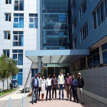
The second stage spanned six days and included hands-on training of programming and analysis of remote sensing data using R. This phase was also held in Addis Ababa at the Ethiopian Construction Works Corporation (ECWC) headquarters on 24th to 28th April 2018. The workshop had approximately 20 participants from the ECWC, the Ethiopian National Meteorological Agency (NMA), and Ethiopian Ministry of Water and Energy.
In the second workshop, each day was divided into more theoretical lectures in the morning, and afternoon laboratories. The focus of the lectures was on the fundamentals of rainfall prediction, with the range of topics including ensemble forecasting, atmospheric and hydrologic predictability, basics of weather forecasting, verification, seasonal forecasting with focus on East African dynamics, and statistical aspects of weather and streamflow prediction including pre- and post-processing and multi-modeling.
In the afternoon laboratories, the range of topics included the basics of linux, CRON and automatic batch processing, the basics of python and R, and postprocessing of ensemble forecasts and verification. The laboratories’ primary focus however, was on enabling the students to generate their own seasonal rainfall forecasts for the river basins of their choice (using the NNME, ENSO SST indices, and statistical techniques provided in python scripts).


