Scientists at NASA’s Short-Term Prediction Research and Transition (SPoRT) project use near real-time data to help the operational weather community with hurricane forecasting
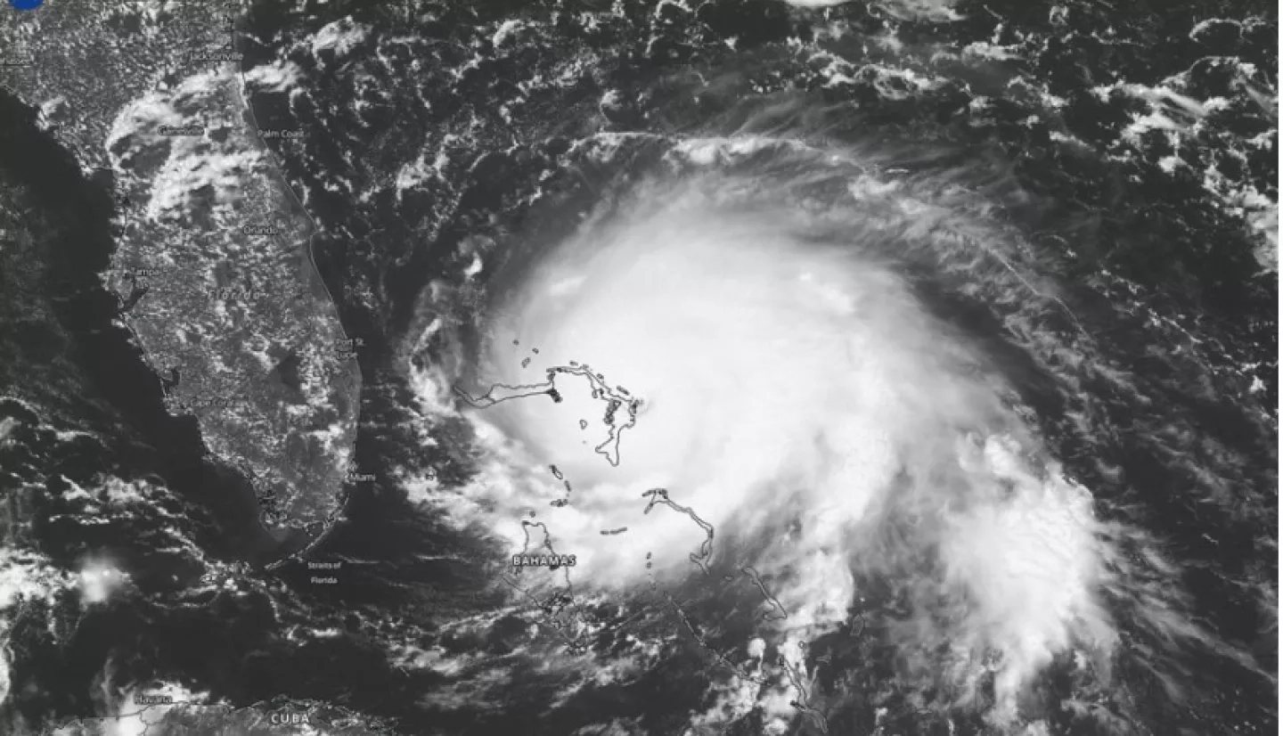
As the Sun came up on September 1, 2019, the eye of Hurricane Dorian was fast approaching the Abaco Islands in the Bahamas. The Category 5 hurricane hit the islands at 12:40 p.m. local time with maximum sustained winds of 298 kilometers per hour (185 miles per hour).
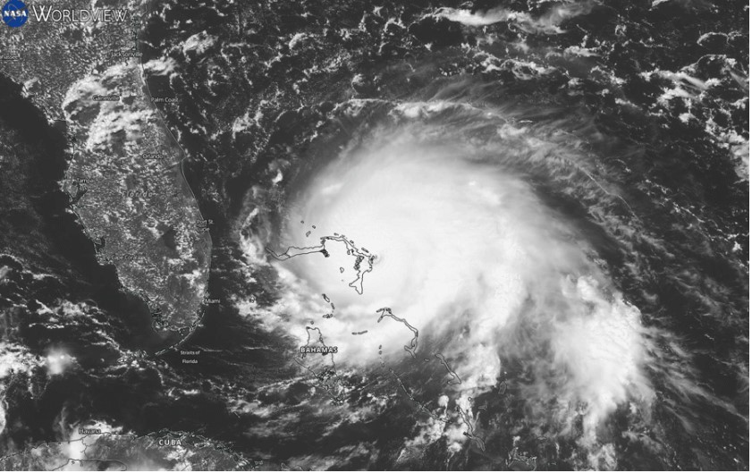
The movement of the storm was captured by the Geostationary Operational Environmental Satellite-East (GOES-East) Advanced Baseline Imager (ABI). GOES-East and GOES-West are joint NASA/NOAA geostationary satellites that provide data on storm evolution by measuring infrared and visible radiation. The GOES imagery is available in 10 minute increments and made available through NASA’s Global Imagery Browse Services (GIBS) and Worldview interactive data visualization application approximately 40 minutes after it is captured by the satellite.
GOES imagery is provided to GIBS by the Short-Term Prediction Research and Transition (SPoRT) project, based at NASA’s Marshall Space Flight Center in Huntsville, Alabama. SPoRT is a NASA project to transition unique observations and research capabilities to the operational weather community to improve short-term forecasts. "Imagery from the GOES ABI instrument is really helpful for seeing the big picture of potential hurricane activity in the Atlantic," said Patrick Duran, Research Physical Scientist at SPoRT.
SPoRT scientists use data and imagery from a number of sources to monitor hurricanes. Near real-time data, which are typically defined as being available within three hours after being captured by satellite, allow scientists to track storms before they begin and during their evolution.
Read the full story at: https://earthdata.nasa.gov/learn/articles/hurricane-forecasts-nrt-data


