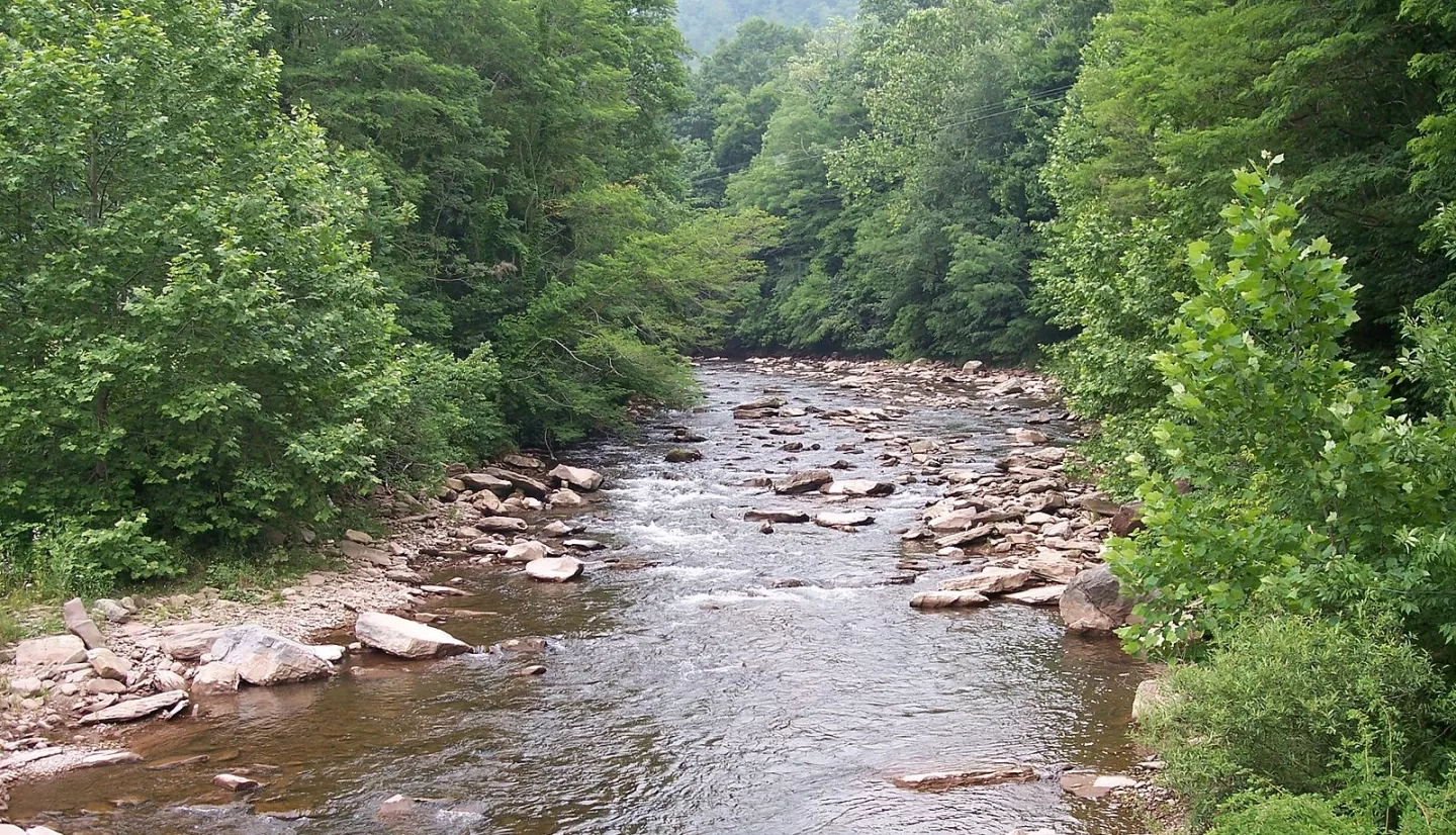
The Cheat River Watershed, located in northeast West Virginia, offers a broad range of social, economic, and recreational opportunities for its estimated 40,000 residents. Famously known for whitewater kayaking and rafting, the Cheat River might have been exactly where John Denver was referring to when he wrote “Take Me Home, Country Roads.” However, this watershed has a storied past with regard to both water quality and quantity.
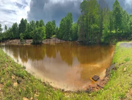
In 1995, the Cheat River was listed by American Rivers, a river advocacy group, as the eighth most endangered river in North America. Centuries of coal mining degraded the water quality due to severe acid mine drainage in the lower basin. Discharge from abandoned mine lands and active coal mine operations accumulated in the watershed, staining river rocks a bright orange color and polluting the river to toxic pH levels.
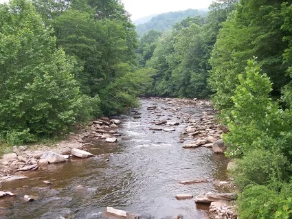
A non-profit organization, Friends of the Cheat, took on the task of restoring, preserving, and promoting the natural qualities of the watershed by remediating acid mine drainage. While the water quality of the Cheat River has greatly improved because of Friends of the Cheat’s efforts, frequent flooding events threaten to reverse years of restoration work aimed at reducing contamination from acid mine drainage. Communities in the Cheat River watershed are confronted with floods that can destroy housing, key infrastructure, crops, and further pollute the river.
"The [DEVELOP] project hit all three parts of our mission statement to preserve, promote, and restore. It gave us the resources to understand what we need to protect, where we need to start preparing for the changes that we will likely see on the Cheat, and how to share that information with the public."
|
To better understand flood vulnerability and create opportunities for flood mitigation in the region, Friends of the Cheat partnered with NASA DEVELOP in the spring of 2021. The project employed a suite of NASA Earth observations including Landsat 5 Thematic Mapper (TM), Landsat 8 Operational Land Imager (OLI), and Shuttle Radar Topography Mission (SRTM), NOAA climate data records, and ancillary data. These datasets were used to study changes in local climate, land cover, and flood vulnerability in Preston and Tucker Counties from 1950 to 2020.
“We have already seen the effects of climate change in our river system, so it was exciting to work with the NASA DEVELOP team, who provided the expertise to assist us in thinking proactively rather than reactively to changing conditions”, said Madison Ball, Restoration Program Manager for Friends of the Cheat.
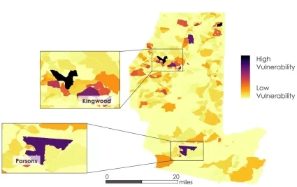
To assess flood risk and vulnerability, the DEVELOP team combined Earth observation data with seven ancillary datasets including roads, underground mines, and census population data to highlight areas of high vulnerability. After examining the maps, Madison Ball explains, “Many areas on the flood vulnerability map were already known to us—however, it was eye-opening to find some new areas on the map that were highly vulnerable."
Friends of the Cheat now uses the DEVELOP team’s maps that highlight vulnerable areas to pursue projects that will increase the watershed’s climate and flood resilience including reforesting riparian areas to reduce erosion during flooding events and adapting acid mine drainage treatment sites to treat seasonal high flow volumes.
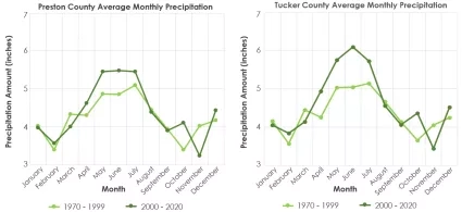
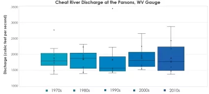
The project also assessed long-term precipitation, temperature, and stream discharge trends in Preston and Tucker Counties. The analysis discovered that between 1970 and 2020, yearly total precipitation had increased by 4.2 inches, while monthly discharge has become more variable, suggesting that flood events may increase with future climate conditions.
Friends of the Cheat has used this information, “as a case for pursuing grant funds to start new projects [that] improve our climate adaptation”, says Madison Ball, “[and now] we actually have data that supports what we are seeing on the ground, and I think that adds more credibility to our very small organization.”
“The project hit all three parts of our mission statement to preserve, promote, and restore”, said Madison Ball, “it gave us the resources to understand what we need to protect, where we need to start preparing for the changes that we will likely see on the Cheat, and how to share that information with the public.”
Friends of the Cheat now use the resources provided by the DEVELOP team to protect flood vulnerable areas in the Cheat watershed and prepare for future changes in climatic variables. Leveraging NASA Earth observations, Friends of the Cheat can now be more proactive in their climate and flood adaptation strategies to protect West Virginia's people and resources.