FLORIDA DISASTERS (Summer 2022)
Team: Liam Megraw, Stefanie Dimayuga Mendoza, Samantha Kelly, Jesse Carlson
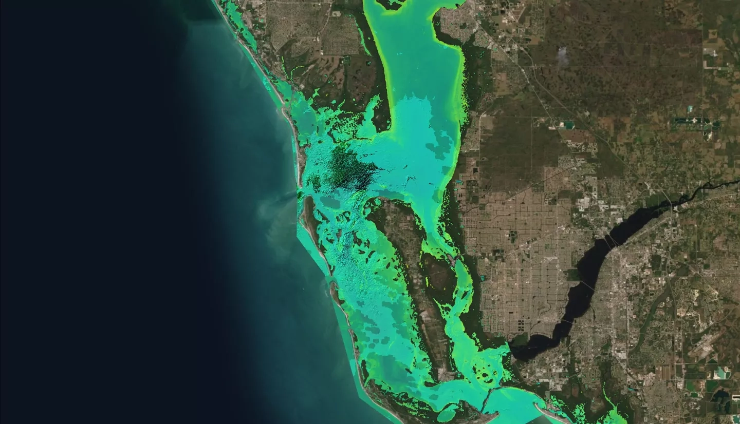
Summary: Intensifying weather events, sea level rise, and extensive coastal development in Southwestern Florida are escalating the need for Florida’s mangrove conservation. These mangroves are imperative for coastline stabilization, habitat provision for native species, and water quality management. Our partner, the Florida Department of Environmental Protection (FDEP), Office of Resilience and Coastal Protection is tasked with monitoring and conserving the Charlotte Harbor, Estero Bay, Rookery Bay, and Pinellas County Aquatic Preserves. We developed the Growth, Resilience, and Optical Vegetation Evaluator (GROVE) Google Earth Engine toolset for partners to determine mangrove forest extent through time, analyze mangrove forest health, and collect several water quality parameters within the preserves from January 2002–August 2022. The toolset provides easily accessible data from Landsat 7 Enhanced Thematic Mapper Plus (ETM+), Landsat 8 Operational Land Imager (OLI), Landsat 9 Operational Land Imager 2 (OLI-2), and the Shuttle Radar Topography Mission (SRTM). Using training datasets of known mangrove forest locations, we also established a machine learning approach to create mangrove extent maps. Maps from all four preserves indicated migration of mangrove forests inland as the greatest areas of change were transitional zones. Additionally, normalized difference vegetation index (NDVI), normalized difference turbidity index (NDTI), and chlorophyll-a maps were generated for the partners. This project provides decision makers with a useful tool for understanding temporal changes in Florida’s aquatic preserves, identifying areas of ecological stress, and providing actionable data to make informed plans for mangrove preservation.