This project blended a satellite-based nowcasting system (Multi-sensor Advection Diffusion NowCAST (MADCast, Descombes et al. 2016; Xu et al. 2016) with a numerical weather prediction nowcasting approach (Weather Research Forecast model-Solar (WRF-Solar®,Jimenez et al. 2016) to create an improved end-to-end solar irradiance forecast system called MAD-WRF. The improved irradiance forecasts from MAD-WRF will help achieve the GEO Vision for Energy (GEO-VENER) goals which include the use of observations and models to make possible the effective deployment, operation, and maintenance of renewable energy systems and their integration into the grid. To this end, MAD-WRF will be distributed as OpenSource code to help achieve GEO-VENER goals beyond the project.
The project first evaluated methods for improving cloud initialization by inferring the presence of clouds based on relative humidity from the first guess, and constraints of the cloud mask and the cloud top / base height from Earth observations. The cloud detection from the WRF analysis
using our project’s cloud fraction parameterization shows the best performance and are used to initialize MAD-WRF. Code was developed to constrain the cloud mask, the CTH and the CBH estimations with Earth observations, which are available within MAD-WRF. The next step was to blend WRF-Solar and an enhanced version of MADCast to create the MAD-WRF model, which can be run in two configurations:
- MAD-WRF in MADCast mode: The initial hydrometeors are advected and diffused with the model dynamics without accounting for any microphysical processes.
- MAD-WRF model: There is a set of hydrometeor tracers that are advected and diffused with the model dynamics. At initial time the tracers are equal to the standard hydrometeors. At the beginning of the simulation the standard hydrometeors are nudged towards the tracers.
Key Results Include:
- Improved version of MADCast and MAD-WRF improved the global horizontal irradiance (GHI) predictions from WRF-Solar by 15%.
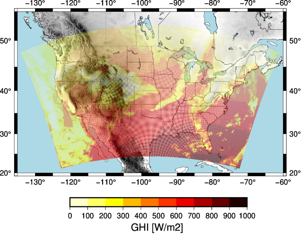
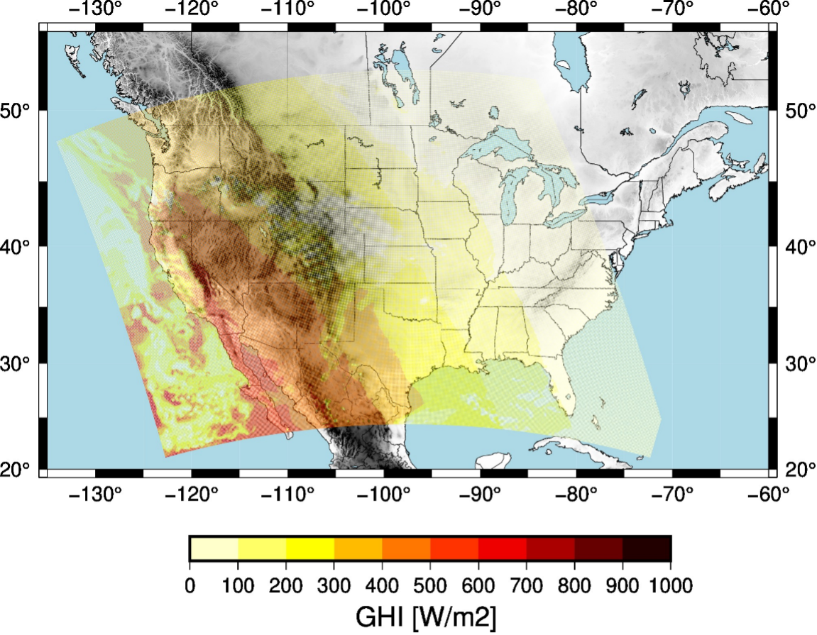
- MAD-WRF is providing forecasts over a grid with 9 km of grid spacing covering the Contiguous U.S. There are runs every hour with a forecast length of 6 hours. The global horizontal irradiance predictions, available every 15 minutes, and cloud analyses are shared with the Group on Earth Observations (GEO) community.
- Data from WRF-Solar, MADCast and MAD-WRF can be downloaded from GEO Vision for Energy initiative website (GEO-VENER) and from the MAD-WRF website.
Recent Publications:
- McCandless, T., and P. A. Jiménez, 2020: Examining the Potential of a Random Forest Derived Cloud Mask from GOES-R Satellites to Improve Solar Irradiance Forecasting. Energies, 13, 1671.
- Jimenez, P.A., 2020: Assessment of the GOES-16 clear sky mask product over the contiguous USA using CALIPSO retrievals. Remote Sens., 12, 1630.
- Jiménez P.A., T. McCandless, 2021: Exploring the Potential of Statistical Modeling to Retrieve the Cloud Base Height from Geostationary Satellites: Applications to the ABI Sensor on Board of the GOES-R Satellite Series. Remote Sens., 13, 375.