Imagen

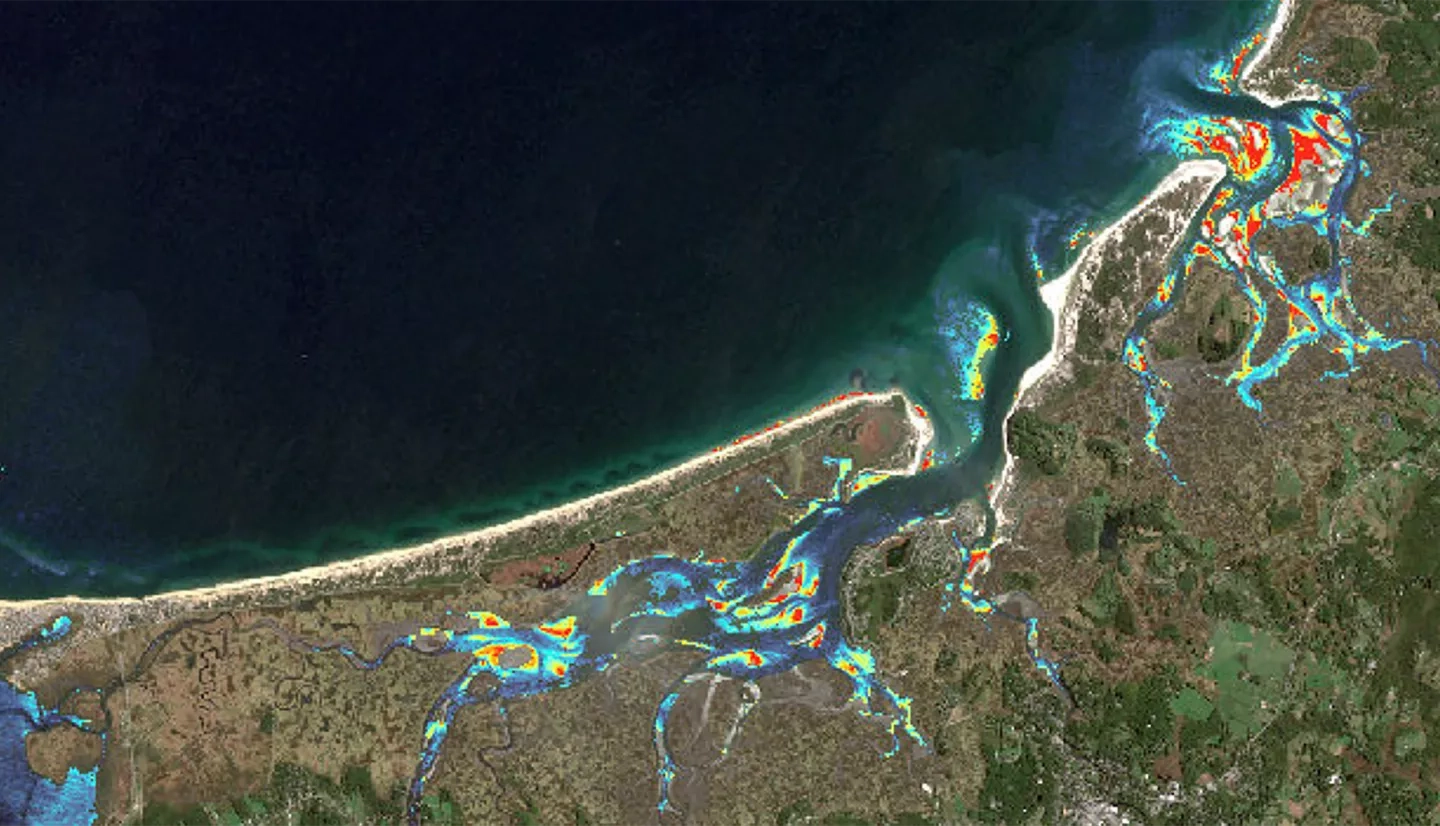
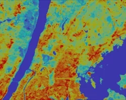
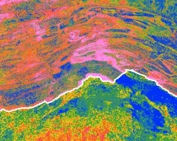
Salt marshes provide valuable ecosystem services, including protection from coastal storms, erosion control, carbon sequestration, improved water quality, and ecological diversity. Plum Island Estuary (PIE), the largest salt marsh in the northeast United States, is a two thousand year-old ecosystem located thirty-five miles north of Boston, Massachusetts. As sea level rises, the structure and health of this marshland ecosystem depends on sediment availability. Current research in the estuary, performed by the United States Geological Survey (USGS) and the Woods Hole Marine Biological Laboratory (MBL), uses point-measurements of sediment fluxes. However, these isolated data points can be misleading when attempting to understand system-wide changes. Landsat 8 Operational Land Imager (OLI) and Sentinel-2 MultiSpectral Instrument (MSI) imagery from 2013 to 2017 were compared to in situ data measurements. An algorithm was generated to calculate total suspended sediment concentration and distribution in the estuary. In dynamic ecosystems like salt marshes, utilizing remote sensing to quantify and visualize sediment supply assists end users in generating current and future vulnerability assessments of PIE to sea level rise.