Start Date: Oct. 16, 2025
Type: Floods
Region: Western Alaska, North America
View maps and data for this event on the NASA Disasters Portal.
UPDATE NOV. 13, 2025
To support the disaster response to heavy rain and coastal flooding in southwestern Alaska following Typhoon Halong, the NASA's Disasters Response Coordination System (DRCS) was activated Oct. 16-30, 2025. During this activation, the NASA Disasters Program worked with the American Red Cross, the USGS Geospatial Information Response Team, and emergency response staff deployed in the Alaska State Emergency Operations Center to deliver critical data and decision-support tools.
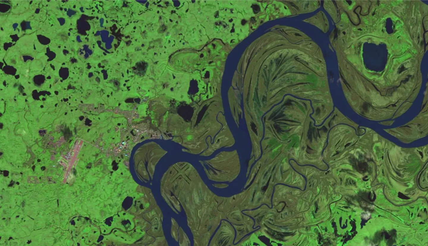
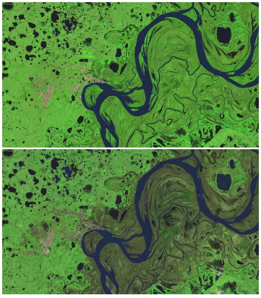
The most significant impacts from the flooding were to the Yukon–Kuskokwim Delta. The Red Cross reported as many as 2,000 people in Western Alaska were evacuated to shelters as responders sought detailed information on flood extent and damage to homes and infrastructure.
The NASA DRCS delivered multiple Earth observation products to support response efforts. The team provided Black Marble Blue/Yellow nighttime lights composite and Black Marble Day/Night Band (BRDF-Corrected) layers to aid in tracking power outages and restoration. Pre-event and post-event optical imagery from the European Space Agency’s Copernicus Sentinel-2 satellites included true color, short-wave infrared, and color-infrared composites, while commercial satellite imagery from Planet via the Commercial Satellite Data Acquisition (CSDA) program provided additional high-resolution coverage of affected areas for damage assessments.
For flood mapping, the DRCS delivered OPERA Sentinel-1 and Harmonized Landsat Sentinel (HLS) water extent maps, along with a flood-extent log-difference product from the University of Alaska Fairbanks derived from ASF Sentinel-1 data. Additional datasets included OPERA Dynamic Surface Water eXtent (DSWx) imagery layers and web maps to enhance mapping coverage as conditions evolved.
The activation was led by DRCS Center Response Coordinators from NASA's Jet Propulsion Laboratory, with support from additional Disasters Program staff at Marshall Space Flight Center, Langley Research Center, and Goddard Space Flight Center. Maps and data supporting response during this activation were shared online via the Alaska Floods October 2025 product gallery on the NASA Disasters Portal and remain available to aid recovery efforts.