Start Date: Aug. 28, 2023
Type: Hurricanes & Cyclones
Region: North America
Info & Resources:
- View maps and data for Idalia on the NASA Disasters Mapping Portal
- NASA Disasters program resources for hurricanes and tropical cyclones
- NASA Earthdata Toolkits – Tropical Cyclones
- NASA Earth Observatory: Hurricane Idalia
- NOAA: One-stop event page for Idalia
- What the Dept. of Homeland Security and FEMA are doing:
- What the U.S. government is doing:
- English: https://usa.gov/hurricane-idalia
- Spanish: https://usa.gov/es/huracan-idalia
UPDATE AUG. 30, 2023
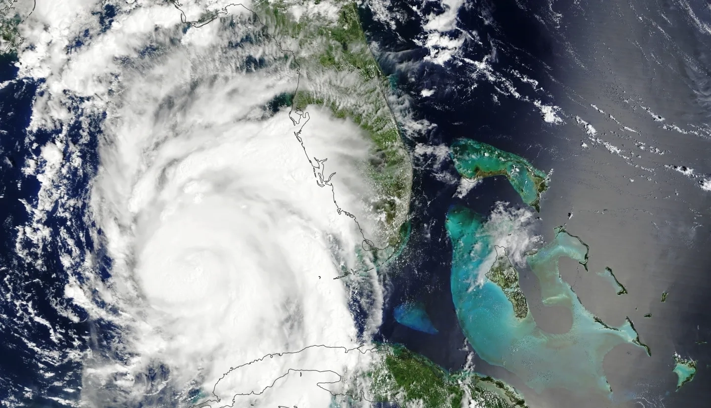
Idalia brought significant storm surge, heavy rains, and strong winds as it made landfall near Keaton Beach in Florida’s Big Bend region at 7:45 a.m. EDT on Aug. 30 as a Category 3 hurricane with maximum sustained winds near 125 mph (205 kph). NOAA records show Idalia as the strongest hurricane to hit the area since Sept. 1896, and media reports Wednesday afternoon indicated that more than 400,000 customers lost power in Florida and Georgia as streets flooded near the coasts. Forecasters predict the system to remain a hurricane as it crosses into Georgia with top winds of 90 mph (150 kph), then pass through the Carolinas overnight as a tropical storm.

The NASA Disasters program activated on Aug. 28 to monitor Idalia and has been participating in federal coordination calls organized by FEMA with federal and state partners to assess needs. In preparation for landfall, the NASA Disasters team posted pre-event optical imagery to the NASA Disasters Mapping Portal. These included data from the Landsat 8 and 9 and Copernicus Sentinel-2 satellites, as well as high-resolution optical imagery derived from commercial satellites enabled by NASA’s Commercial Smallsat Data Acquisition Program. Responders and scientists can compare these with post-event imagery once the storm has passed to identify changes to the impacted regions and assess flooding and other damage.
The NASA Disasters program continues to monitor the storm and provide Earth observation data and mapping to assist response agencies.