Date
Start Date: June 24, 2024
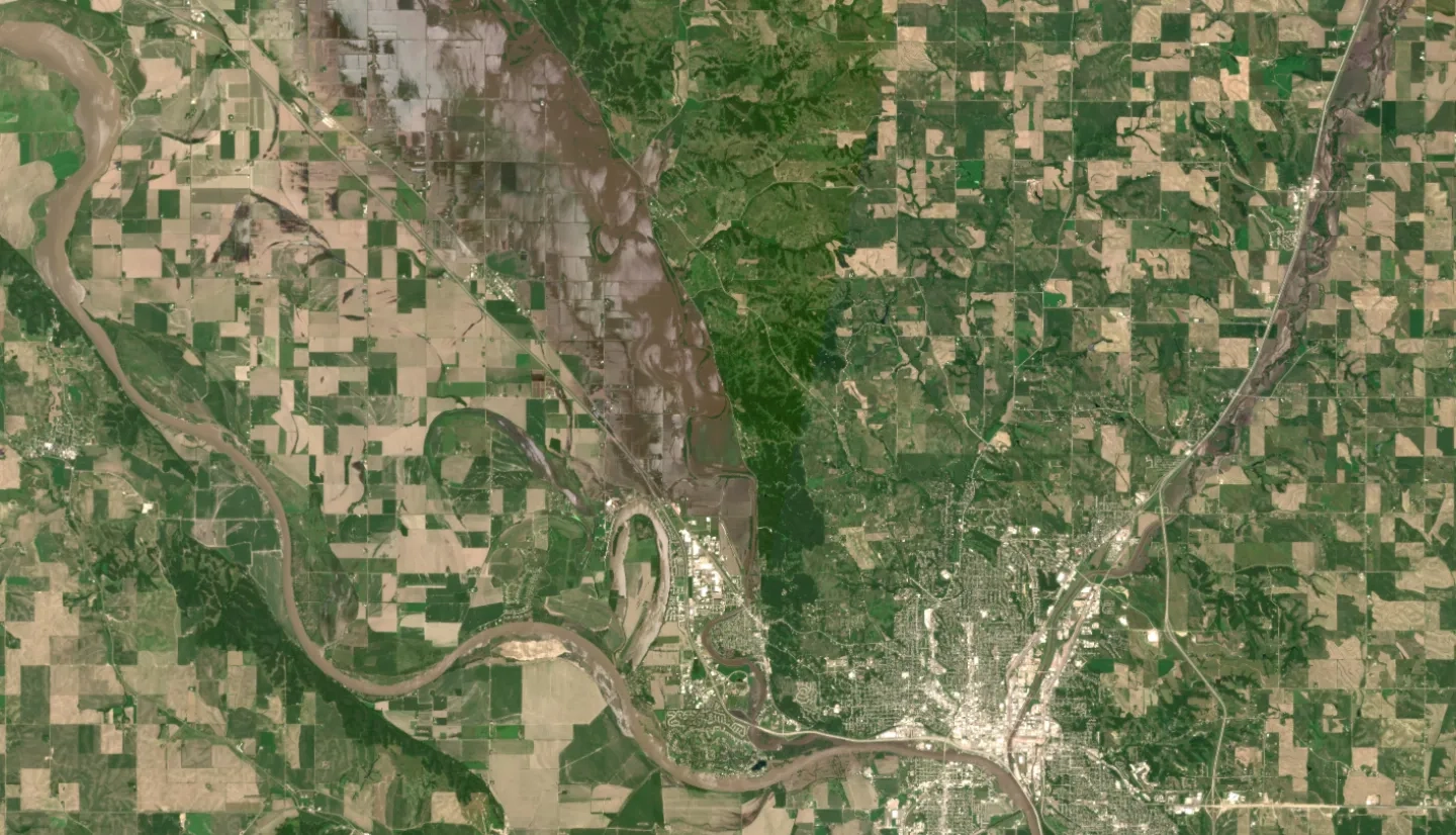
Type: Floods
Region: North America
Info & Resources:
Overview:
NASA's Disasters Response Coordination System (DRCS) provided FEMA with high resolution optical and infrared imagery, water extent, and flood extent maps to support their response for flooding in Iowa. In the following weeks, the program provided additional data as the situation evolved and flooding progressed to other locations in Iowa and the surrounding states.
