Start Date: April 14, 2026
Disaster Type: Hurricanes & Cyclones
Region: Northern Mariana Islands, Oceania
View Maps & Data on the NASA Disasters Portal
UPDATE APRIL 24, 2026
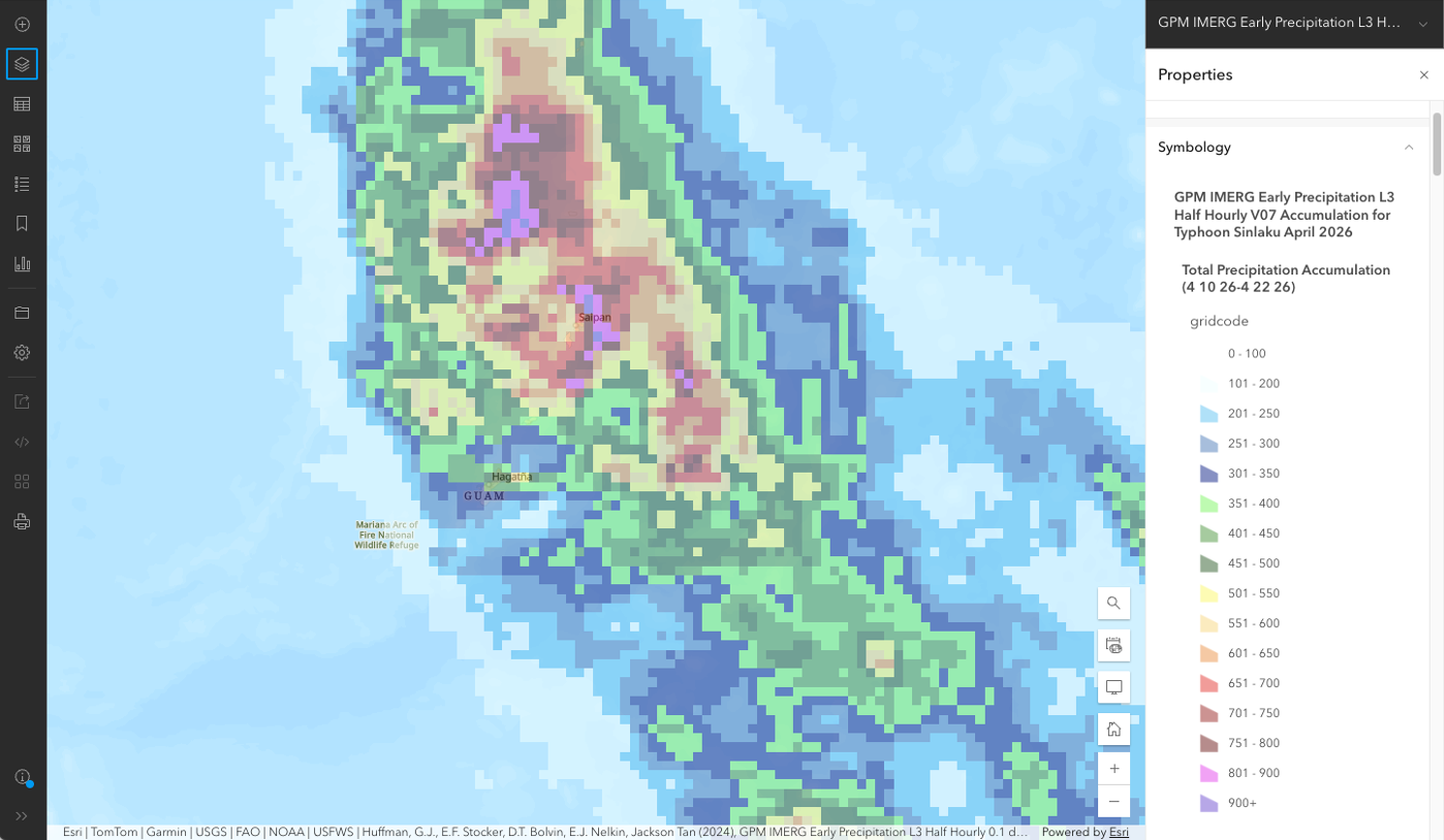
NASA Tracked Sinlaku's Rainfall from Space When Ground Radars Went Dark
UPDATE APRIL 15, 2026
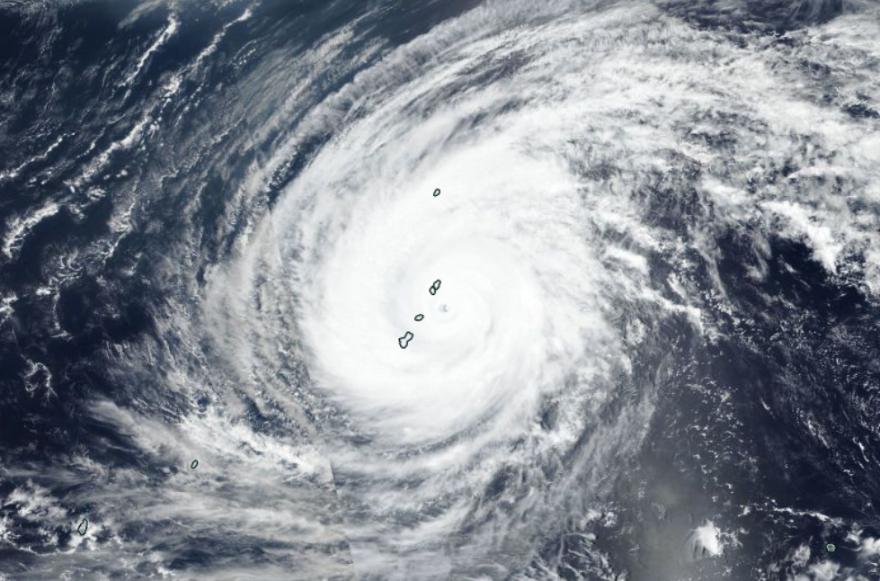
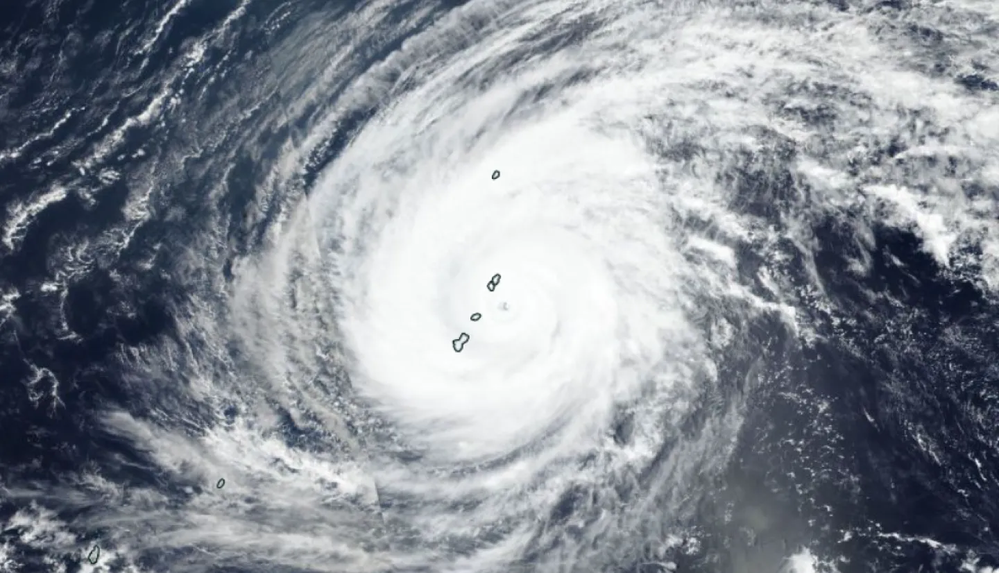
Typhoon Sinlaku made landfall in the Northern Mariana Islands on April 14 as a powerful Category 4 storm, with sustained winds of 150 mph and recorded gusts reaching 185 mph. The islands of Saipan and Tinian experienced widespread power blackouts and extensive damage to homes and infrastructure, as well as heavy flooding from over 20 inches of rain. Guam also experienced significant impacts, including power outages and flash flooding, though it avoided a direct hit from the storm's eye.
In coordination with FEMA and other federal partners, the NASA Disasters Program is working with the American Red Cross and the Centers for Medicare and Medicaid Services to support their response to the storm. The program is sharing satellite-based maps and data with partners, including NASA Black Marble data to assess power outages, landslide hazard assessment maps, and imagery from commercial partners – enabled by NASA’s Commercial Satellite Data Acquisition Program – that provide context and situational awareness.
The NASA Disasters Program is also working with NASA’s Goddard Space Flight Center Emergency Management program to support the Guam Remote Ground Terminal (GRGT), a key facility for relaying and processing NASA satellite data.
Maps and data are being shared to the NASA Disasters Portal as they become available.