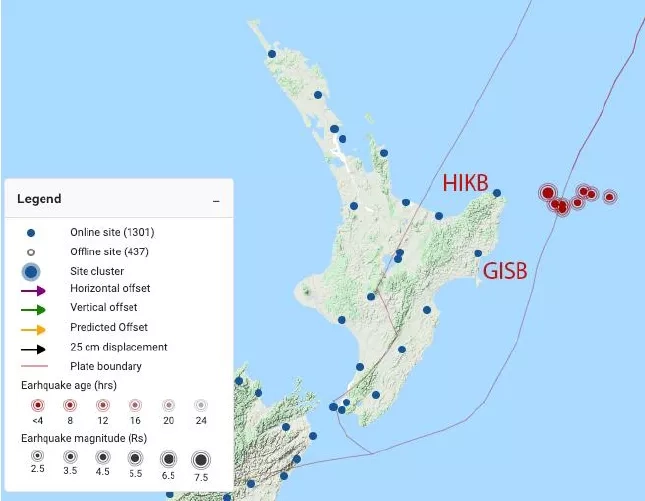
On March 4, 2021, a magnitude 7.3 earthquake occurred in the ocean northeast of Gisborne, New Zealand, followed by two other earthquakes further north shortly thereafter. A constellation of satellites and ground stations monitored this tectonic activity in near real-time as part of a system being developed to provide early warnings for tsunamis.
It is commonly said that if you can see the tsunami coming, it’s already too late to outrun it. Therefore, reducing evacuation start time is the most critical variable in saving lives when a tsunami is imminent. To achieve this, a team of researchers from the University of Oregon, the University of Washington, and Central Washington University (CWU) is working to develop a tsunami early warning system using data from a network of over 1,600 Global Navigation Satellite System (GNSS) ground stations. The system rapidly detects displacement on the ground, uses models to identify potential tsunami activity, and sends this data to local disaster response agencies to generate tsunami warnings – all within seconds of the tectonic activity occurring.
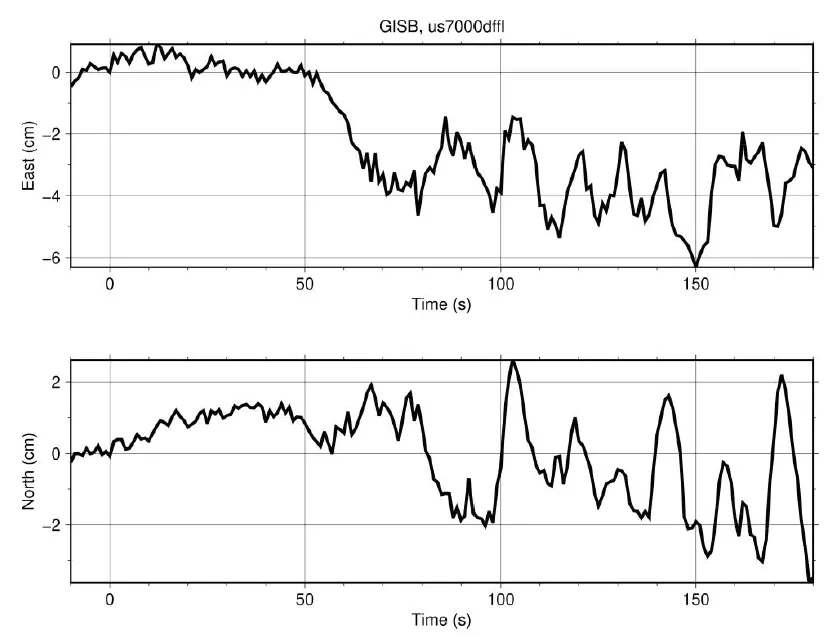
The two closest GNSS sites in New Zealand, GISB and HIKB, were roughly 100km from the epicenter of the earthquake, and registered peak ground displacement between 3 - 7cm. Although the Geodetic First Approximation of Size and Timing (GFAST) system at NOAA that monitors for the activity was offline at the time of this event, the real-time GNSS processing worked as expected, with low latencies, and with noise levels comparable to previous events.
The event served as a valuable test of the capabilities of GNSS for monitoring for tsunami activity, and another step towards developing a robust and capable global tsunami early warning system. The work is funded in part by the NASA’s Earth Applied Sciences Disasters Program, via the ROSES A.37 research project “Enlisting Satellite Data to Modernize Local Tsunami Early Warning”. The Disasters Program funds this and other research in order to improve the prediction of, preparation for, response to and recovery from hazards and disasters around the world.