Two weeks after it ignited, the Dixie fire continues to burn in Northern California, east of the city of Chico. The fire has merged with the nearby Fly fire, and together they have consumed more than 221,000 acres of timber and chapparal (small bushes, shrubs and trees) in Butte and Plumas counties and in Lassen National Forest. It is the largest wildfire in California in 2021.
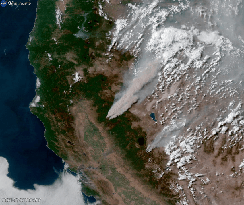
The NOAA GOES-West satellite captured the above true color imagery of smoke emanating from the fires on July 21. Click here to view this in NASA Worldview.
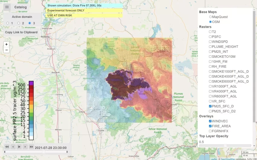
The NASA Disasters program area-funded research project “Coupled Interactive Forecasting of Weather, Fire Behavior, and Smoke Impact for Improved Wildland Fire Decision Making” is producing experimental smoke forecast maps for the Dixie fire using the Weather Research Forecasting – Spread FIRE (WRF-SFIRE) system. The project aims to reduce the risks associated with wildland fires and their management through the integration of weather data, surface fuel moisture observations, satellite fire detections, and operational numerical weather prediction models using very high-resolution coupled fire-fuel-atmosphere-smoke modeling.
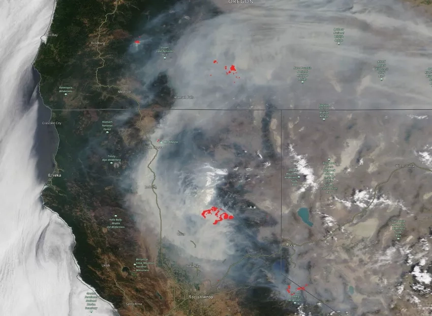
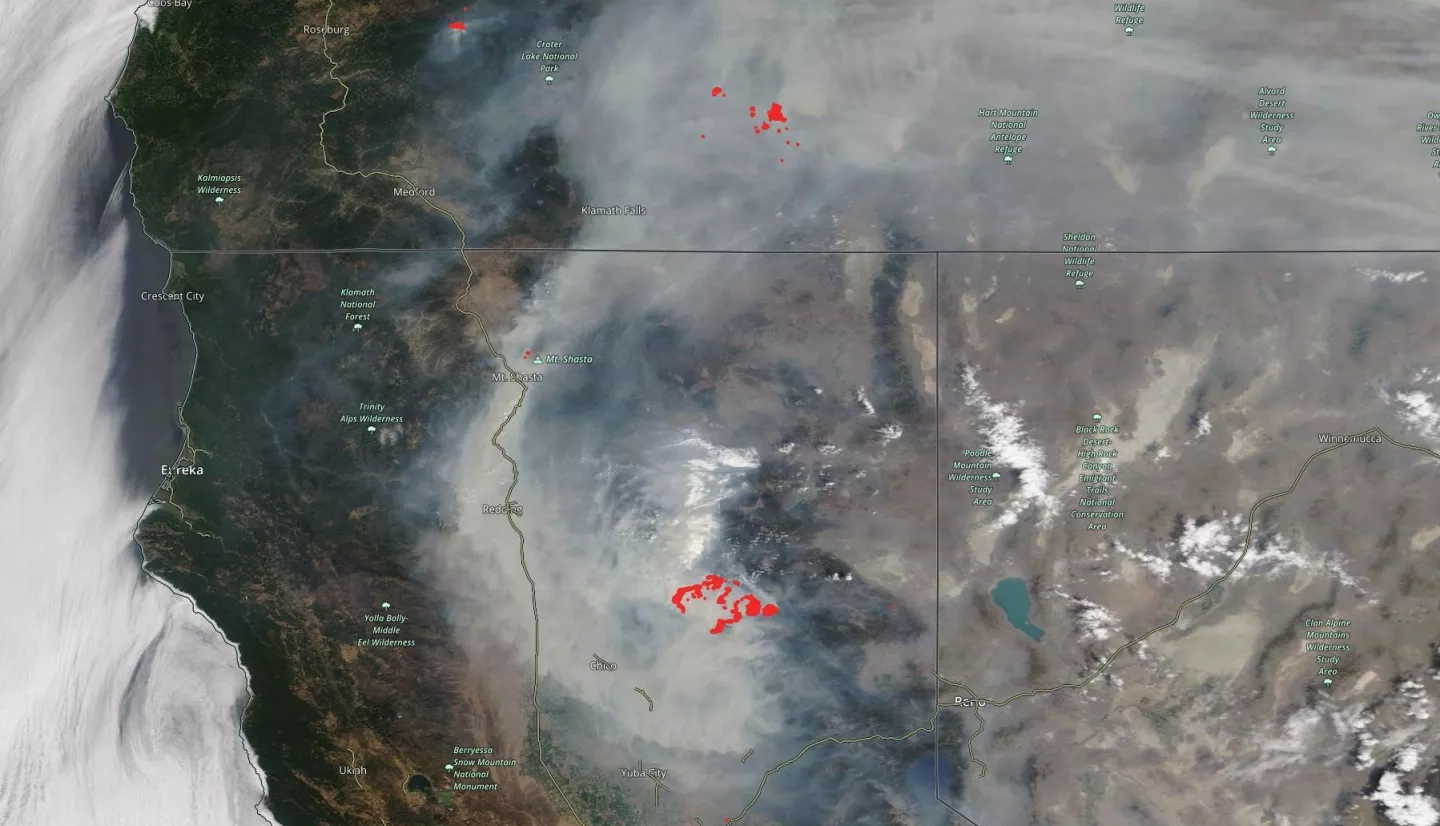
In the late morning on July 24, 2021, the Moderate Resolution Imaging Spectroradiometer (MODIS) on NASA’s Terra satellite acquired this natural-color image of the expansive smoke plume from the fire and others in California and Oregon. “Hot spots” showing the location of the fires are shown in red, derived from Terra’s Visible Infrared Imaging Radiometer Suite (VIIRS). Use NASA Worldview to view a time-lapse of MODIS observations of the fire since it began on July 13.
Read more at NASA’s Earth Observatory: Extensive Plumes from the Dixie Fire
By using Earth-observing data and innovative applied research, NASA studies fires from an integrated Earth systems perspective, and works to support decision-making for local response agencies before, during and after a fire. Learn more about how NASA Earth Applied Sciences supports risk reduction, response, and recovery for fires.


