Over the past decade, increasing wildfire frequency and intensity in the United States has led to several devastating wildfire seasons. The United States’ fire-prone landscape is more densely settled and developed than in previous years, resulting in steeply rising fire-suppression costs. The Weather Research Forecasting – SFIRE (WRF-SFIRE) aims to reduce the risks associated with wildland fires and their management through the integration of weather data, surface fuel moisture observations, satellite fire detections, operational numerical weather prediction models, and high-resolution coupled fire-atmosphere smoke modeling.
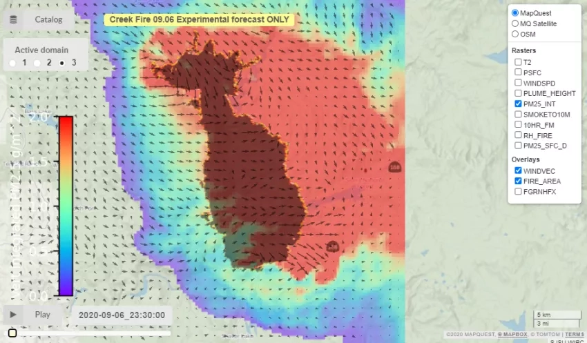
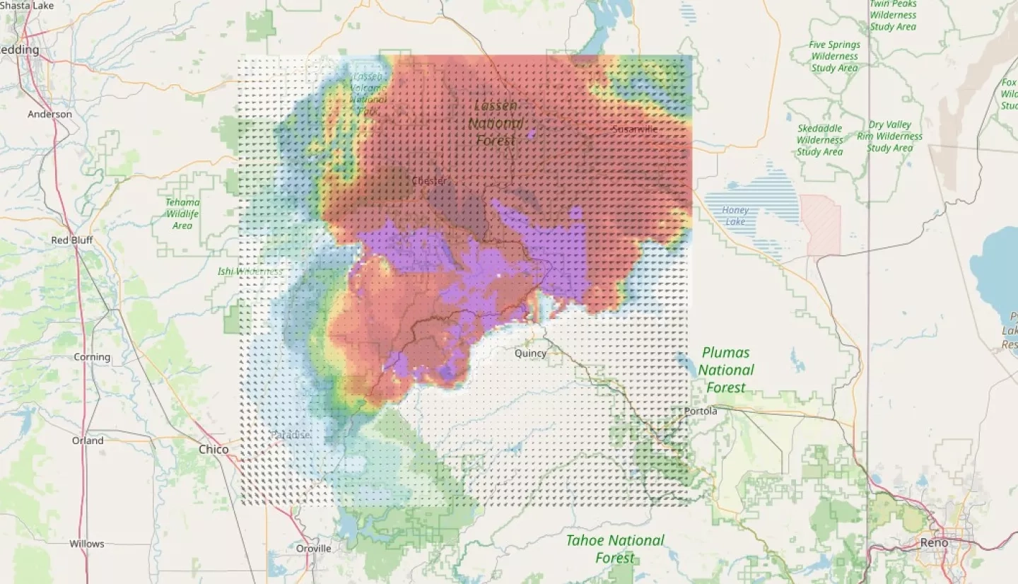
With Kyle Hilburn as the primary investigator, the project’s most recent breakthrough was enabling the WRF-SFIRE system to provide daily forecasts of fire behavior, fuel moisture, and smoke impacts for the California wildfires in Fall 2020. Air support teams for the 2020 California wildfire season used these forecasts in their decision-making process when deciding if and where to deploy their air resources.
The project is currently in its second year and the plan is to continue working with the U.S. Forest Service and the National Predictive Services over the next few years to make sure the system can meet their needs and lead to its sustained usage.
Click here to view the WRF-SFIRE experimental fire forecast products.
Full Project Description
There is a significant need for management decisions based on a multifaceted analysis of risks and benefits associated with wildfires and prescribed burns. Better and more advanced decision-support tools that integrate satellite/aerial remote sensing with economic data, with a coupled fire, weather, fuel and smoke modeling framework are therefore necessary.
The primary goal of this project is to significantly reduce the risks associated with wildland fires and their management through the development and deployment of new decision support and situational awareness tools. These new tools will focus on rendering the spatial and temporal variability of weather and fuel conditions, in addition to the two-way interactions between fire behavior, local weather, and smoke, which do not currently exist in operational fire management. The project aims to improve situational awareness and support decisions, especially for wildland fire incidents that are impacted by significant weather variability. Such incidents are difficult to handle with the current system, which utilizes hourly weather station data often located miles away from the fire.
Through a seamless integration of weather data, surface fuel moisture observations, satellite fire detections, operational numerical weather prediction models and a state-of-the-art high-resolution, coupled fire-atmosphere smoke modeling, the project will deploy novel integrated decision-support tools that designed to reduce the risk associated with wildfire management. The new system will provide a 3-D spatial representation of essential elements that affect fire behavior, including dead-fuel moisture, fire spread and smoke.