A list of “Geospatial Rising Stars” for 2021 includes several people affiliated with the Applied Sciences Program. Compiled by the editorial board of the media outlet Geospatial World, they are highlighted for their outstanding accomplishments in geospatial technology.
Selected from a list of over 250 impressive nominations from within the community, the honorees include entrepreneurs, data scientists, researchers, GIS specialists, surveyors and other professionals representing various sectors across 6 continents and 24 countries. Geospatial World is a news outlet run by Geospatial Media and Communications; a private company based in the northern India state of Uttar Pradesh. The commendation states, "These 50 candidates stand out at the top of their class and are well on their way to redefining the next generation [of] geospatial leadership.”

Krystal Azelton is currently the director of Space Applications Programs for the Secure World Foundation, a private foundation established in 2002 with a mission to develop and promote secure, sustainable and peaceful uses of outer space benefiting Earth. Azelton serves as co-chair of the Group on Earth Observations Programme Board and is working on sustainable development projects in Africa and Afghanistan.
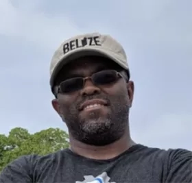
Emil Cherrington is the regional science coordination lead for West Africa for SERVIR in the Capacity Building program area. The Rising Star editorial board cited Cherrington’s avid science communication skills and his more than 16 years working in geographic information systems and remote sensing. He holds a double Ph.D. in forest ecology, with a focus in remote sensing from AgroParisTech (France) and the Technische Universität Dresden (Germany). According to the award, “His work in Africa and Central America have helped him advance his aspirations of ensuring geospatial technologies help people everywhere, not just in developed nations.” More about Cherrington can be found at his Applied Sciences profile, SERVIR-ing up New Opportunities with Emil Cherrington.

Lilian Ndungu pioneered the setting up of the Food Security theme in Kenya’s Regional Centre for Mapping of Resources for Development (RCMRD). As theme lead for Agriculture and Food Security in the Eastern and Southern Africa hub of SERVIR, she worked with partners to map croplands to inform decision-makers on drivers and productivity trends on croplands, and monitoring vegetation conditions in rangelands. This support of the Kenya crop insurance program resulted in a 70% reduction in implementation costs. More on Applied Sciences’ impact in Kenya can be found at the article titled NASA Earth Observations Help Kenya Aid Program Reach More Farmers.

Paloma Merodio is the vice president of Mexico’s National Institute of Statistics and Geography (INEGI). In December 2017 she became the president of the United Nations Regional Committee on Global Geospatial Information Management for the Americas (UN-GGIM). She has a long history in working for government and private companies for various projects including the think tank Fundación IDEA, where she collaborated as a consultant in economic and social development issues.

Kellie (Eleanor) Stokes leads strategic operations at the Universities Space Research Association (USRA), a private non-profit corporation. Stokes has led the way in using NASA’s first nighttime lights product, the Black Marble, and in developing the methodologies and techniques used to develop and validate this data. The Black Marble has spawned hundreds of social and environmental research projects. In addition, Stokes is examining the seasonal changes in nighttime lights over thousands of cities worldwide to assess impacts of the COVID-19 pandemic on urban economic activities and has collaborated on a number of Group of Earth Observation projects.

Rohini S. Swaminathan currently works with the world aid program UNICEF and formerly was with the Capacity Building’s DEVELOP program area. She improves geospatial innovation and promotes its adoption internationally for social good. The highlight notes that Swaminathan is a steering committee member of the group Women in Geospatial+ and that “she has been widely-deployed to build geospatial solutions in the Global South, in South Sudan, Afghanistan, Djibouti, Eswatini, Bangladesh and more.”

