Picture this: after decades of discrimination, hundreds of thousands of refugees flee to a nearby country. To make space for displaced community’s tents, decision-makers decide to clear out a nearby forest. However, the clearing is in a region of the world that experiences monsoons. Without any trees to hold the soil in place, the already vulnerable community will be at an even higher risk for flash flooding and landslides.
So, what went wrong?
The environment is frequently not considered during humanitarian relief and disaster response planning. Without proper environmental evaluation, disaster response organizations can overlook variables that contribute to future risk and loss of life for at-risk communities.
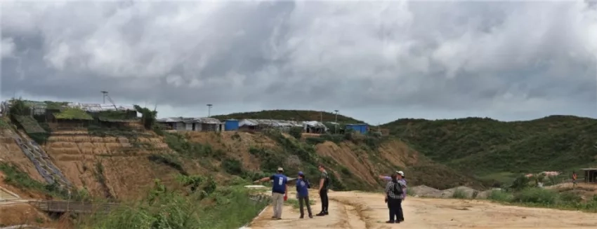
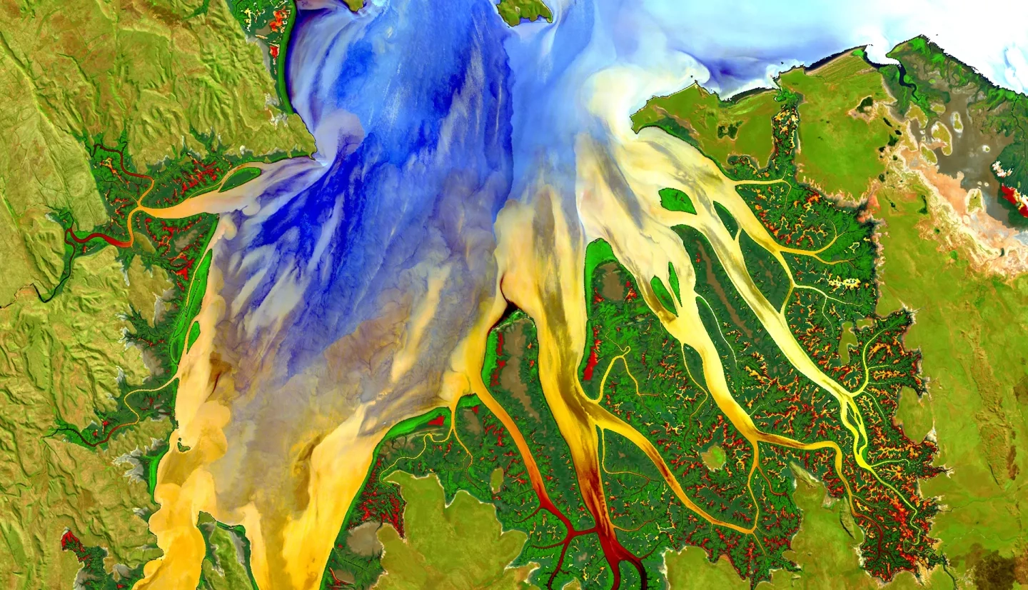
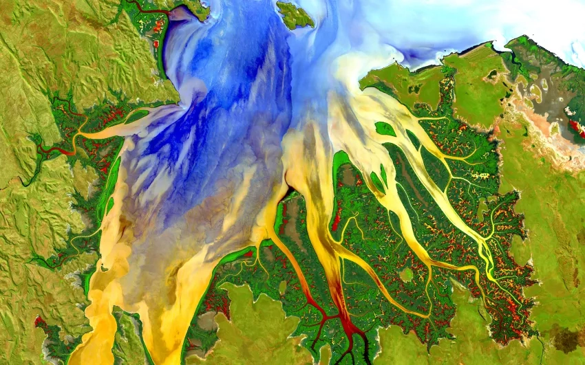
The example above depicts the living situation of Rohingya refugees, a community living in Bangladesh to escape discrimination in their home country of Myanmar. In July 2019, 14 inches of rain fell on the camps in Bangladesh in just three days. The intense precipitation triggered 26 landslides – killing one person and leaving more than 4,500 without shelter. To address this crisis, the camps are now incorporating NASA satellite observations into their decision-making to reduce the risk to refugees from natural hazards. Camp managers now have access to maps and a daily-updated website that provides NASA data on land use, rainfall, and elevation. Together, these maps and data provide a clearer picture of when and where landslide hazard is concentrated. While the Rohingya refugee crisis is only one example of the consequences of environmental neglect in decision-making, it illustrates a genuine issue that many disaster victims face.
Learn more about NASA’s response to the Rohingya refugee crisis.
This Earth Day, the NASA Disasters program area wants to highlight the importance of considering the environment in disaster management. The program supports an ongoing effort – along with organizations such as the United Nations Office for the Coordination of Humanitarian Affairs (UN-OCHA), World Wildlife Fund (WWF), U.S. Agency for International Development (USAID), and more – to include the environment in the disaster management cycle. These efforts began with the UN Environment / OCHA Joint Unit (JEU), which developed the Environment in Humanitarian Action initiative, or EHA Connect. This is the first digital archive of EHA tools and resources to guide environmental consideration in humanitarian action.
Learn more about NASA’s contributions to UN Disaster Risk Reduction guidelines.
NASA Disasters’ ability to study Earth from space makes the program uniquely qualified to incorporate the environment into disaster response. Using NASA’s Earth-observing satellites, the program can see how interactions among the environment, humans, and natural hazards work together to influence disaster risk. This systems view of disasters enables a more comprehensive approach to disaster response – leading to lowered disaster risk and safer communities worldwide.


