More than 925,000 Rohingya refugees currently reside in Bangladesh, but the camps they stay in are at risk from deadly landslides, especially during monsoon season. Decision makers there are using NASA Earth observations to inform which areas are most at risk – and now, the United Nations Office for Disaster Risk Reduction (UNDRR) has incorporated these practices into a set of recommendations.
Titled "Recommendations for Integrating Disaster Risk Reduction into Humanitarian Response," these UNDRR guidelines highlight opportunities for scientists, humanitarian agencies and local decision makers to collaborate on risk reduction in crisis-prone settings.
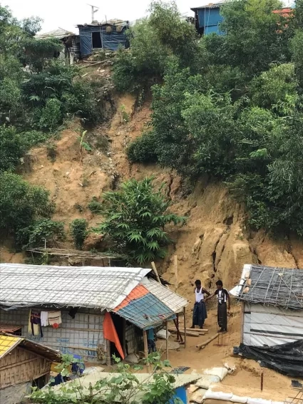
Those settings include southeastern Bangladesh, where hundreds of thousands of refugees live in camps built in hillsides prone to landslides and flash floods. This puts camp residents and staff at risk and makes it extremely difficult for organizations to provide humanitarian assistance.
To reduce the risk of these types of disaster, NASA's Earth Applied Sciences Disasters program area is collaborating with the Columbia University International Research Institute for Climate and Society (IRI). They worked with partner organizations, camp managers and local decision makers to design a landslide risk assessment tool that informs where to build future refugee camps, and which areas may be too unstable to even store supplies.
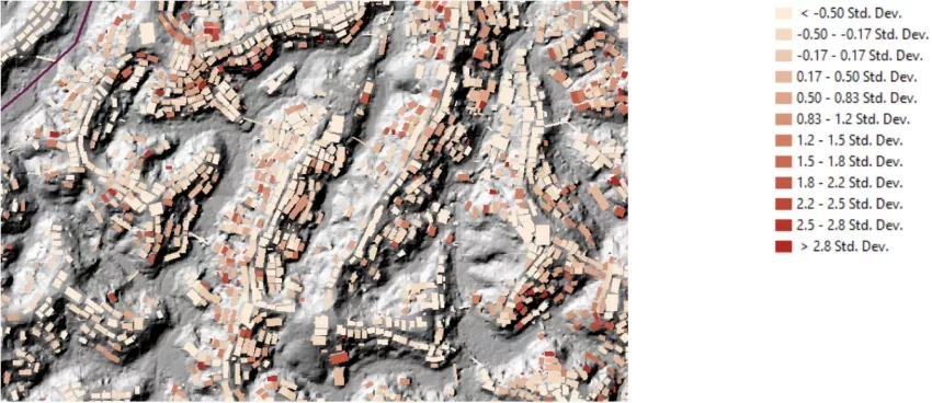
The new UNDRR recommendations outline the approaches used by NASA and Columbia University in the Rohingya camps as an example of improved hazard monitoring and site planning using Earth observations.
Partner organizations on this effort include the humanitarian organizations the International Organization for Migration (IOM), the United Nations Development Programme (UNDP), the United Nations High Commission for Refugees (UNHCR), and the Bangladesh government.
The UNDRR acts as the Secretariat to the Sendai Framework for Disaster Risk Reduction, which brings together governments, partners and communities to reduce disaster risk and work toward more sustainable futures. Their recognition of NASA's collaborative work in Bangladesh offers a unique opportunity to build future partnerships and share lessons learned on how to replicate these activities in different settings around the world. Detailed information about NASA's work on assessing landslide risk can be found at a Nov. 18, 2019 NASA.gov story titled "NASA Data Helps Assess Landslide Risk in Rohingya Refugee Camps."


