A joint effort to keep Eastern Africa fed
When life and livelihood depend upon the rain, the whim of weather creates a precarious relationship between farmer and Mother Nature.
Finding a Remedy
“Flooding and drought… are challenging issues in Ethiopia.” 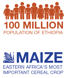
As a scientist at the Ethiopian Institute of Agriculture Research, Degefie Tibebe has seen the effects that meteorological mood swings can have on his nation’s welfare. “In 2015… El Niño triggered water shortages and crop failures in large parts of the country. It left almost one-fifth of Ethiopians needing food aid.”
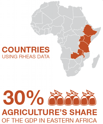
Ethiopia was not alone. The climate pattern parched much of Eastern Africa, a region where agriculture is nearly one-third of the GDP.
So how do you help stabilize the teetering food security of a region where almost all of the crops are highly dependent on rain?
That question was the focus behind our project that aimed to make Eastern Africa more resilient to the wet and dry cycles of weather by using readilyavailable data from Earth-observing satellites.
Mapping the Future
The result was the Regional Hydrologic Extremes Assessment System (RHEAS). RHEAS is the culmination of a multi-year partnership with the International Research Institute, the Climate Change, Agriculture and Food Security Initiative, and our SERVIR program.
RHEAS is breaking new ground in sub-Saharan farming by integrating data from Aqua’s Advanced Microwave Scanning Radiometer-EOS, the Soil Moisture Active Passive mission, and other satellitesand sensors, into water and crop forecasts. RHEAS can estimate and predict such factors as seasonal conditions, vegetation health, and expected crop yield, as well as drought onset, severity, and duration.
Marking a major milestone, RHEAS became open source in 2015. The Nairobi-based organization and SERVIR partner, the Regional Center for Mapping of Resources for Development (RCMRD), helped to transfer and disseminate the RHEAS data to the Ministries of Agriculture in six countries of Eastern Africa, including Tibebe’s homeland of Ethiopia. People can map the information to provide detailed forecasts in the form of very shortterm “nowcasts” (0-6 hours), as well as seasonal outlooks and long-term projections.
This new visual information was vital for the region, yet it came with obstacles. A major one was, how do you reach local agricultural officials so they can access, interpret, and use this new information?
Cultivating Knowledge
In a word—outreach. Project partners organized national workshops with local government personnel in five participating countries.
Eager to learn the applications of this new system, Tibebe attended the workshop in Ethiopia. “We were very impressed,” he said, “RHEAS integrates satellite products to simulate extreme events. Drought is one of the extreme events that affects Ethiopia repeatedly.”
These workshops also gave attendees the chance to provide valuable feedback on how to tailor the RHEAS project to meet specific needs, such as working with local ministries and extension agents to ensure that maps are in a readily useable and timely format.
One solution? Making forecast maps accessible via the Web, which provides information to decision makers more quickly and easily.
With the increasing prevalence of extreme weather events in Eastern Africa, Tibebe explained the importance of having the RHEAS system in place. “About a century ago, the frequency of drought occurrence in Ethiopia was once every 10 years. However… it is now occurring once every five years, or even less.”
Dan Irwin leads our SERVIR program.


