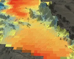
Low-lying deltas in Indochina are vulnerable to water resources availability due to dense population and extensive irrigation. Inhabitants of the deltas depend heavily on groundwater to supplement surface water stocks for irrigation and domestic use, especially during the dry season. Over-exploitation of groundwater has led to land subsidence, and hence increased the risk of flood magnified with coastal sea level rise. The vulnerability worsens due to 12uncoordinated human activity in the upstream regions, such as extraction, diversion and dam impoundment of river waters. The delta’s vulnerability is largely related to lack of resilient capacity of the co-riparian countries to manage the water resources under the current socio-economic development pressures and impacts due to climate change in recent years. Hence, building capacity in the use of NASA’s satellite data that can provide complementary hydrologic variables with unprecedented accuracy is urgently neededThe proposed project is aligned to support the unique needs of SERVIR-Mekong through thedevelopment of a comprehensive system that can routinely map, warn, and enable decision-making on water-related vulnerability issues in low-lying deltas of Indochina: 1.Satellite altimetry (Jason-2/3, AltiKa, Sentinel-3, ICESat-2) based virtual stream gauging and river level forecasting in near real-time for Vietnam, Cambodia, and Thailand.2.GRACE-based monthly monitoring of groundwater storage anomalies for Vietnam and Thailand. 3.Satellite precipitation (GPM) and climate model based seasonal forecasting ofanomalies of water availability using VIC macroscale hydrologic model for entire Mekong, Red, and Chao Phraya basins. 4.Satellite-based monthly-to-seasonal reservoir outflow estimation using GPM, MODIS and satellite altimetry measurements for Vietnam and Cambodia.5.Interferometric Synthetic Aperture Radar (InSAR)-based monitoring land subsidence over the deltas and their major coastal cities for Vietnam and Thailand.6.Satellite altimetry based monitoring of coastal sea-level changes for Vietnam and Thailand.The project team aims to reach Application Readiness Level (ARL) 7-9 in the third year (2019) for these satellite-based water management products and applications by strengthening the capacity of government institutions or agencies in Indochina, so that sustainable application can be built by end users without any further incubation after the project ends. The PI’s team is uniquely qualified to achieve this goal due to the long working relationship in Asia, which has led to two ARL=9 achievements for (1) Jason-2 altimetry based 8-day operational flood forecasting system adopted by the Flood Forecasting and Warning Center (FFWC) of Bangladesh and (2) GRACE-based operational groundwater monitoring system adopted by Pakistan Council of Research in Water Resources (PCRWR) of Pakistan, using a new training model called Backward-Forward Iterative Capacity Building Model. The proposed project also has a direct synergy, at no additional cost to the project, with a parallel application effort: recently funded USAID-NSF Partnerships for Enhanced Engagement in Research (PEER) project (2015-2018, PI: Luong Duc Nguyen, National University of Civil Engineering (NUCE), Vietnam). The proposed applications will also have a positive impact on the data product development of NASA’s four new and future satellite missions, which are Jason-3, GRACE Follow-On (GRACE-FO), Surface Water Ocean Topography (SWOT), and NASA-ISRO SAR (NISAR), by providing feedback on scientific requirements of accuracy and sampling
Related Impact

Tagged: DEVELOP, Tagged: Capacity Building, Tagged: Ecological Conservation
Tagged: DEVELOP, Tagged: Capacity Building, Tagged: Water Resources
Tagged: Urban Development, Tagged: DEVELOP, Tagged: Capacity Building