- PI: Shubharoop Ghosh, ImageCat
- Co-Is : Tirtha Banerjee, PhD, University of California
- Irvine and Ronald Eguchi, ImageCat
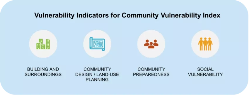
Catastrophic wildfire economic losses in recent years underscore the need to more accurately estimate vulnerability, loss potential, and future risk to support effective risk management decisions. This research aims to develop a novel Community Wildfire Vulnerability Index using data derived from Earth Observation (EO), wildfire hazard maps that define WUIs, building-level damage or vulnerability functions for wildfire damage and loss, community wildfire planning and design tools.
The project is led by ImageCat scientists working with researchers from the University of California, Irvine. The project team will work with partners from the National Fire Protection Agency’s Research Foundation to ensure that the research outcomes provide meaningful real-world applications and solutions to end-users. Innovative approaches with EO data will be used to develop a wildfire vulnerability index to help communities and other public and private stakeholders determine which physical and social assets are likely to be impacted by wildfires.
The vulnerability index is intended to enable targeted risk mitigation and prevention measures to help communities and other broader stakeholders at different decision-making levels. Organizations involved in wildfire risk management, local governments, planning agencies, and insurance companies stand to benefit from the outcomes of the proposed project.
Related Impact