Fire danger rating systems (FDRS) are cornerstones of wildland fire management, but fire danger data are not available in many fire-prone parts of the world. The NASA GISS Global Fire Weather Database (GFWED) was used to meet the global fire research and management communities’ needs for consistent fire danger data anywhere in the world. GFWED is a small ensemble of Fire Weather Index products using weather data from reanalysis, weather forecasts, and satellite precipitation retrievals, available from 1981-present, and in near-real-time.
Key highlights include:
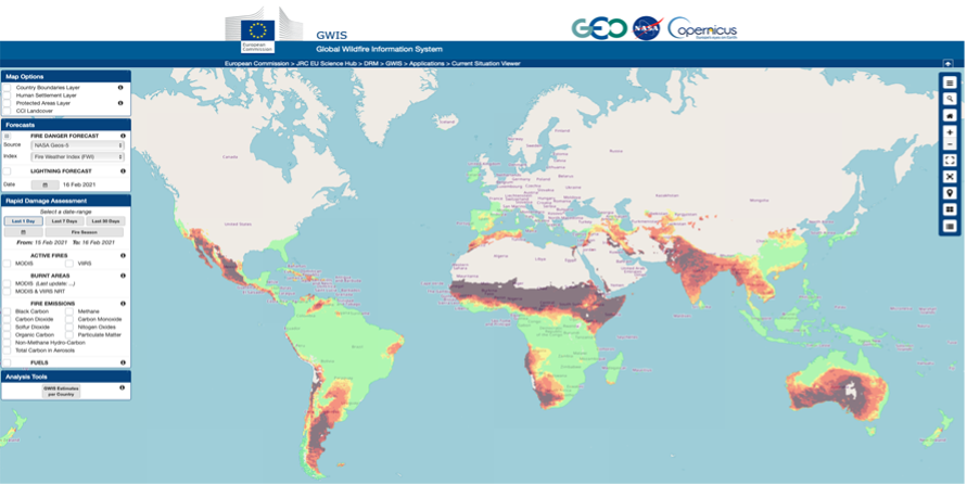
- GEOS-5 based fire weather forecasts from GFWED were made available on the Global Wildfire Information System (GWIS) alongside similar data from the European Centre for Medium Range Weather Forecasts.
- A new GFWED ensemble member based on the blended Tropical Rainfall Measurement Mission / Global Precipitation Measurement Mission (TRMM/GPM), Integrated Multi-satellite Retrievals for GPM (IMERG) version-006 retrieval was added, which begins in 2000, has 0.1ox 0.1o spatial resolution, and has pole-to-pole coverage.
- A comparison of fire weather data calculated from reanalysis and weather station data, the global skill of the GEOS-5 forecasts was published, as was a book chapter describing the GPM-based fire weather for case studies in Chile, Greece and Indonesia.
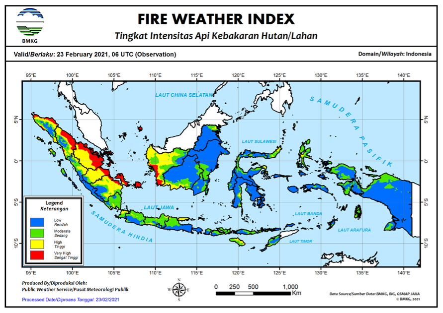
- Regionally, the Indonesian FDRS run by the Indonesian Meteorology, Climatology and Geophysical Agency is also based on the same Fire Weather Index System as GFWED. GPM precipitation retrievals were incorporated into the Indonesian FDRS and made publicly available.
- The Uruguayan Meteorological Service began evaluating GFWED for operational use through distribution of daily maps through an internal Telegram channel.
- The Wildfire Emissions Inventory System based at the Michigan Tech Research Institute began using GFWED data to estimate the fuel-moisture dependence of smoke emissions from fires in North America.