Great Slave Lake Water Resources (Summer 2022)
Team: Yuhe Chang (Project Lead), Virgil Alfred, Ethan McIntosh, Catherine Shea
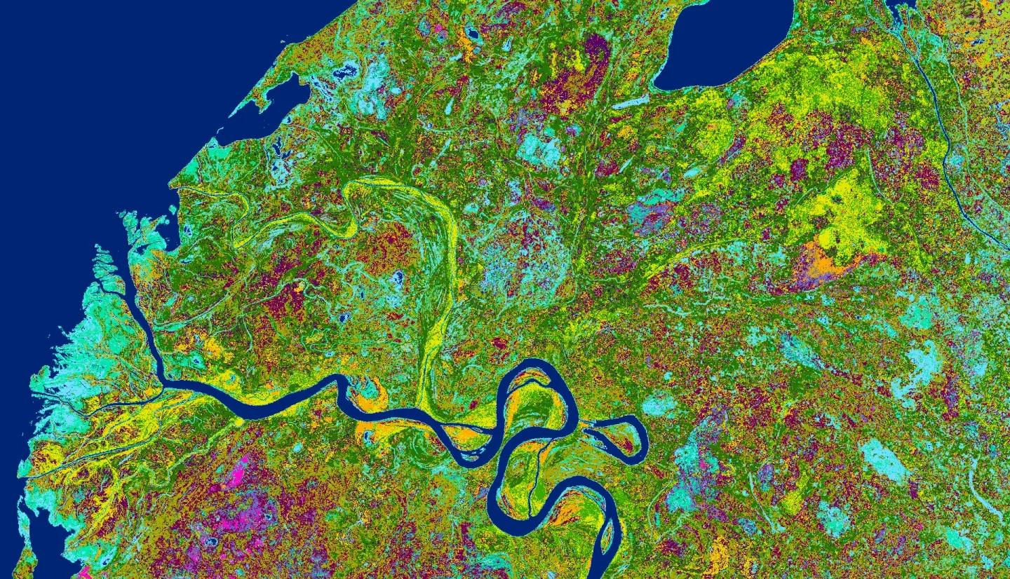
Summary: Indigenous communities around the Great Slave Lake (GSL) in Canada’s Northwest Territories have observed long-term changes in water levels within the Slave River Delta (SRD), causing concern over the alteration and loss of natural and cultural resources. Changes in delta water dynamics have impeded fishing and transportation accessibility and threatened to alter important wetland ecosystems, leading to greater uncertainty in natural resources management. In partnership with the Fort Resolution Métis Government (FRMG), the Deninu K'ue First Nation (DKFN), the Akaitcho Territory Government (ATG), and Environment and Climate Change Canada (ECCC), this project provided a visual archive of water patterns and land cover in the Slave River Delta for summer months (May to October) from 1984 to 2021. We produced time series animations, maps, and charts of land cover and delta morphology changes using data from NASA's Landsat 5 Thematic Mapper (TM) and Landsat 8 Operational Land Imager (OLI) missions, augmented with other NASA-supported satellite imagery, land cover classifications, and precipitation datasets. Satellite observations confirm that changes in surface water and wetland extent in the delta tend to correlate with changes in Slave River discharge and precipitation in the drainage basin. However, we identified several water channels in the Slave River Delta and several areas of former wetlands whose drying trends have persisted despite increases in precipitation and discharge from 2010 to 2020. By synthesizing various Earth observations into understandable and accessible data visualizations, the project strengthened decision-makers overall understanding of drivers of change in the Slave River Delta.
Related Impact