Start Date: August 8, 2023
Type: Fires
Region: Oceania – Hawaii, USA
Info & Resources:
- View Products on the NASA Disasters Mapping Portal
- NASA Disasters Program Resources for Fires
- NASA Earth Observatory - Devastation in Maui
- What DHS and FEMA are doing:
- What the U.S. government is doing:
UPDATE AUG. 18, 2023
While the majority of fires in Maui have been contained, residents are still grappling with the aftermath of the deadliest U.S. wildfires in more than a century. NASA’s Earth Applied Sciences Disasters program continues to work closely with stakeholders responding to the event, including FEMA, the World Central Kitchen and the Pacific Disaster Center, among others. The Disasters team is coordinating across NASA centers to develop maps and data and provide scientific expertise to support response and recovery efforts.

NASA developed a damage proxy map of Maui using data from JAXA’s ALOS-2 satellite showing buildings and structures that were likely damaged by the fires. This map illustrate the staggering extent of devastation to the historic town of Lahaina, which had over 2,200 structures destroyed or damaged according to Hawaii Governor Josh Green. Responders can use these maps to determine where to best allocate their resources for response efforts and humanitarian relief. The Advanced Rapid Imaging and Analysis team at NASA's Jet Propulsion Laboratory and California Institute of Technology developed the damage proxy map, supported by funding from NASA’s Disasters program. The team compared the data with the media reports and other images to perform preliminary validation on the damage map. This map can be used as guidance to identify damaged areas but may be less reliable over vegetated areas.

In addition, the NASA Disasters team has developed and shared maps of burn scars using Landsat 8 and 9 and ESA Copernicus Sentinel-2 satellite data in coordination with NASA Marshall Space Flight Center researchers. The Disasters team has also shared high resolution optical Planet Labs imagery of the fires enabled by the Commercial Smallsat Data Acquisition (CSDA) program, as well as land surface temperature data from NASA’s ECOSTRESS mission aboard the International Space Station, which can be used to identify burned areas.

On Aug. 12, 2023, astronauts aboard the Space Station photographed Maui, capturing some of the damage to the town of Lahaina. Scientists within the Earth Science and Remote Sensing Unit at NASA’s Johnson Space Center geo-reference astronaut photographs to support situational awareness for active disasters in the U.S. and abroad, including support of the International Disasters Charter.
NASA’s Disasters program strives to make Earth observing data more accessible and usable for response agencies and humanitarian organizations. For example, the World Central Kitchen noted the usefulness of the NASA Earth Information System Fire Event Data Suite (FEDS) VIIRS active fires points and fire perimeter data hosted on the NASA Disasters Mapping Portal for their humanitarian efforts on the ground. The Disasters Mapping Portal is a free and openly accessible geographic information systems (GIS) platform for disaster data. The Disasters team is also sharing data and imagery and corresponding directly with stakeholders.
NASA continues to monitor Maui and the other Hawaiian Islands as response and recovery efforts progress and stands ready to provide support as needed.
UPDATE AUG. 11, 2023
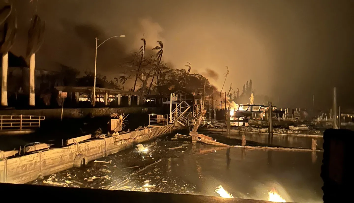
Since Aug. 8, wildfires have swept through several Hawaiian communities, causing evacuations, road closures, and widespread power outages. Communities on the islands of Maui and Hawai’i (“the Big Island”) have been particularly impacted, with hundreds of destroyed buildings in the historic city of Lahaina and media reports indicating multiple deaths across Maui county. Strong gusts from Hurricane Dora have made fire containment efforts challenging, with high winds temporarily grounding firefighting helicopters. President Biden issued a disaster declaration on Thursday Aug. 10 and ordered federal aid to support the affected areas.

NASA’s Disasters program has activated to support response efforts for the wildfires, sharing Earth observing data and imagery to help identify the location of the fires and assess their impacts. The NASA Disasters team is currently working with the Pacific Disaster Center (PDC), the World Central Kitchen (WCK), FEMA Region 9, and the Esri Disaster Response Program. The team is sharing products including NASA Fire Information for Resource Management (FIRMS) active fire points derived from MODIS and VIIRS data, high-resolution optical imagery from Planet Labs and Maxar satellites, and a collection of near real-time Earth observing datasets for fires. The team is also working to identify upcoming satellite overpasses that could provide additional situational awareness for the area. Data are being shared as they are made available on the Disasters Mapping Portal.
NASA continues to monitor the Hawaiian Islands as the situation evolves and remains in close contact with stakeholders to provide support as needed.

Updates by Jacob Reed, NASA Disasters