Start Date: Sept. 25, 2024
Type: Hurricanes & Cyclones
Region: North America
View maps and data on the NASA Disasters Mapping Portal
What DHS and FEMA are doing: https://www.fema.gov/hurricane-helene (Spanish: https://www.fema.gov/es/helene)
What the U.S. government is doing: https://usa.gov/hurricane-helene (Spanish: https://usa.gov/es/huracan-helene)
Update Oct. 10, 2024
Communities across the southern U.S. are still recovering from the wide-reaching impacts of Hurricane Helene two weeks after it made landfall. The Disasters Response Coordination System (DRCS) continues to work closely with federal and state partners to support response and recovery efforts.
The DRCS has shared multiple products on the NASA Disasters Mapping Portal, including:
- Daily NASA Black Marble nighttime lights radiance maps, and a swipe app to compare imagery at different times before and after the event.
- An experimental luminosity change map to identify areas that may have experienced power outages
- Pre- and post-event optical imagery from Copernicus Sentinel 2 and Landsat satellites that provide situational awareness and can help users visualize and identify impacts from flooding and landslides.
- Normalized Difference Vegetation Index (NDVI) analysis to identify changes in vegetation that may indicate damage or other impacts.
- Pre- and post-incident Copernicus Sentinel 1 synthetic aperture radar (SAR) colorized rasters and derived water extent products to help identify flooded areas.
The NASA DRCS team has also developed and shared an interactive StoryMap showcasing some of these products to provide additional context and educate partners on how they can be used. FEMA shared NASA’s Helene Gallery and StoryMap on their incident resources page to make it accessible to agency partners. The DRCS continues to update products on the mapping portal and StoryMap as new data becomes available.
The DRCS is also activated and aiding response efforts for Hurricane Milton in Florida.

UPDATE OCT. 3, 2024
As communities across the southeastern U.S. grapple with the impacts of Hurricane Helene, the Disasters Response Coordination System (DRCS) continues to work closely with response organizations and equip them with Earth observing maps and data. DRCS team members are attending daily coordination calls with both FEMA and the United States Geological Survey (USGS) to assess needs and share resources. The DRCS team is also supporting FEMA’s National Response Coordination Center in Washington, DC, allowing them to work directly with FEMA and other interagency emergency managers to identify novel uses of Earth observation data to aid response.
The DRSC team has produced and shared many products to the free and openly accessible NASA Disasters Mapping Portal, and these products are being updated regularly as new data becomes available. These data are being used by partners including FEMA, USGS, the American Red Cross, and state emergency management agencies, to inform situational awareness and support effective decision-making,

DRCS Center Response Coordinators from NASA’s Goddard Space Flight Center are working with USGS scientists to help manually map landslides in western North Carolina, South Carolina, and Virginia. The teams are using high-resolution optical satellite imagery to identify areas where landslides likely occurred and are sharing them to USGS’s Landslide Observations Dashboard. These data can help responders identify roads and structures that may have been impacted by landslides so they can better plan deployment of resources.

Persistent cloud cover following the hurricane has made it difficult to collect useful satellite observations of the impacted regions. However, some recent breaks in the clouds have allowed scientists to compare imagery from before and after the hurricane to show the impacts of the storm. Additionally, the Copernicus Sentinel 1 satellite collected synthetic aperture radar observations in the days after the storm, which can see through the clouds. Center Response Coordinators and scientists from NASA’s Marshall Space Flight center and the OPERA team from NASA’s Jet Propulsion Laboratory used these data to generate water extent maps which can help identify flooded areas.
UPDATE SEPT. 27, 2024
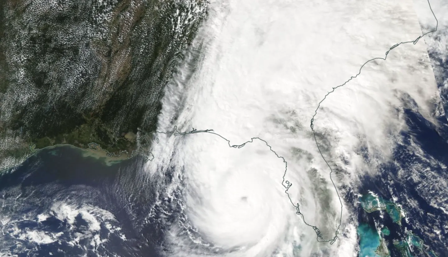
Hurricane Helene made landfall in Florida’s Big Bend region at around 11:00 p.m. ET on Thursday, Sept. 26, 2024. The powerful Category 4 storm brought damaging winds, flooding, and storm surge to the communities in its path, according to media reports. After being downgraded to a tropical depression, Helene brought high winds, flooding, and widespread power outages to Florida, Georgia, Tennessee, North Carolina, and South Carolina.
The Disasters Response Coordination System (DRCS) continues to coordinate closely with federal, state, and voluntary agencies responding to Helene. DRCS team members are working to identify areas where Earth observation data could be most useful to the response efforts and are processing satellite data to generate maps that provide valuable situational awareness. These include NASA Black Marble Nighttime Lights Blue/Yellow Composite imagery to aid in identifying areas without power, and Copernicus Sentinel 1 and 2 imagery which can help identify flooded regions.

UPDATE SEPT. 26, 2024
Members of Disasters Response Coordination System (DRCS) continue to participate in interagency coordination calls and prepare data products to aid responders as the southeast U.S. braces for Hurricane Helene. Since Wednesday, the DRCS team has published several additional products intended to provide situational awareness of pre-incident conditions, including maps of landslide hazard probability, precipitation totals, and soil moisture conditions. These data can help responders prepare for the storm’s impacts and identify which regions may be most at risk of flooding or landslides. The DRCS team is also preparing pre-event satellite imagery, which can be compared with imagery gathered after the storm passes to help identify flooded or damaged areas.


Update Sept. 25, 2024
Helene formed as a tropical storm in the Gulf of Mexico on Sept. 24, 2024, and is currently forecast to make landfall in Florida’s Big Bend region the evening of Sept. 26 as a Category 3 hurricane. Meteorologists also anticipate impacts in Georgia, Alabama, Tennessee, and the Carolinas, as the storm moves north after landfall.
The Disasters Response Coordination System (DRCS) has activated to support FEMA's response to Hurricane Helene and is also supporting the Florida Division of Emergency Management (FDEM). DRCS team members are attending coordination calls with agencies responding to the hurricane. They have also deployed a page on the NASA Disasters Mapping Portal to share maps and data products, which currently includes near real-time NASA Black Marble Blue/Yellow Composite products to aid in identifying potential power outages, and services to access near real-time flood detection products that will update automatically when data becomes available.

More on Hurricane Helene:
- NASA Earth Observatory:
- NASA Global Precipitation Measurement Mission: