Strengthening Worldwide Public Health with Innovative Uses of Earth Observation Data
NASA’s Earth Applied Sciences Program continues to support cutting-edge scientific research that uses Earth observation data to examine real-time community health challenges. For the international One Health Day 2019 campaign, we highlight NASA’s commitment to the One Health concept by encouraging public engagement and promoting the use of Earth-observing satellite data to solve down-to-Earth issues that affect human and animal health.
Here are few of the innovative public health projects supported by NASA’s Health and Air Quality Applications area.
New Map Shows Risk of Sunburn Across the United States
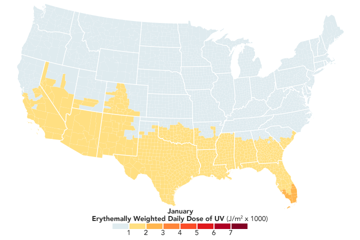
NASA continues to help public health officials track ultraviolet (UV) radiation exposure, a primary risk factor for skin cancer. In the United States, melanoma rates have increased over the past three decades, contributing to more than 75 percent of skin cancer deaths, or an estimated 9,500 deaths per year. In partnership with the Centers for Disease Control and Prevention (CDC) Environmental Tracking Program, the Health and Air Quality Applications area created the first publicly available map of UV radiation for all counties in the contiguous United States. The team used surface UV data from the NASA’s Aura spacecraft Ozone Monitoring Instrument (OMI) to map UV exposure across the country.
“Before this, there hasn’t been a true comprehensive exposure measure of UV radiation,” said Yang Liu, an associate professor at Emory University’s Rollins School of Public Health. “People have been studying Sun exposure using very crude indicators. We are looking at the specific UV wavelengths that can cause skin cancer.”
Available on the CDC's National Environmental Public Health Tracking Network, state- and county-level data from 2005 to 2015 provide information on the variation of UV radiation levels across time and geography. Using these data, public health officials and city planners can be aware of the real-time UV radiation levels and make informed decisions for program planning and implementation in their local community. Educational programs can provide health information and resources for community members to prevent the harmful exposure of UV radiation and reduce risk of developing skin cancer.
“Think of this like a risk map, showing the likelihood of a person getting sunburnt in an area,” said Liu. “The idea is to produce a UV exposure indicator that may be used by public health researchers to link to skin cancer incidences.”
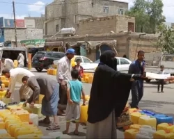
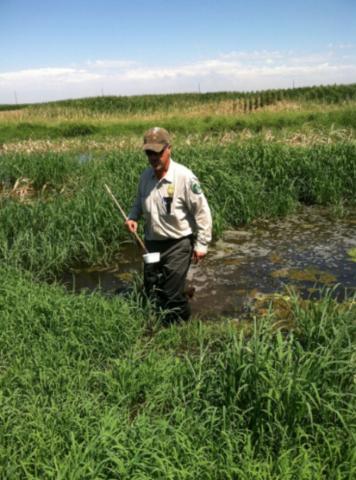
NASA Helps Fight the Mosquito Bite Coast-to-Coast
According to the CDC, the number of cases of mosquito-borne disease in the United States is growing – the rate of these infections was 10 times higher in 2016 than in 2004. Hence, expanding national surveillance of mosquitoes is becoming more pressing. In the United States, higher mosquito activity reaches its peak during the heat of summer. Rising global temperatures are associated with warmer spring and fall temperatures, which allow mosquitoes to breed and multiply beyond the summer months.
Chris Barker, an associate professor of epidemiology at the University of California, Davis, leads the NASA Applied Sciences’ Health and Air Quality Applications project. Through additional support by the National Oceanic and Atmospheric Administration (NOAA), the California Department of Public Health (CDPH), and the Mosquito and Vector Control Association of California, Barker and his team have contributed to the California Vectorborne Disease Surveillance System (CalSurv) to strengthen mosquito control efforts in California.
They have used data from several Earth-observing satellites, including precipitation observations from the Global Precipitation Measurement mission (GPM), land cover/land use data from the Landsat satellites, and land-surface temperature data from NASA’s Terrestrial Observation and Prediction System (TOPS). They also incorporated vegetation data from the Moderate Resolution Imaging Spectroradiometer (MODIS) aboard NASA's Terra and Aqua satellites, Visible Infrared Imaging Radiometer Suite (VIIRS) aboard the Suomi National Polar-orbiting Partnership (Suomi NPP) satellite, and NASA’s North American Land Data Assimilation System (NLDAS).
More recently, the successful implementation of this Calsurv tool in California has been expanded to New Jersey (JerseySurv), Utah (UtahSurv), and the United States’ territory of Guam. These data can help mosquito control agencies and public health officials monitor and respond to potential outbreaks of mosquito-borne diseases by mapping the insects that can carry these deadly viruses.
Barker says that this information provides critical updates to mosquito control agencies across the United States. “NASA’s Earth observations give us hourly data across the country – in other words, any state can easily use the CalSurv gateway.”
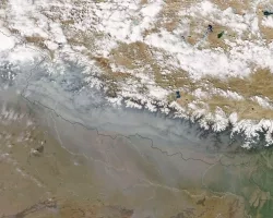
NASA Data Strengthens United States' Air Quality Warnings
Daily air quality forecasts for particulate matter in the United States could potentially be more accurate as the result of incorporating NASA’s Earth-observing satellite data, according to a recent study in the American Geophysical Union journal, JGR: Atmospheres.
Lead investigator Rajesh Kumar of the National Center for Atmospheric Research in Boulder, Colorado, incorporated satellite data of aerosol optical depth at three-hour intervals into the NOAA’s National Air Quality Forecast Capability (NAQFC). These changes have resulted in an approximately 38% improvement in the accuracy of the particulate pollutants reported in the NAQFC tests, which contributes to daily Air Quality Index (AQI) forecasts created by the United States’ Environmental Protection Agency (EPA).
Kumar said that providing measurements on real-time conditions – not computer estimates – means that Americans can better count on air quality warnings to make decisions that protect their health. The more frequently updated data will better track changing air quality conditions during events like smoke emissions from fires.
Kumar mentioned that this study is an important example of how NASA Earth science data can increase the safety and security of the nation. “NASA exists to serve the citizens,” said Kumar. “With this data, Americans get the most accurate and up-to-date air quality warnings possible to protect their health.”
Compiled by Aries Keck
NASA Earth Applied Sciences