Following a disaster, first responders can use satellite imagery to pinpoint areas that require immediate assistance, often looking at power outages as an indicator of distress. However, in instances where there is not enough moonlight to highlight clouds, it can be difficult to determine whether changes in nighttime lights are the result of power outages or dense cloud cover.
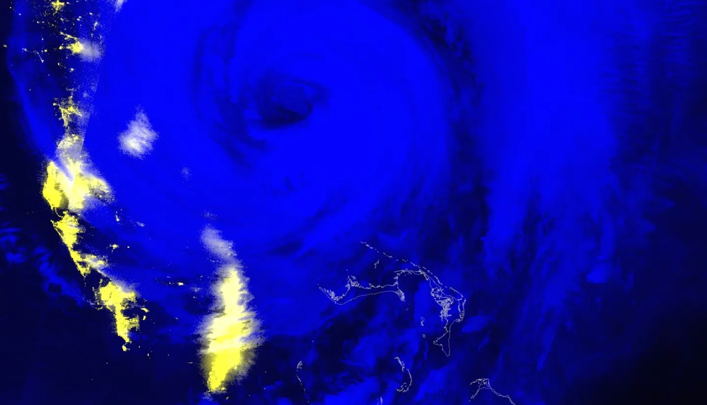
To address this problem, scientists at the U.S. Naval Research Laboratory combined Day/Night Band (DNB) and longwave infrared data to create imagery in which clouds are easier to detect and note. NASA’s Short-term Prediction Research and Transition (SPoRT) Center at NASA's Marshall Space Flight Center later adapted this product for use with NOAA’s National Weather Service partners. The NASA Earth Applied Sciences Disasters program area recently worked with partners at NASA and Esri to integrate it as a near real-time (NRT) product on the NASA Disasters Mapping Portal. The SPoRT product, known as the Black Marble Nighttime Blue/Yellow Composite, produces imagery that shows nighttime city lights in shades of yellow with clouds presented in shades of blue when no moon is present, making it easier for users to identify clouds that are blocking the lights.

Before the Mapping Portal integration, the Black Marble product was created manually on an as-needed basis, taking hours of effort from researchers to produce updates for an event. Now it can be used anywhere for any event when the skies are clear, freeing up valuable resources and making data available to local decision-makers quickly when time is of the essence.
“The fact that the product had to be made manually in the past limited its availability, since staff were not always available to generate the imagery,” says Jeremy Kirkendall, Emergency Management Specialist at NASA's Goddard Space Flight Center. “Now that it’s been automated, we can check the near real-time (NRT) product at any time there is a disaster to see if there is a noticeable difference in the nighttime lights.”
Members of the emergency management community have already used the Black Marble Blue-Yellow Composite product to monitor the impact of Hurricanes Michael, Florence, and Dorian, and the January 2020 earthquake in Puerto Rico. NASA disaster coordinators and researchers expect it to be a valuable resource to aid response and recovery efforts during the 2021 Hurricane Season.
Learn more at earthdata.nasa.gov: New Black Marble Nighttime Blue/Yellow Composite Product Makes Detecting Power Outages Easier


