As storms threaten communities across the United States, the NASA Disasters Program is developing new techniques to identify severe weather impacts and equip decision-makers with information that helps protect lives and local economies.
A powerful storm system unleashed severe weather in the Southeastern U.S. on March 14-16, 2025, causing destruction across multiple states. Officials at the NOAA/NWS Storm Prediction Center documented over 100 tornado reports, accompanied by significant hail and damaging winds.
As these storms swept through communities on the ground, weather satellites monitored the storms from space. NOAA’s Geostationary Operational Environmental Satellites (GOES) observe Earth’s atmospheric conditions around the clock, providing valuable data that can help scientists and forecasters understand storm impacts.
At NASA’s Langley Research Center in Hampton, Virginia, researchers supported by the NASA Disasters Program are working to harness this satellite data to better identify atmospheric patterns that can indicate severe weather on the ground. This information can help provide a more complete picture of storm damage, enabling better informed decisions during emergency response and recovery. This data is particularly valuable in rural areas where national-scale ground-based storm tracking and rapid damage assessments are limited or unavailable.
The NASA team is developing an open-source machine learning model that uses geostationary satellite data to identify potential overshooting cloud tops and above-anvil cirrus plumes. These patterns in the tops of storms can indicate intense thunderstorm updrafts, which are often responsible for triggering severe weather on the ground such as heavy rain, hail, tornadoes, and damaging straight-line winds.
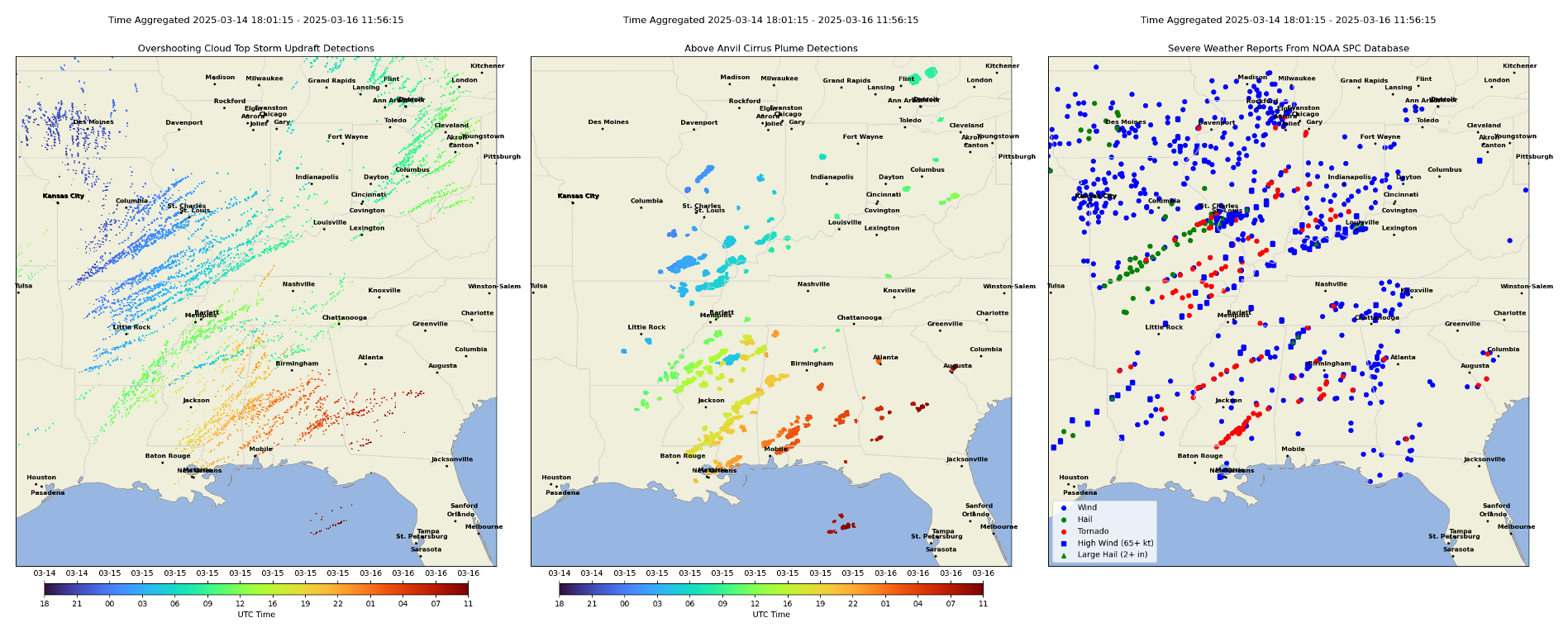
The NASA researchers applied this model to the recent severe weather outbreak in the Southeastern U.S. and compared it to National Weather Service (NWS) severe storm warnings and severe weather reports. In the NASA imagery, the long, nearly straight lines in the overshooting cloud tops and above-anvil cirrus plume detections indicate long-lived and intense updraft regions. These patterns serve as strong indicators of hazardous ground conditions, aligning closely with NWS reports in many areas. This demonstrates the model’s potential to support nowcasting and post-incident analysis. As these methods improve, they could help identify severe weather impacts that may be missed by ground-based observations.
The NASA team is also using these techniques to inform their work developing hailstorm climatology models that provide a better understanding of the frequency and severity of severe weather events over time. Working closely with partners in the re-insurance industry and weather forecasting communities, they are developing and deploying tools to translate storm data into actionable risk insights that will strengthen resilience in communities around the world.
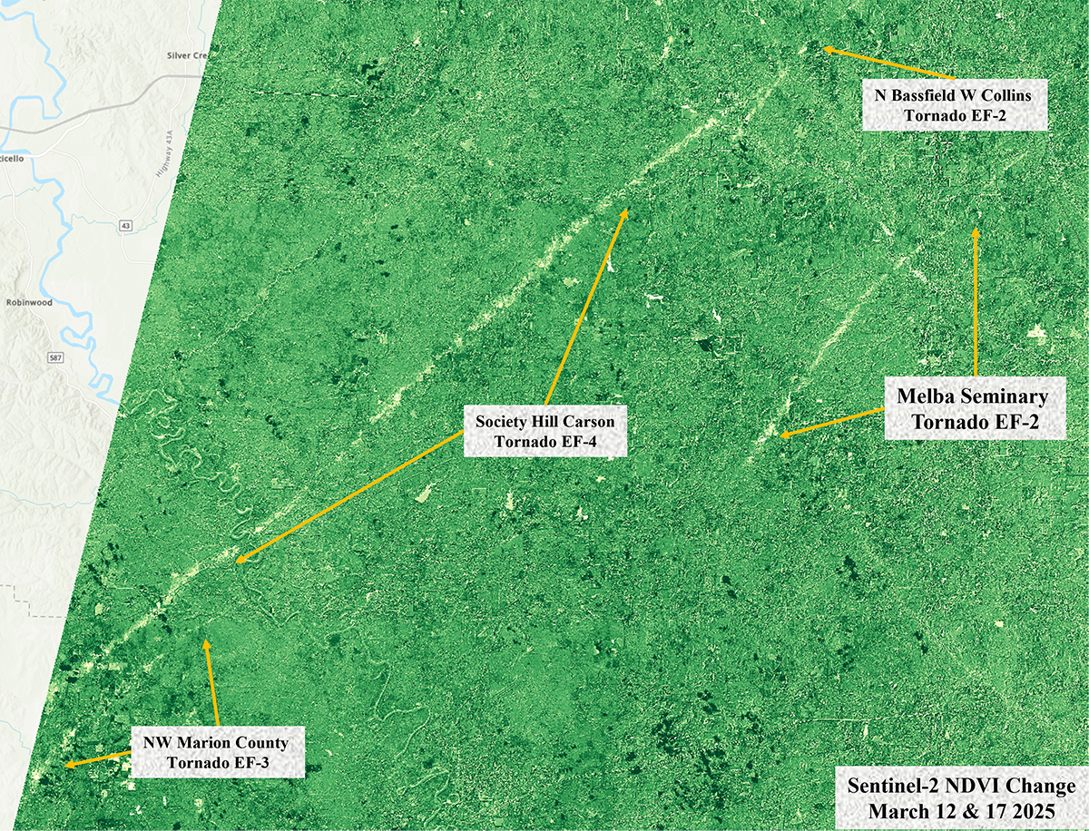
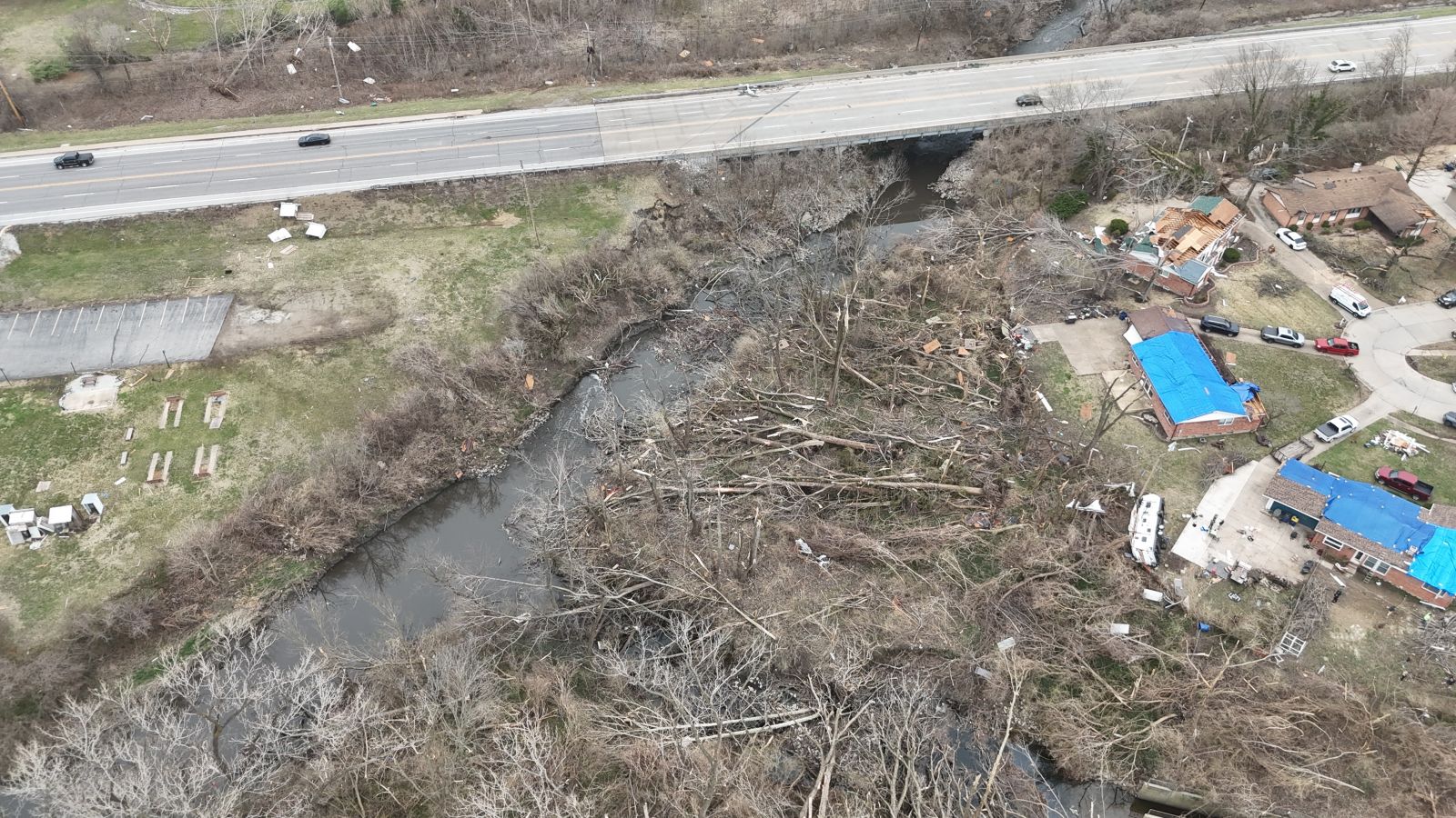
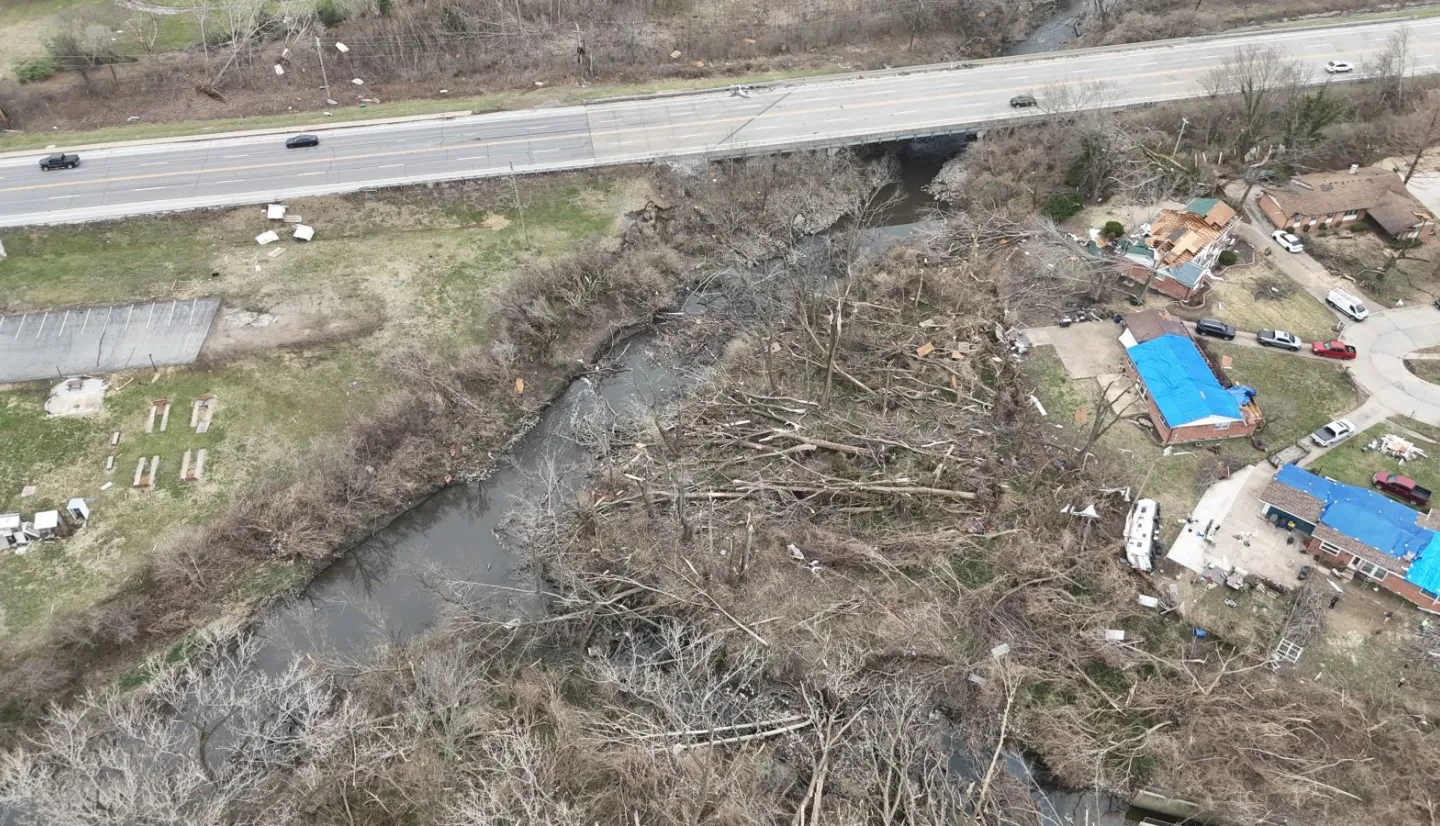
In the wake of the Southeastern U.S. storms, the NASA Disasters Program also worked directly with the NWS Southern Region to support their damage assessment process. NWS damage assessments serve as the official record of the path and strength of each tornado. They inform state and federal disaster declarations, help emergency responders prioritize aid, and contribute to validating and improving early warning systems. Identifying damaged areas and tornado tracks can be challenging in rural areas with limited road access, and satellite data helps provide a more complete picture. NASA Disasters Response Coordination System team members provided several types of satellite imagery to support NWS damage assessments, including Landsat 8 and 9 imagery, ESA Sentinel-2 imagery, and high-resolution Planet Labs imagery acquired through NASA’s Commercial Satellite Data Acquisitions (CSDA) program. This work builds upon a longstanding collaboration between the two agencies, such as when NASA supported NWS tornado damage mapping efforts in Texas following Hurricane Beryl in July 2024.
NASA science is transforming the way disaster management organizations understand severe weather, turning satellite data into insights that improve preparedness, enhance response, and strengthen recovery. As severe weather events become more frequent and severe, these partnerships and innovations are vital to building community resilience and improving our nation's ability to prepare for, respond to, and recover from devastating storms.