Earthquakes, landslides, flooding, cyber-attacks, and avian flu outbreaks were all on deck for emergency drills testing the preparedness of local disaster response agencies and, for the first-time, private companies.
Disaster preparation took center stage during the 3rd Regional Simulation of Disaster Response and Humanitarian Assistance in Panama City, Panama, June 13-16. Organized by the Coordination Center for the Prevention of Natural Disasters in Central America (CEPREDENAC) and the Central American Integration System (SICA), the event served as a dynamic testing ground for regional and national disaster response strategies and protocols. It also strengthened relationships that will make a difference when future disasters loom.
Central America, a region known for its rich culture and biodiversity, is regrettably also known for standing in the crosshairs of threats from an array of natural hazards. Hurricanes and tropical storms, fueled by the warm waters of the Caribbean Sea and the Pacific Ocean, frequently batter the region, causing extensive flooding, mudslides, and wind damage. Alongside these meteorological events, seismic activities along the tectonic boundary between the Caribbean and Cocos Plates remind residents of the persistent chance of earthquakes and volcanic eruptions. Furthermore, the effects of climate change are exacerbating the risks and impacts of these threats, adding to the urgency of effective response strategies and readiness for the region.

Bringing Together First Responders
Over 600 emergency management and disaster professionals took part in the event, with participants from international organizations and 15 countries across the globe joining their colleagues in Panama. The drill exercises simulated 19 scenarios through six categories of overlapping disasters, including a major earthquake, associated landslides, flooding - even an avian flu outbreak and cyber-attack. For the first time, organizers also invited private sector organizations to participate, with private sector representatives from more than 15 countries around the globe joining the multi-day activities to strengthen coordination between public and private sectors and humanitarian organizations.

On June 14, NASA’s Earth Applied Sciences Disasters program area presented a well-attended educational workshop co-hosted with one of their key private industry partners, ImageCat Inc. In the joint workshop, NASA Disasters team members shared the agency’s capabilities and resources to help communities move from risk to resilience. Decision-makers, emergency responders, scientists, engineers, and humanitarians participating in the event were drawn together by a common desire to improve disaster preparedness in the Americas.
Bringing Space Data Down to Earth
NASA Disasters program coordinator Ricardo Quiroga started the three-hour workshop with an overview of the agency’s Disasters Mapping Portal. This powerful ArcGIS-based online interface hosts an array of NASA research, data, and satellite imagery. Quiroga answered the enthusiastic audience’s questions while showcasing the Portal’s ability to host web applications and maps to support disaster response, recovery, and emergency mitigation approaches.

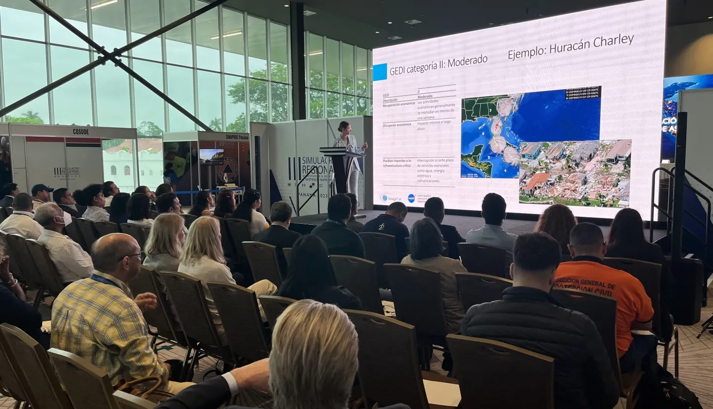
Dr. Marina Mendoza from ImageCat then introduced the Global Economic Disruption Index (GEDI) a groundbreaking economic risk modeling framework that highlights the kind of innovation made possible by government and private industry working together. The GEDI framework leverages satellite data, artificial intelligence, and vast amounts of socioeconomic data to generate comprehensive analyses of potential economic disruption in regions from disasters. GEDI can analyze and illustrate a disaster's ripple effects on a regional economy, helping decision-makers develop effective mitigation strategies.
As the workshop showcased opportunities to use NASA-enabled tools, including GEDI, in the humanitarian sphere, the three-hour workshop also provided a valuable opportunity to learn more about the specific demands and challenges that the Latin America and the Caribbean region brings. With that goal in mind, ImageCat cofounder and vice president Charles Huyck led attendees in an insightful, interactive portion of the workshop focused on understanding current and future needs of the Latin American and Caribbean region. The valuable feedback helps inform NASA’s Disaster program efforts - particularly in the Central American region - and helps the program continually enhance the vast portfolio of publicly-available resources they offer to support decision-making throughout the disaster management cycle.
Participants in the workshop expressed a desire and appreciation for features such as advanced forecasting systems. They stressed the benefits of incorporating LiDAR and radar technologies and articulated the importance of higher-resolution imagery and data. The discussions also affirmed the importance of continuing to improve capabilities such as regional mapping, especially in the Americas region. Some participants revealed how they might use the Portal for insights into things such as identifying at-risk animal populations, emphasizing the diverse needs of the disaster management community.

“The NASA Disaster program's contribution to Central America has been highly significant, remarked Claudia Herrera Melgar, executive secretary of CEPREDENAC. “Improved access to Earth observation data via the cloud-based disasters mapping portal, and implementation of the GEDI framework for risk assessment will advance response support capabilities.” “This strategic collaboration empowers the disasters community in Central American region to make science-informed, evidence-based decisions, build resilience in the most vulnerable communities in the Central American region and fulfill our main purpose, to save lives."
For NASA, participating in events like this with private industry partners, such as ImageCat, helps the agency bridge the gap between advanced scientific understanding and practical decision-making tools in disaster response.

“The four days in Panama were rich with opportunities for us to identify the strengths and challenges in the region” says NASA Disasters program manager Shanna McClain. “Perhaps just as important, was the opportunity to strengthen meaningful relationships with regional stakeholders.” “Ultimately, when hazards threaten, the relationships we’ve fostered in the Panama drill will help emergency responders and decision-makers across the region take action with the knowledge that they have access to the best disaster science in the world to support and inform their actions.”


