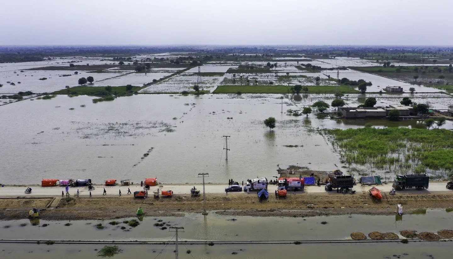
Floods are among the most deadly and destructive disasters worldwide, and climate change has only increased their severity. To make matters worse, many smaller communities lack the tools they need to detect and respond to floods, leaving them vulnerable to the full force of their impacts.
To help protect these communities, NASA's Earth Applied Sciences Disasters program area has partnered with several leading scientific institutions to develop a new flood detection tool called "Model of Models" (MoM). This tool combines data from open-source hydrological models with Earth observing satellite data to generate global flood risk severity updates several times a day. This is the first time that comprehensive global flood early warnings have been available at the sub-watershed level, giving communities the knowledge they need to take early action to protect themselves.

But for this knowledge to be put into use, it must reach the hands of local decision-makers – that’s where the Pacific Disaster Center (PDC) comes in. The PDC is a University of Hawai’I applied science and research center specializing in disaster risk reduction science and technology, that supports organizations worldwide in creating a safer, more disaster resilient world. NASA partnered with the PDC to integrate MoM into their global multi-hazard alerting platform DisasterAWARE. When the MoM detects a high likelihood of flooding in a region, DisasterAWARE sends a flood early warning notification to impacted communities, letting them quickly take the steps necessary to save lives and livelihoods. Local authorities may use this information to activate emergency response plans, order evacuations, or deploy response teams and humanitarian relief.
“This new technology covers the face of the globe, enabling us to observe flood risk and anticipate the likelihood of floods in ways never before possible,” said Dr. Shanna McClain, Disasters Program Manager for NASA’s Earth Science Applied Sciences Program. “The technology we’ve developed will be transformative, enabling early action by communities around the globe—especially small island communities and developing states that lack the necessary early warning information to protect themselves and their loved ones during flood events.”
This animation shows how the Model of Models combines multiple hydrological models with Earth observing data to forecast watershed flood risk and generate alerts for the DisasterAWARE platform. Credits: Pacific Disaster Center (PDC)
Dr. McClain has credited the entire Disasters flood team, which is made up of a collective of cross-sectoral experts who dedicated the past three years to developing an algorithm to reduce the impact of global floods under the NASA ROSES A.37 project “Advancing Access to Global Flood Modeling and Alerting using the PDC DisasterAWARE® Platform and Remote Sensing Technologies”. Development continued under the Global Initiative for Flood Forecasting and Alerting (GIFFT) project, which enhanced MoM by incorporating features such as triggers for synthetic aperture radar (SAR) analysis, and exposure analysis through ImageCat’s Global Economic Disruption Index (GEDI).
“The ‘Model of Models’ approach makes use of already existing technologies and combines them in unique ways that give us a powerful understanding of flood risk,” said NASA’s Margaret Glasscoe, Research Associate at the University of Alabama in Huntsville, who leads the project team.
Early Warning to Protect the Vulnerable
Roughly half of the world's countries are currently lacking adequate hazard early warning systems, according to a recent study by the United Nations Office for Disaster Risk Reduction (UNDRR) and the World Meteorological Organization (WMO). Developing countries are particularly vulnerable to the impacts of disasters and climate change, but they are often the least equipped to deal with them. In the Sendai Framework for Disaster Risk Reduction, the UNDRR has called on the global community to take urgent action to implement flood early warning systems. Thanks to Model of Models, NASA and the Pacific Disaster Center are now well-positioned to help meet this need.

“Effective early warning information is proven to save lives. Flood early warning has so far been expensive and requiring hyper local investment, knowledge and maintenance. I am looking forward to helping PDC and NASA make this powerful tool available to all communities to complement the efforts of national disaster management organizations and meteorological agencies to help early warnings reach the last mile,” said Omar Abou-Samra, Director of the International Federation of Red Cross and Red Crescent Societies (IFRC)’s Global Disaster Preparedness Center.
The IFRC currently integrates all of PDC’s DisasterAWARE early warning and risk information into its Go Platform, which provides its 192 national societies and more than 15 million volunteers with critical emergency needs information and the tools they need to provide adequate response.
“Until now, comprehensive global flood early warnings have not been possible. Either due to limitations in hydrologic monitoring networks, forecast models, or expertise to operate and widely disseminate their results, especially in small and vulnerable countries. MoM will be a game changer,” said PDC’s Deputy Executive Director Chris Chiesa.
PDC’s Executive Director Ray Shirkhodai adds, “Our decades-long track record of innovating technologies for multi-hazard early warning, risk analysis, and impact estimation makes PDC an optimal partner for receiving NASA’s new daily global flood model updates,”
PDC’s DisasterAWARE platform serves tens of thousands of disaster management and humanitarian assistance professionals worldwide and reaches millions more through PDC’s free mobile app Disaster Alert. The business community is also able to access this new flood hazard information for supply chain and continuity of operations planning through DisasterAWARE Enterprise. Through MoM and DisaterAWARE, community leaders and disaster response teams can accurately gauge flood severity through various data layers which include multi hazard risk, exposure, vulnerability, coping capacity, and national profile assessments.
“The operational launch of this new model by the University of Hawaii’s Pacific Disaster Center and the NASA Disasters flood team is not only an impressive example of what people can do when they come together to solve hard problems, but also timely and paramount to the climate-change crisis issues at hand,” said the University of Hawaii’s President Dr. David Lassner.
The disaster management community can access PDC’s free DisasterAWARE platform and sign up for global flood alerts, as well as several other types of hazard alerts at https://disasteraware.pdc.org
Learn more about MoM and Glasscoe’s flood project.


