Floods are both the most deadly and costly natural hazard. Until now, flooding experts have had to extract and merge data from multiple sources by hand to obtain reliable information about global flooding events. A team of NASA researchers is streamlining access to real-time flooding information from satellites and incorporating it along with multiple other data sources into an existing platform for emergency managers called DisasterAWARE. Once the team completes this project, users will be able to register for notifications about flooding in their area and access information on flooding risk and extent as it becomes available from the satellites in real time.
Margaret Glasscoe, who goes by Maggi, is a research scientist at NASA’s Jet Propulsion Laboratory and the project’s principal investigator through the Applied Sciences Disasters program area. She said this work will be vital to first responders around the world.
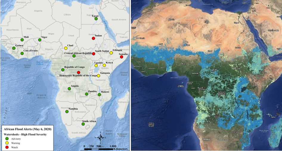
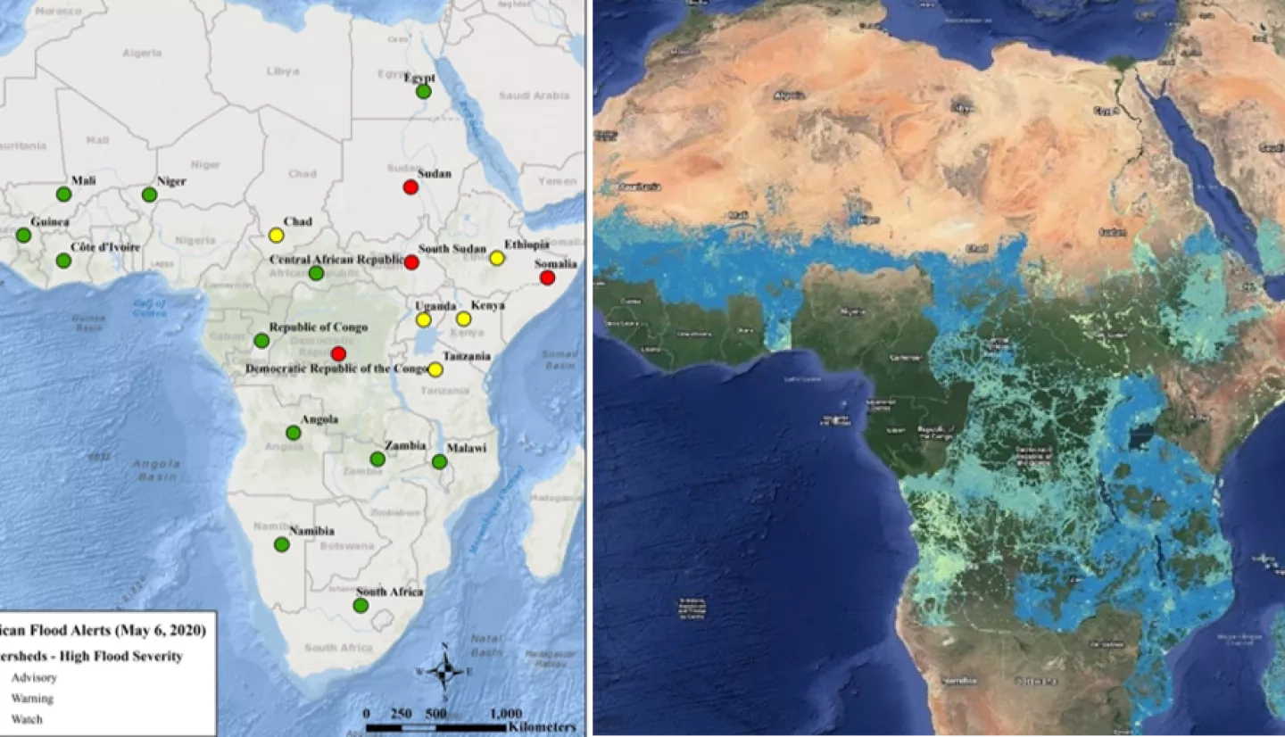
“Currently, global disaster managers are dealing with a firehose of information when it comes to flooding,” said Glasscoe. “They get so many alerts, not necessarily even for their area. We’re trying to produce automatic, more narrowly-focused flood alerts so they can prepare for when action is needed.”
Glasscoe’s team designed a prototype of their system that combines data from multiple sources in real-time to trigger an automatic alert. The prototype accesses international flood forecasting models, like the NASA-funded Global Flood Monitoring System (GFMS) and the European Community’s Global Flood Awareness System (GloFAS). Then it combines that information on local watersheds to automate the process of sending flood alerts.
“It’s exciting to work on something that could have an impact on a global problem that doesn’t have a solution yet,” Glasscoe said. “We have a comprehensive system in the U.S. and have seen how important that is. But globally, this information is just not readily available.”
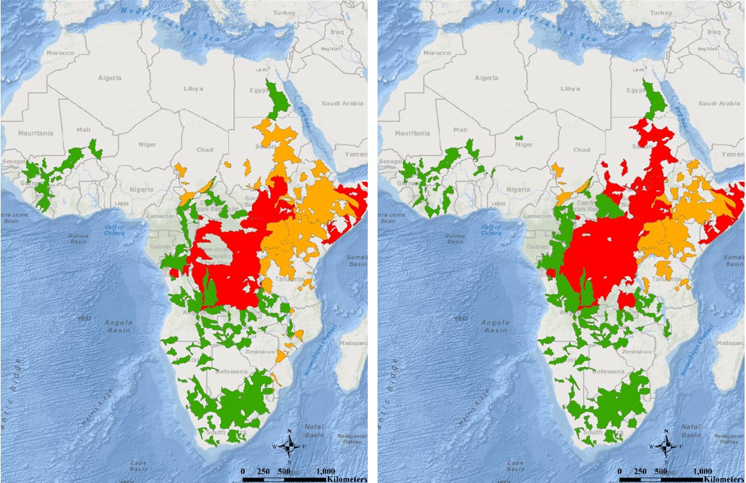
The project team uses interferometric Synthetic Aperture Radar (InSAR) data to double-check their prototype’s accuracy. InSAR enables them to measure relative ground surface change from added water and compare two highly detailed images of the Earth’s surface to see precisely where and how much a section of that surface is higher or lower than it was before flooding occurred. They also use NASA’s WorldView interface to examine building footprints as a way to measure the visible extent of flood damage and its impact on infrastructure.
The team uses machine learning to ensure this resource becomes even more precise as it is used over time and more data become available. By the time it is incorporated into DisasterAWARE in 2024, this system will be the first to provide this information on a global scale.
More information on Glasscoe's research and career can be found in the joint profile Maggi Glasscoe and Dalia Kirschbaum: Collaborating to Improve Flood and Landslide Monitoring.


