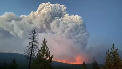
The Spring 2023 Wildland Fires interns investigate every aspect of fire, from burn effects in the tundra to soil damage. Hailing from around the country, each intern worked independently and as part of a team to identify and solve challenges and conduct research. Get to know the interns and learn more about what they’ve been working on below.
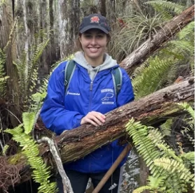
Zoey Armstrong
Hometown: Smithtown, New York
Studying: Recent graduate from Miami University with a Master’s in Geography and Bachelor’s in Biology
Hobbies: Rock climbing, hiking, photography, and tabletop games
What’s next for you? I’m looking to continue with my passion for making an impact on environmental issues by pursuing a Ph.D. in environmental sciences.
What have you been working on during your internship? I have been working on building a stakeholder database from the ground up. Once it’s set up, it will allow for easier engagement and interaction between fire science researchers. Establishing a network to foster more cooperation between researchers of various types and those working on the ground preventing fires. I have also been involved with a team working on creating an advanced visualization of the Hermit’s Peak fire in New Mexico. My role on the project has been to create and gather geospatial data for the visualization which helps to better understand the causes and conditions were that led to the fire going out of control.
What accomplishment are you most proud of from your work with NASA? I’m most proud of my involvement in the wildfires stakeholders database. I’ve acted as the lead on the project and it has been really fulfilling to work alongside NASA and ESRI engineers to develop this new tool for the wildfire team that will eventually lead to more cooperation in the fire sciences field.
What’s the coolest thing you’ve learned in your role? The coolest things I’ve learned in my internship are the new visualization techniques I’ve been using on the Hermit’s Peak project. As one part of my work on the project, I progressed my skills in R by creating an animation showing the day-by-day progression of the actively burning fire areas throughout the Hermit’s Peak region.
Emily Gelbart
Hometown: Las Vegas, Nevada
Studying: Recent Graduate from New York University Tandon School of Engineering for a M.S. in Environmental Sciences
Hobbies: Baking, Running, Jump Roping, Memorizing Pi
What’s next for you? I have been accepted to a few different programs for a PhD in Environmental Engineering and hope to start in the fall of 2023!
What have you been working on during your internship? I am working on two different projects this semester. I am helping to revamp the Actionable Fire Science and Information (AFSI) Hub in conjunction with ESRI. Through this project, I am learning how to use the ArcGIS Online program in heavy detail. I was not aware of the different applications and functions that are so useful for online users! Our team goal is to launch the new website mid-April. This opportunity has pushed me to learn how to code in HTML which I think is great!
My second project is working with the Climate Science Alliance (CSA) and Desert Research Institute (DRI). I work with the fantastic other intern, Karla Monroy! Together, we are helping to create activities for the Climate Kids program for CSA where we hope to teach younger audiences about climate change. We are also collecting research on climate impacts in the Southwest region of the United States, specifically Nevada and California.
What accomplishment are you most proud of from your work with NASA, and/or what do you look forward to?
I am grateful to have had the opportunity to work as a NASA intern for a few semesters. In my previous internship project, I helped to re-establish and host a prize competition. We asked users to combine remote sensing products with in-situ measurements to address water quality issues such as Harmful Algal Blooms (HABs). The prize competition recently ended, and we had over 900 submissions and 1,000 participants. It feels great to spread awareness about HABs and help end-users in mitigating these issues. I look forward to making more accomplishments in my role with the Wildland Fire group.
What’s the coolest thing you’ve learned in your role? As a wastewater specialist, I never thought there would be opportunities for me to work in space. That’s until I thought about it more and realized, even astronauts need to go to bathroom. I kept working towards my goal to get to NASA. I feel so lucky to be a NASA intern because my background in water quality is what got me through the door. I work in a field that is interdisciplinary and encourages teamwork. It has allowed me to work on different projects, for different groups, and still apply my knowledge while learning about new fields. I have even seen a future for working on wastewater systems in space. NASA has endless opportunities, and I would have not realized that before becoming an intern.
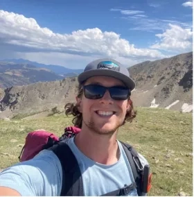
Avi Grant
Hometown: Potomac, MD
Studying: Geospatial Data Science
Hobbies: Photography, going to concerts, traveling, trying new foods.
What’s next for you? I am graduating in the spring from the University of Maryland and applying for graduate school for a masters to study GIS further in depth.
What have you been working on during your internship? I am working on identifying fire-related use cases that integrate multiple remote sensing data sources. To do this, first I collected resources for fire related GIS papers. Then I began working on a project to utilize GOES, MODIS and VIIRS data to make a spatial temporal distribution map of fire as detected by these three instruments over a time span of the last five years across the Florida region from 2017-2022. In the end this data product will be included in the AFSI Hub.
What accomplishment are you most proud of from your work with NASA, and/or what do you look forward to? I look forward to producing a map of fires that will be useful to stakeholders that view the science Hub. In addition, I look forward to furthering connections with my intern peers and others at NASA that could be helpful for the future.
What’s the coolest thing you’ve learned in your role? I have learned how satellite sensors are used to detect fires as well as how people on the ground can take steps to promote wildfire management, such as by removing undergrowth that is at risk for starting fires.
Ashley Grinstead
Hometown: Arcadia, CA
Studied: Environmental Studies and Physical Geography at the University of California, Santa Barbara
Hobbies: I enjoy playing disc golf, trying new restaurants, reading books, hosting board games nights, playing video games, and playing with my two cats Bean and Frog.
What’s next for you? I’m going to get my Master’s in Natural Resources and the Environment with a focus in remote sensing at the University of Connecticut in the fall.
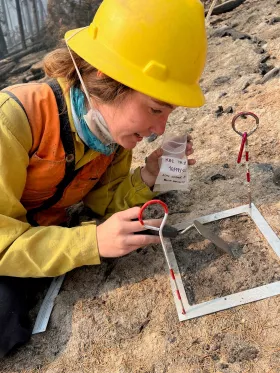
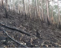
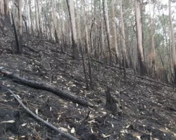
What have you been working on during your internship? I have been partnered with a remote sensing scientist (Dr. Erik Boren) at Weyerhaeuser (a private timber company) to help research if both topographic and multispectral data can be combined to predict riparian burn risk and map out riparian damage severity in watersheds around the 2020 fires (Holiday Farm, Riverside, and Beachie Creek) in Northwestern Oregon. To map out riparian damage severity, I’m gathering data that are important in determining how much a riparian ecosystem has been impacted and will be using this data to hopefully create a new technique that measures riparian damage severity. To predict riparian burn risk, I plan to train a maximum entropy model that uses climatic, multispectral, and topographic data to create a map that displays the probability of predicted locations where burn risk is the highest.
What are you looking forward to from your work with NASA? I’m excited to see the results of the maximum entropy model I plan to run for the prediction of burn risk in riparian areas. I’m also excited to present my work to the Weyerhaeuser remote sensing team when I visit their headquarters in Seattle and see how this research influences decisions at Weyerhaeuser.
What’s the coolest thing you’ve learned in your role? The coolest things I’ve learned in my role are: how riparian ecosystems respond to wildfires; how certain factors in a riparian ecosystem can influence burn severity; how Weyerhaeuser uses science to make decisions; how collaborative the fire science community at NASA is in working to develop fire management solutions by partnering with so many different organizations; and realizing that I want to continue my involvement in the fire science community. Before this internship began, I had a solid foundation in water science but lacked any experience in wildfire management or fire science. After being immersed in an internship that combines both fields, I’m determined to use this interdisciplinary knowledge in my future research and career.
Sofia Grossman
Hometown: Olney, Maryland
Studying: Degree in Environmental Science and Technology; Ecosystem Health Concentration, with a minor in Geographic Information Science
Hobbies: I am a track and field nerd. I am on the club track team at the University of Maryland - College Park where I compete in the high jump, sprints, and shot put. I hopes to one day do a heptathlon. Outside of track I enjoy hiking, going out with friends, and watching movies.
What’s next for you? After graduating in May of 2023 with a B.S. I hope to become involved with conservation work with forests, wetlands or coastal areas using GIS technology before going to graduate school.
What have you been working on during your internship? My internship has been split up into two main projects. The first project being my work with Navteca, where I have been researching information on wildfire incidents in New Mexico and including this information into their chat AI “Voice Atlas” that will later be paired with VR technology to better present geospatial data on wildfires. My other project has been working with burned area products of MODIS imagery in boreal forest and tundra northern regions. I have been working on burned area classification verification to improve the products being used by scientists and managers in these regions.
What accomplishment are you most proud of from your work with NASA?
So far I am most proud of my work with Navteca and getting to work with different stakeholders involved with wildland fires in New Mexico to predict favorable environmental conditions for prescribed burns.
What’s the coolest thing you’ve learned in your role? Learning how wildfires in boreal forests affect those region’s albedo has been the most intriguing. One would think that wildfires would decrease the albedo and make these cold climates warmer because of their disturbance to the forest. The reality that one study found was because of wildfires, there was less tree cover and so more open land covered by snow thus more sunlight reflectance and an increase in albedo, having a cooling effect on the area.
Colin Hughes
Hometown: Cincinnati, Ohio
Major: Geography and Sustainability
Hobbies: Backpacking, camping, hockey, and fitness
What’s next for you? I plan to graduate from Miami University in December 2023. After college, I will pursue a career in wildland fire management and research.
What have you been working on during your internship? I have been partnering with a private timber company, Weyerhaeuser and using their plots of forest land in the Cascade Range of northern Oregon as a study area. I am investigating the relationships of the various factors that influence soil burn severity. I’ve studied the Riverside, Holiday Farm, and Beachie Creek fires in 2020 using publicly available data on topography, soil type, landcover, species type and age to improve the understanding and prediction capabilities where soil burn severity will be the greatest. My research focused on how these factors influence fire and where to find accurate and available data. I compiled my data and created layers in ArcPro and indicated where I believe the greatest risk would exist within the perimeters of these three fires. From there I will analyze how we can accurately and effectively predict soil burn severity of fire.
What accomplishment are you most proud of from your work with NASA? Working with the data and visualizing it on a map to see the relationships to the soil burn severity maps produced by BAER. I worked as a wildland firefighter during the summer of 2022. Having observed the infrastructure, logistics, and hazards first hand, now I can see how data analysis and research can improve effectiveness, protect the environment and mitigate post fire effects. It is interesting to research and have a better understanding of what may influence a fire. Since fires don’t always burn in a predictable manner; having the additional insight from data analysis to make connections and draw conclusions has great potential. I am proud of developing GIS skills and understanding of the subject.
What’s the coolest thing you’ve learned in your role? Getting to work with NASA is such an unexpected opportunity; even a year ago I didn’t know this was a possibility. In less than 1 year, I’ve worked side by side with a wildland firefighting crew and now I am doing research with NASA. It is a dream come true. I have learned so much about the field and how to utilize data and technology in wildfire science. The team we have in the Wildland management program is a truly diverse mix, there is so much to learn from everyone.
Deanna Johnson
Hometown: Chicago, IL
Studying: Computer Engineering and Environmental Science
Hobbies: Drawing, sculpting, wheelthrowing, ceramics
What’s next for you? I will be continuing my internship with Open Innovations and Community Applications within the Applied Sciences program after completing my research with the Wildland Fires program and FireSense project. While doing so, I will be transferring to a different university to complete my bachelors degree and applying for graduate school.
What have you been working on during your internship? I am working on 2 different projects this current semester. During my internship for the Wildland Fires program, I have become the bridge between the NASA Applied Sciences Wildland Fires program and the FireSense project office by bridging any knowledge or communication gaps. I helped worked on a potential FireSense graphic identifier for the new project, and working on compiling a list of wildfire focused airborne sensors that are useful for both programs between now and a 5-year plan.
For my internship with Open Innovations and Community Applications, I developed a feasibility plan to determine if current operations can continue to be feasible and impactful for Applied Sciences, and for NASA by analyzing key points. This study is being done by creating both a written and visual document that can be easily understood for stakeholders.
What accomplishment are you most proud of from your work with NASA, and/or what do you look forward to? I am proud of being a part of the NASA Day engagement team for NASA’s participation at the Smithsonian Folklife Festival in 2022, I was awarded the NASA Innovator accomplishment in 2022 for my contribution to the “Moonlight for the Human Research Program” campaign, I’m assisting with NASA research that directly helps the Wildland Fires program, and I’m proud of being a part of the team for NASA Earth’s first Comic Strip Art Contest which helps spread the word to a diverse group of people on how satellite imagery benefits life on Earth by helping communities protect our oceans, air, and land.
What’s the coolest thing you’ve learned in your role? I believe it’s pretty cool I’ve learned how to navigate NASA and the nuances of the federal government system. It took some time to understand some of the particular legalities and I’m still learning a lot more, but it’s a major accomplishment. I also think it’s cool to know there are very passionate and knowledgeable people who truly want to help our Mother Earth and the people that live on it. As a prior paramedic and paramedic instructor with a huge artistic background, I am grateful to have the opportunity to work with NASA as an intern and contribute to the NASA mission in many different ways. I’ve learned that research and data is not just all about graphs and numbers, but also about storytelling and how you can convey that information to many different groups of people so it can best be understood.
Karla Nailea Monroy
Hometown: Menifee, California
Studying: B.A. Urban Studies, B.A. Social Policy & Public Service, next up is a Master of Urban & Regional Planning all at University of California, Irvine
Hobbies: Film photography, video games, hiking
What’s next for you? This Spring I am graduating from UC Irvine with a Master of Urban & Regional Planning. After graduation, I will continue doing research on environmental change with NASA Terrestrial Ecology Program’s Arctic-Boreal Vulnerability Experiment (ABoVE)! I intend to pursue my PhD in the future!
What have you been working on during your internship? I have been working with Climate Science Alliance (CSA) and Desert Research Institute (DRI) alongside my awesome teammate, Emily Gelbart! We have been designing creative activities on climate change for CSA’s Climate Kids Program! Additionally, we are collecting research on climate impacts in the Southwest region of the United States, particularly in Nevada and California.
What accomplishment are you most proud of from your work with NASA, and/or what do you look forward to? I am incredibly proud to work with Climate Science Alliance and Desert Research Institute to support Southern California tribes and Indigenous communities in the Nevada region climate impacts. When jumping into projects, I always find it important to not only think about the scientific research, but also the communities who are impacted and how they can be better served. I look forward to creating supportive tools and resources for tribes to use and utilizing my first language to translate important documents for native-Spanish speakers. I will gather all my experience with NASA and take it with me as I move forward studying for my PhD in the future!
What’s the coolest thing you’ve learned in your role? My experience interning for NASA has shown me a horizon of opportunities that overlap with my studies in urban planning. The usual response when I mention I intern for NASA is, “I didn’t know NASA has urban planning internships.” However, I’ve learned the coolest thing about being a NASA intern is that science is everywhere, and anyone can make a difference! I educated myself more on indigenous science and tribal climate adaptation compared to what I’ve learned in school. NASA has provided me the opportunity to collaborate with incredible organizations and an amazing team!

Jenessa Stemke
Hometown: Napa, CA
Studying: Senior in nutrition at Oregon State University. I also hold a B.S. in Plant Biology and M.S. in Environmental Science from UC Riverside.
Hobbies: I enjoy ice skating, attempting to play jazz piano, and building multi-purpose furniture
What have you been working on during your internship? I am working with ESIP (Earth Science Information Partners) to catalog needs of the fire community. I’m also working with WIFIRE to catalog and characterize datasets and their uses
What accomplishment are you most proud of from your work with NASA, and/or what do you look forward to? I’ve had the incredible opportunity to hear from many fire experts about challenges, their work environment, and best practices. I ask people two main questions: “What do you like, and what would you like to see change?” and “What do you wish others knew about your job?” Initially my focus was on data, but the conversations were inseparable from other insightful anecdotes. Data without context is just data. Data that is integrated appropriately is useful information - applied science at its finest. I’ve enjoyed cataloging this information. I have a solid GIS background, but it’s been transformational to learn about social, political, financial, and logistical aspects that affect fire and convey this to others who may not have much on-the-ground fire experience so that we can collectively provide the best support.
What’s the coolest thing you’ve learned in your role? While shadowing first responders on an active fire, I learned that public misperceptions about fire present a major challenge. It’s understandable - many of us grew up with Smokey the Bear admonishing us not to start a wildfire. The dominant dogma of fire suppression makes it socially, logistically, and politically difficult to reintroduce fire. Many technology advances are on the horizon, but there’s a largely untapped potential to leverage spaceborne and airborne data to aid in public communication of fire science, and that’s something I’ve been investigating.
What’s next for you? I plan to get my Red Card certification for fire response, and hope to work on an active fire as a GIS Specialist. I’m also graduating with a nutrition degree in June, and plan to complete a dietetic internship next year (similar to a medical residency) so I can earn my registered dietitian license. Fire + nutrition seems random, but I’ve got plans to improve nutrition and taste for wildland fire and fire departments. I plan to stay involved in both fire science and nutrition throughout my career.
Paige Wirth
Hometown: Madison WI
Studying: BS in Environmental Geoscience from Texas A&M University (graduated December 2022), MS in Forestry from UW Madison (starting Summer 2023)
Hobbies: I enjoy anything that gives me the excuse to get outside. I love to observe nature and learn about different organisms while camping, hiking, or backpacking. I also enjoy activities like snowboarding, rock climbing, and wakeboarding. Indoors I mainly like to read, play dungeons and dragons, and see my friends.
What's next for you? I am planning on starting a master’s program at UW Madison’s SILVIS lab. I will be continuing my research in Fire Science and Fire Ecology.
What have you been working on during your internship? Over the last year, I have worked on multiple different projects, from writing articles on the effects of fire on the Arizona Trail, to researching fire in the Sagebrush Ecosystem, to creating a guide for land owners interested in prescribed burning. Currently, I am working with Madison’s SILVIS lab to study the Wildland Urban Interface and different topographic and biotic variables that surround homes within burned areas.
What accomplishment are you most proud of from your work with NASA? Reflecting over the last year, I am most proud of my development as a researcher. Before NASA, I would often struggle to see details. Being around so many other scientists who study topics across the spectrum of fire science has exposed me to the scientific background that is required to take a detail-oriented approach to my own research. By collaborating with other researchers and through feedback I’ve been given by my colleagues, I’m learning to slow down and ensure that I am not missing any steps in my own processes. My time with the Wildland Fire Management Program has undoubtedly been the period in which I’ve grown most as a researcher and as a scientist, and I’m excited to apply what I’ve learned throughout my academic career.
What’s the coolest thing you’ve learned in your role? Learning about the different data that fire scientists use has been so incredibly useful for my research. Even though I have a background in GIS and remote sensing, I feel that before my NASA internship, I wasn’t as aware of what data was out there and how I could access it. Through this process I’ve been exposed to so many different tools, technologies, and datasets and I can’t wait explore them more.
Rujula Yete
Hometown: Cary, NC
Studying: Statistics and Physics at the University of North Carolina at Chapel Hill
Hobbies: Playing guitar, dancing, reading
What’s next for you? I want to continue exploring the intersection between data science and the natural sciences through interdisciplinary fields such as wildfire research.
What have you been working on during your internship? This semester, I am working with the WIFIRE Lab at UC San Diego to evaluate the accessibility and usability of datasets in the WIFIRE Data Commons, which is a collective source for a variety of wildfire related data. As more advanced satellites and remote sensing technologies are made, it is essential that the data from these tools can be integrated into wildfire management practices. With WIFIRE, I am working to establish protocols based on open data standards in order to help data providers meet the needs of users.
What accomplishment are you most proud of from your work with NASA, and/or what do you look forward to? I am excited to continue supporting NASA’s goals for Open Science. I have gained a lot of insight about data organization from my projects both this semester and last semester (working with vegetation data analysis), and hope to keep expanding the potential for Earth science data in decision making.
What’s the coolest thing you’ve learned in your role? I have loved being able to meet people from all backgrounds working towards solutions in the wildfire and Earth science community. This past December, as part of the Wildland Fire program, I attended the American Geophysical Union (AGU) Fall Meeting in Chicago. This is one of the largest scientific conferences in the country. I learned a lot about different techniques for studying wildfires, as well as various perspectives from local to international approaches for wildland fire management.
Banner Image:
Thumbnail Image: