Displaying 1 - 2 of 2
Topic
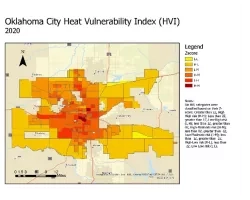
A spatial decision support system for identifying heat vulnerability based on a comprehensive energy budget model and multi-criteria decision analysis in Oklahoma City, OK Team...
Topic
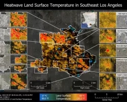
In partnership with Communities for a Better Environment, a community-based organization leading the advancement of zero-emission technologies and green infrastructure in environmental justice communities, our...