Palau, a small island state in the Pacific Ocean, relies heavily on seafood for the food security of the citizens. Aquaculture is emerging in Palau as a strategy to supplement seafood production from wild resources, but farming practices can threaten the fragile marine ecosystems if not sited and managed properly. This project aims to support the Government of Palau's efforts to ensure environmentally sustainable development of aquaculture to benefit food security by utilizing Earth Observation data and local knowledge to identify optimal locations for aquaculture, considering human and ocean health needs. The project directly advances UN Sustainable Development Goal (SDG) 14 Life below Water.
Outputs & Impact
Creation of an aquaculture spatial planning and management guidance manual for use by stakeholders (SDG 14.a, 14.2, & 14.7)
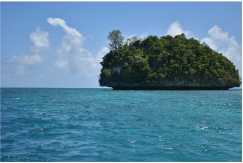
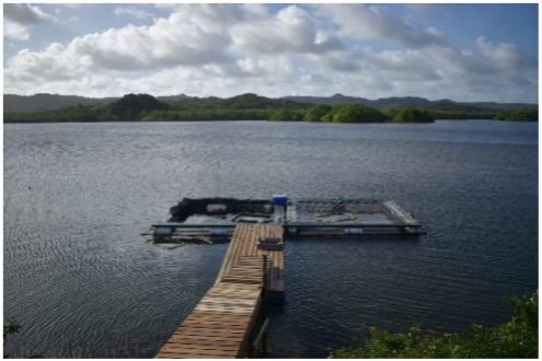
The guidance document includes descriptions of current aquaculture conditions in Palau (Figures 1 & 2), which stakeholders can refer to when conducting sitting analysis and crafting management plans. Aquaculture case studies, risk assessments, policy recommendations, and development principles are central considerations within the guidance document. Farm sites are evaluated on environmental factors such as water depth, turbidity, and nutrient levels. A guidance manual is being utilized by government partners and farmers, but the project team plans to publish an updated version after the latest data is incorporated and stakeholder feedback is received. The government of Palau puts out a bi-annual SDG report that will include a description of the work completed by this project.
Trainings in aquaculture spatial siting capacities for Palau stakeholders (SDG 14.1 & 14.2)
The project team developed a multi-month online spatial siting and aquaculture training course through ArcGIS for Palau stakeholders and students. The goal of the training is to eliminate the need for outside assistance with aquaculture spatial siting in Palau once the project period finishes. Due to covid restrictions, the trainings had to be moved online, although this allowed for the course to be developed in greater depth and at a slower pace than originally planned. TNC has built the training model with broader applications to aquaculture development efforts ongoing around the world in mind. The trainings will finish in September 2021 and will be available for use in aquaculture siting and spatial management endeavors around the world. TNC intends to utilize the training materials for an upcoming aquaculture siting project in 2022 in Lake Victoria, Kenya.
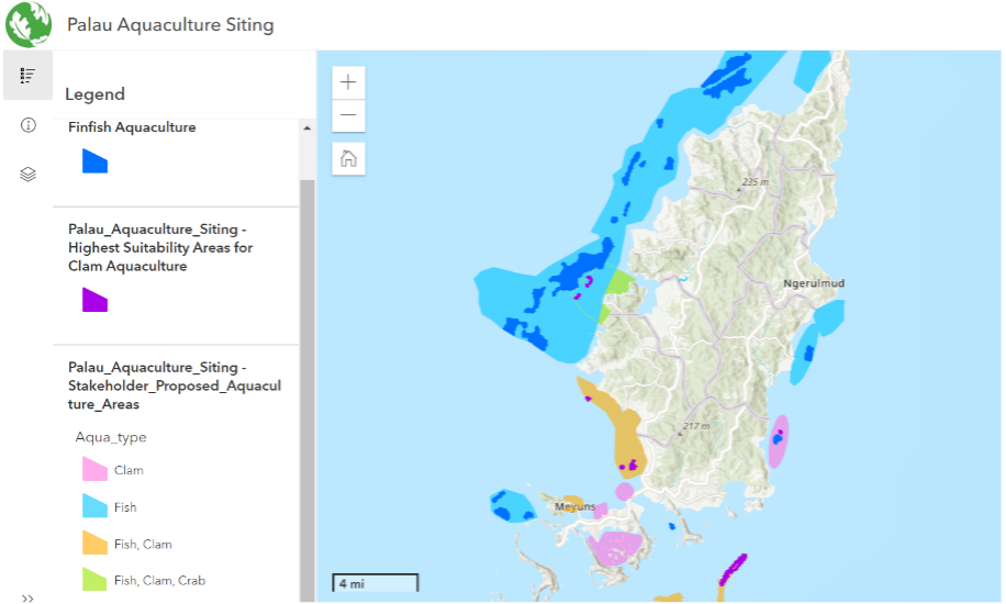
Creation of aquaculture spatial planning and modeling tool (SDG 14.1, 14.2 & 14.7)
The prototype online mapping tool proposes aquaculture sites as well as aquaculture areas based on the project team's analysis. MODIS data is collected on Chlorophyll a and Kd490 (turbidity). MUR data is collected on SST (sea surface temperature) and SST DHW (sea surface temperature degree heating week). As shown in Figure 4, the tool utilizes this data and others to map out optimal locations for aquaculture sites. Figure 3 illustrates the specific siting recommendations made for finish and giant clams due to their importance to the citizens of Palau. Plans to evaluate proposed and recommended sites in person have been delayed due to COVID, and the team is working on finalizing the tool once in-situ data can be incorporated into an updated analysis. The government of Palau puts out a bi-annual SDG report that will include a description of the work being done by this project, and the team is working to emphasize the human health component of the project in relation to the SDGs.