Team: Kevin Mueller (Cleveland State University), Brice Grunert (Cleveland State University), Thomas Hilde (Cleveland State University), Kaiguang Zhao (Ohio State University), Daniel Meaney (Cuyahoga County Planning Commission), Amanda Wood (Holden Arboretum)
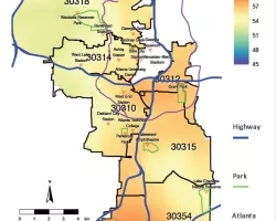
Summary: In the U.S., trees in cities provide ecosystem services valued at $18 billion dollars per year, but the urban forest in our nation is shrinking and stressed. This is evident in Cleveland, OH, where tree canopies are most sparse in the areas with residents who are most in need of the benefits trees provide. The canopy cover and ecosystem services in redlined neighborhoods with high poverty and pollution are often half or even a tenth of those in richer, whiter neighborhoods. Momentum is now building to reverse the decline of the urban forest and to enhance ‘tree equity’ in Cleveland and Cuyahoga County. The effort to regrow Cleveland’s urban forest is collaborative and coordinated by the Cleveland Tree Coalition. A primary goal of this coalition is to minimize socioeconomic and demographic disparities in tree equity by focusing efforts to maintain and expand the tree canopy in areas with unjustly lower tree cover and greater environmental burdens.
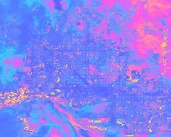
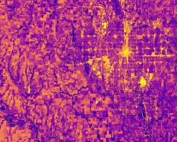
Currently, the Cleveland Tree Coalition relies on tree canopy cover data to map tree equity, and to make plans to minimize gaps in tree equity. Similar local and national efforts to map and mitigate tree equity are also based on canopy cover alone. But, the benefits provided by urban trees are a function of not only their quantity (i.e., canopy cover), but also their quality (e.g., the density and health of leaves in a canopy). Thus, in Cleveland and nationwide, current plans to mitigate tree equity are based on only half of the picture.
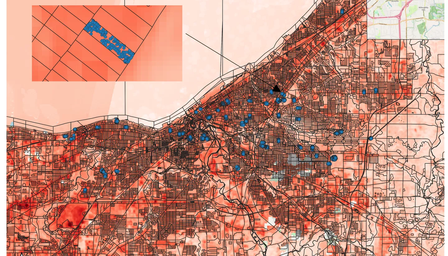
We work with community partners, including the Cleveland Tree Coalition, to demonstrate and optimize the ability of Landsat 8- derived vegetation indices and land surface temperatures to map, monitor, and mitigate ‘tree inequities’. We use existing geospatial datasets managed by community partners to share the ability of common vegetation indices to explain spatial patterns of tree functionand quality that are not represented in maps of tree canopy cover. This primary objective highlights the feasibility aspect of this project – do Landsat 8 products provide additional information that can be used to monitor and enhance tree equity in cities? We work with community partners to: i) evaluate the ability of Landsat 8 products to better characterize environmental injustice and assist in planning for improved tree equity; and ii) establish a workflow that provides sustainable delivery of Landsat 8 products and integrates these into existing, publicly available geodatabases. As part of our evaluation of satellite products, we are conducting ground surveys to quantify tree quality and function in select census blocks and greenspaces. This ground-truthing is designed to build our community partners’ confidence in, and understanding of, the relevance of Landsat 8 data to tree function and equity. To further address historic inequities, we provide field experiences and remote sensing workshops for members of a community outreach and workforce development program, the Holden Arboretum Tree Corps. This program was developed to increase accessibility of urban forestry and arboriculture to traditionally underserved community members. This activity promotes NASA ESD’s commitment to equity and environmental justice as aligned with increasing opportunities and accessibility of NASA science, applications and career opportunities. Our approach enables us to determine which Landsat 8 products best inform tree quality and function in urban settings, and to provide this information to further inform plans by our community partners to enhance tree equity.
Related Impact