Southeast US Climate II (2023 Spring)
Team: Cassie Ferrante (Project Lead), Katherine Scott, James Karroum, Cate Lull
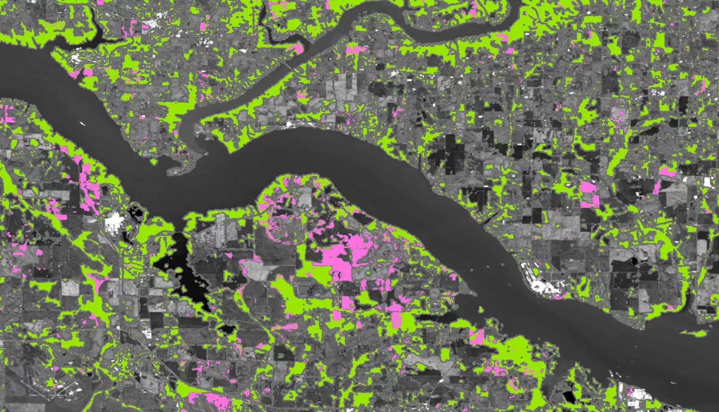
Summary: The balancing of atmospheric CO2 sources and sinks is fundamental to curbing climate change. Forests draw CO2 from the atmosphere and accumulate carbon in tree biomass and soil over time, but forest loss releases the carbon stored in aboveground biomass (AGB) back to the atmosphere. This project assessed the feasibility of using different earth observations to quantify CO2 emissions from forest cover loss across Alabama and Tennessee. The team generated four maps of stable forest and forest cover loss from 2016 through either 2019, 2021, or 2022, using data from Landsat 5 Thematic Mapper, Landsat 7 Enhanced Thematic Mapper Plus, Landsat 8 Operational Land Imager, and open-source land cover datasets, and validated the maps using Sentinel-2 satellite imagery. The Global Ecosystem Dynamics Investigation (GEDI) and Advanced Topographic Laser Altimeter System satellite light detection and ranging instruments measured tree canopy height, yielding estimates of AGB across the study area. The team calculated average annual CO2 emissions from forest cover loss, based on forest loss area and average AGB density of forest land per county. Validation showed that emissions calculated using the National Land Cover Database for forest loss and GEDI for AGB density were most accurate. The team’s partners — the Land Trust of North Alabama, Alabama Forestry Commission, American Forest Foundation, and Tennessee Department of Environment and Conservation’s Division of Air Pollution Control and Division of Water Resources — can compare these remote sensing results against existing ground-based observations to help inform where to focus forest management resources to minimize CO2 emissions from forest loss.
Related Impact