The fresh water resource in lower Mekong is confronted with challenges due to uncoordinated human activity in the upstream regions, such as extraction, diversion and dam impoundment of river waters. Due to the planned development, the dry season water level would rise, and the wet season water level would become lower, relative to the current condition. Consequently, the active and planned hydropower development would threaten the livelihood of about 40 million people in the lower Mekong who depend on wild-caught fish and rice as major nutrition sources. The risk become exacerbated due to lack of resilient capacity of the co-riparian countries to manage the water resources under the current socio-economic development pressures and more frequent extreme flood and drought events. This project is building sustainable capacity, using satellite products for decision-making activities in lower Mekong (Vietnam and Cambodia). This project employs user-centric co-planning, co-design, co-mobilize, co-delivery and co-evaluation methodologies.
Key Results include
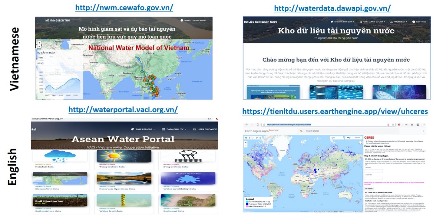
- Asean Water portal has been updated with short-term and seasonal forecast streamflow, assessing impact of climate change on water resources over the Great Mekong region using HYPE model
- “Inundation Forecasting System” over lower Mekong using FIER (Forecasting Inundation Extents using Rotated empirical orthogonal function analysis) has been developed for the lower Mekong in Google Colab environment.
- Operational water data services are available at: http://waterdata.dawapi.gov.vn/
- Operational water resources forecasting are available at: from http://nwm.dawapi.gov.vn/
- Citizen Science Approach Monitoring Reservoir Operation from Space for Poorly Gauged Reservoirs (CERES) app has been integrated into the DAWAPI (Department of Water Resources Data at NAWAPI) portal
Selected Publications
- Chang, C.-H.*, H. Lee, D. Kim, E. Hwang, F. Hossain, F. Chishtie, S. Jayasinghe, S. Basnayke (2020) Hindcast and forecast of daily inundation extents using satellite SAR altimetry data with rotated empirical orthogonal function analysis: case study in Tonle Sap Lake Floodplain, Remote Sensing of Environment, 241, 111732.
- Du, T.L.T.*, H. Lee, D.D. Bui, B. Arheimer, H.-Y. Li, J. Olsson, S.E. Darby, J. Sheffield, D. Kim (2020) Streamflow prediction in ‘geopolitically ungauged’ basins using satellite observations and regionalization at subcontinental scale, Journal of Hydrology, 588, 125016.
- Lee, H., T. Yuan, H. Yu*, H.C. Jung (2020) Interferometric SAR for wetland hydrology: An overview of methods, challenges, and trends, IEEE Geoscience and Remote Sensing Magazine (Invited for Special Issue of “Synthetic Aperture Radar Interferometry”), 8, 120-135, doi:10.1109/MGRS.2019.2958653.
*Advisees supported by this project